Franklin Park (Pennsylvania)
| Franklin Park | ||
|---|---|---|
Trinity German Evangelical Lutheran Church | ||
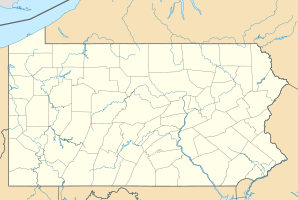
| Lage in Pennsylvania | ||
| Basisdaten | ||
| Gründung: | 1823 | |
| Staat: | Vereinigte Staaten | |
| Bundesstaat: | Pennsylvania | |
| County: | Allegheny County | |
| Koordinaten: | 40° 35′ N, 80° 6′ W | |
| Zeitzone: | Eastern (UTC−5/−4) | |
| Einwohner: | 15.479 (Stand: 2020) | |
| Haushalte: | 5.284 (Stand: 2020) | |
| Fläche: | 35,03 km² (ca. 14 mi²) davon 35,02 km² (ca. 14 mi²) Land | |
| Bevölkerungsdichte: | 442 Einwohner je km² | |
| Höhe: | 384 m | |
| Postleitzahlen: | 15090, 15143, 15237 | |
| Vorwahl: | +1 412, 724, 878 | |
| FIPS: | 42-27552 | |
| GNIS-ID: | 2086666 1214120 | |
| Website: | www.franklinparkborough.us | |
Franklin Park ist eine Gemeinde (Borough) im Allegheny County im US-Bundesstaat Pennsylvania. Das U.S. Census Bureau hat bei der Volkszählung 2020 eine Einwohnerzahl von 15.479[1] auf einer Fläche von 35 km² ermittelt. Sie ist Teil der Metropolregion Pittsburgh.
Demografie
Nach einer Schätzung von 2019 leben in Franklin Park 14.885 Menschen. Die Bevölkerung teilt sich im selben Jahr auf in 81,0 % Weiße, 2,6 % Afroamerikaner, 0,4 % amerikanische Ureinwohner, 12,5 % Asiaten und 2,3 % mit zwei oder mehr Ethnizitäten. Hispanics oder Latinos aller Ethnien machten 2,5 % der Bevölkerung aus. Das mittlere Haushaltseinkommen lag bei 134.688 US-Dollar und die Armutsquote bei 3,6 %.[2]
| Bevölkerungsentwicklung | |||
|---|---|---|---|
| Census | Einwohner | ± rel. | |
| 1970 | 5.310 | — | |
| 1980 | 6.135 | 15,5 % | |
| 1990 | 10.109 | 64,8 % | |
| 2000 | 11.364 | 12,4 % | |
| 2010 | 13.470 | 18,5 % | |
| 2020 | 15.479 | 14,9 % | |
| Quelle: US Census Bureau | |||
Weblinks
Einzelnachweise
- ↑ Explore Census Data Total Population in Franklin Park borough, Pennsylvania. Abgerufen am 22. März 2023.
- ↑ U.S. Census Bureau QuickFacts: Franklin Park borough, Pennsylvania. Abgerufen am 11. Februar 2021 (englisch).
Auf dieser Seite verwendete Medien
(c) Leepaxton at en.wikipedia, CC BY-SA 4.0
Picture of the Trinity German Evangelical Lutheran Church located at 2500 Brandt School Road in Franklin Park, Pennsylvania, on September 23, 2010. Built in 1868, the church is on the List of Pittsburgh History and Landmarks Foundation Historic Landmarks. A stone marker in German is located over the front entrance. On pages 191 and 192 in James D. Van Trump and Arthur P. Ziegler, Jr.'s book Landmark Architecture of Allegheny County (1967, Pittsburgh History and Landmarks Foundation, Pittsburgh, Pennsylvania, LCCN) it lists this church as the "German Evangelical Lutheran Church" and describes the architectural style as "Mid-Nineteenth Century Eclectic Vernacular". It goes on to say, "This is a red brick gabled structure with white trim. It is a hall church and has round topped windows, brick corbeling, pilasters, and a modern Classical porch. There is small white cupola on the front gable." Not far from the church, a historical marker for the Kuskusky Path says the following: "Kuskusky Path - Hunters, traders, warriors, militia, war captives, and diplomats all used this early Native American path, which passed this location, for most of the 1700s as part of a regional network of trails. It provided a direct route between Fort Duquesne/Fort Pitt, a major trade center, and the Delaware Indian community of Kuskusky, now New Castle. Europeans who began moving into the area built homes and churches adjacent to the path by 1800. Pennsylvania Historical and Museum Commission 2008".
Autor/Urheber: Alexrk2, Lizenz: CC BY 3.0
Positionskarte von Pennsylvania, USA
This is a locator map showing Allegheny County in Pennsylvania. For more information, see Commons:United States county locator maps.


