Foley Island
| Foley Island | ||
|---|---|---|
 | ||
| Gewässer | Foxe Basin | |
| Inselgruppe | Kanadisch-arktischer Archipel | |
| Geographische Lage | 68° 32′ N, 75° 5′ W | |
| Länge | 46 km | |
| Breite | 19 km | |
| Fläche | 637 km² | |
| Höchste Erhebung | 61 m | |
| Einwohner | unbewohnt | |
 | ||
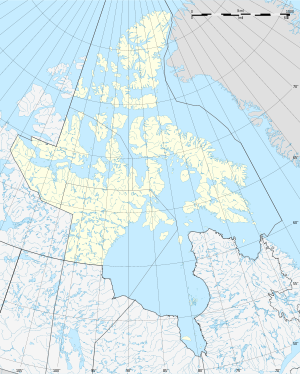
Karte von Foley Island | ||
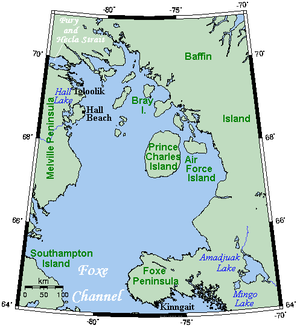
Foley Island ist eine Insel im Kanadisch-arktischen Archipel. Sie liegt im Norden des Foxe Basin vor der Südküste von Baffin Island. Politisch gehört die Insel zur Qikiqtaaluk-Region des kanadischen Territoriums Nunavut.
Die Landfläche von Foley Island beträgt 637 km².[1] Die höchste Erhebung der Insel erreicht 61 m.[2]
Die Insel wurde von Albert-Ernest Tomkinson, einem Navigator der Royal Canadian Air Force, 1948 an Bord einer Avro Lancaster aus entdeckt. Im selben Jahr wurden auch die benachbarten Inseln Prince Charles Island und Air Force Island entdeckt. Die drei Inseln werden als wichtiges Brutgebiet mehrerer Vogelarten von BirdLife International als Important Bird Area Foxe Basin Islands (NU011) ausgewiesen.[3]
Einzelnachweise
- ↑ Natural Resources Canada - The Atlas of Canada - Sea Islands (Memento vom 6. Oktober 2012 im Internet Archive)
- ↑ UN SYSTEM-WIDE EARTHWATCH Web Site - Foley
- ↑ Foxe Basin Islands auf der Website von IBA Canada (englisch)
Auf dieser Seite verwendete Medien
Autor/Urheber: Base image created by Keith Edkins as GFDL, modified by Tim Vasquez., Lizenz: CC BY-SA 3.0
Autor/Urheber:
- Canada_Nunavut_location_map-lambert_proj.svg: Flappiefh
- derivative work: NordNordWest
Positionskarte von Nunavut, Kanada
Autor/Urheber: Original uploader was Kelisi at en.wikipedia, Lizenz: CC BY-SA 3.0
A map showing Foxe Basin and nearby areas. This map's source is here, with the uploader's modifications, and the GMT homepage says that the tools are released under the GNU General Public License.


