Flotta
| Flotta | |
|---|---|
(c) Iain Macaulay, CC BY-SA 2.0 | |
| Gewässer | Nordsee |
| Inselgruppe | Orkneyinseln |
| Geographische Lage | 58° 49′ 41″ N, 3° 7′ 4″ W |
| Länge | 4 km |
| Breite | 3,5 km |
| Fläche | 8,76 km² |
| Höchste Erhebung | West Hill 58 m |
| Einwohner | 80 (2011) 9,1 Einw./km² |
| Hauptort | Whome |
Die Insel Flotta (eigentlich Flottay; von Norn Fleuks (Flunder) „die flache Insel“) gehört zur Gruppe der Orkneys und liegt etwa 30 km nord-nordöstlich vor Schottland. 2011 lebten 80 Personen auf Flotta.[1]
Innerhalb des Archipels liegt sie zwei Kilometer östlich der zweitgrößten Insel Hoy und acht Kilometer südlich der Hauptinsel Mainland am Südausgang der Bucht von Scapa Flow. Noch 1910 war die Insel landwirtschaftlich geprägt und hatte 431 Einwohner. Aufgrund ihrer Lage kam ihr in beiden Weltkriegen eine besondere strategische Bedeutung zu. Noch heute besitzt sie das einzige nennenswerte Wäldchen der Orkney, das im Zweiten Weltkrieg zur Tarnung der Militäranlagen angepflanzt wurde.
Die nur wenige Quadratkilometer große bewohnte Insel besitzt ein bedeutendes Erdölterminal sowie einen kleinen Flugplatz. Regelmäßige Fährverbindungen bestehen nach Schottland sowie zu den Nachbarinseln. Aufgrund einer tief einschneidenden Bucht an der Ostküste hat sie in etwa eine „C“-Form bei ungefähren Ausmaßen von vier Kilometern in Ost-West- und 3,5 km in Nord-Süd-Richtung.
Der Flotta Stone (auch Flotta Cross) ein bei Lurdy gefundener Cross Slab, heute im National Museum of Antiquities of Scotland in Edinburgh ist fraglos das meistbeachtete Relikt aus der Vorzeit dieser Insel.
Einzelnachweise
Weblinks
Auf dieser Seite verwendete Medien
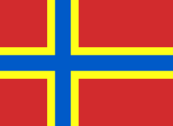
2007 Flag of Orkney
My own vector of the official flag of the Isles of Orkney, Scotland, created using Inkscape. This version is based upon the official version designed by Duncan Tullock of Birsay and voted for by the people of Orkney and approved by the Court of the Lord Lyon in 2007 from a short list of 5 designs. It is a Nordic Cross, in keeping with the flag's unofficial predecesor the Cross of St Magnus, and for which, according to Mr Tullock, "Orkney has always been represented by red, so that was an obvious choice. The yellow symbolizes the royal standards of both Scotland and Norway and blue is for Scotland, and also for the sea that surrounds us".
(c) Kelisi aus der englischsprachigen Wikipedia, CC BY-SA 3.0
A map of the Pentland Firth, northern Scotland, showing various towns and villages on the British mainland and in Orkney, as well as physical features, including islands in the Firth. This map's source is here, with the uploader's modifications, and the GMT homepage says that the tools are released under the GNU General Public License.
VK Flotta.PNG (Orkney and Shetland islands, UK)


