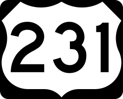
U.S. Highway 231
| Karte | |
|---|---|
| Basisdaten | |
| Gesamtlänge: | 912 mi/1467 km |
| Eröffnung: | 1926 |
| Bundesstaaten: | Florida Alabama Tennessee Kentucky Indiana |
| Anfangspunkt: | |
| Endpunkt: | |
Der U.S. Highway 231 (kurz US 231) ist ein United States Highway in den Vereinigten Staaten. Er beginnt am U.S. Highway 98 in Panama City und endet in St. John am U.S. Highway 41. Der US 231 überquert mit der 1373 Meter langen William H. Natcher Bridge zwischen Owensboro und Rockport den Ohio River. Seine Nummer gibt an, dass es sich um eine Nebenroute zum U.S. Highway 31 handelt.
Verlauf
Florida
Von Panama City verläuft der U.S. Highway 231 in nördlicher Richtung und trifft im Süden von Cottondale auf die Interstate 10 und den U.S. Highway 90. Nach der Stadt Campbellton erreicht der Highway die Grenze zu Alabama. Die Strecke trägt in Florida auch die verdeckte Bezeichnung Florida State Road 75.
Alabama
Der US 231 nutzt zwischen Dothan, der ersten größeren Stadt in Alabama, und Huntsville die Trasse der Alabama State Route 53. Im Osten von Montgomery kreuzt er die Interstate 85, bei Pell City die Interstate 20 sowie nahe Ashville die Interstate 59. Vor Huntsville überquert er den Tennessee River.
Tennessee
Mit Fayetteville erreicht der Highway die erste Ortschaft in Tennessee. Im Süden von Murfreesboro trifft er auf die Interstate 24. Zwischen Murfreesboro und Lebanon verläuft der US 231 parallel zur Tennessee State Route 840 bis zur Interstate 40. Ab Westmoreland verbindet er sich mit dem U.S. Highway 31E.
Kentucky
Ab Scottsville trennt sie der US 231 wieder vom U.S. Highway 31E und bewegt sich in nordwestlicher Richtung nach Bowling Green. In Bowling Green trifft er auf die Interstate 65 und führt weiter bis Owensboro. Nach der Überquerung des Ohio Rivers nördlich von Owensboro erreicht er den Bundesstaat Indiana.
Indiana
In Indiana verläuft der U.S. Highway 231 zum größten Teil durch ländliche Gebiete. Nördlich von Dale kreuzt er die Interstate 64, bei Cloverdale die Interstate 70, im Norden von Crawfordsville die Interstate 74 sowie nördlich von LaFayette und im Osten von Crown Point zweimal die I-65. Nach 1467 Kilometern endet der Highway in St. John am U.S. Highway 41.
Weblinks
- Indiana Highway (englisch)
- US Highway Ends (englisch)
Auf dieser Seite verwendete Medien
24 in by 24 in (600 mm by 600 mm) Florida State Road shield, made to the specifications of the sign detail. Uses the Roadgeek 2005 fonts. (United States law does not permit the copyrighting of typeface designs, and the fonts are meant to be copies of a U.S. Government-produced work anyway.) The outside border has a width of 1 (1/16 in) and a color of black so it shows up; in reality, signs have no outside border. Note that the drawing does not provide the border width or curve radii. (The previous page does but seems very inaccurate.) Thus those measurements are approximated from the drawing. The state outline is extracted from the PDF and cleaned up (to make the inside match the outside).
24 in by 24 in (600 mm by 600 mm) Florida State Road shield, made to the specifications of the sign detail. Uses the Roadgeek 2005 fonts. (United States law does not permit the copyrighting of typeface designs, and the fonts are meant to be copies of a U.S. Government-produced work anyway.) The outside border has a width of 1 (1/16 in) and a color of black so it shows up; in reality, signs have no outside border. Note that the drawing does not provide the border width or curve radii. (The previous page does but seems very inaccurate.) Thus those measurements are approximated from the drawing. The state outline is extracted from the PDF and cleaned up (to make the inside match the outside).
600 mm × 600 mm (24 in × 24 in) U.S. Highway shield, made to the specifications of the 2004 edition of Standard Highway Signs. (Note that there is a missing "J" label on the left side of the diagram.) Uses the Roadgeek 2005 fonts. (United States law does not permit the copyrighting of typeface designs, and the fonts are meant to be copies of a U.S. Government-produced work anyway.)
750 mm × 600 mm (30 in × 24 in) U.S. Highway shield, made to the specifications of the 2004 edition of Standard Highway Signs. (Note that there is a missing "J" label on the left side of the diagram.) Uses the Roadgeek 2005 fonts. (United States law does not permit the copyrighting of typeface designs, and the fonts are meant to be copies of a U.S. Government-produced work anyway.)
600 mm × 600 mm (24 in × 24 in) U.S. Highway shield, made to the specifications of the 2004 edition of Standard Highway Signs. (Note that there is a missing "J" label on the left side of the diagram.) Uses the Roadgeek 2005 fonts. (United States law does not permit the copyrighting of typeface designs, and the fonts are meant to be copies of a U.S. Government-produced work anyway.)
600 mm × 600 mm (24 in × 24 in) U.S. Highway shield, made to the specifications of the 2004 edition of Standard Highway Signs. (Note that there is a missing "J" label on the left side of the diagram.) Uses the Roadgeek 2005 fonts. (United States law does not permit the copyrighting of typeface designs, and the fonts are meant to be copies of a U.S. Government-produced work anyway.)
600 mm × 600 mm (24 in × 24 in) U.S. Highway shield, made to the specifications of the 2004 edition of Standard Highway Signs. (Note that there is a missing "J" label on the left side of the diagram.) Uses the Roadgeek 2005 fonts. (United States law does not permit the copyrighting of typeface designs, and the fonts are meant to be copies of a U.S. Government-produced work anyway.)


