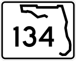
Florida State Road 134
 | |
|---|---|
| Basisdaten | |
| Gesamtlänge: | 11 mi/18 km |
| Bundesstaat: | Florida |
| Anfangspunkt: | |
| Endpunkt: | |
| County: | Duval |
Die Florida State Road 134 (kurz FL 134) ist eine State Route im US-Bundesstaat Florida, die in Ost-West-Richtung verläuft.
Die State Road beginnt an der State Road 228 südwestlich von Jacksonville und endet nach 18 Kilometern in Jacksonville am U.S. Highway 17.
Verlauf
Ab der State Road 228 nördlich des Cecil Field Airports verläuft die Strecke in östlicher Richtung und trifft im Süden von Jacksonville auf die Interstate 295. Nach etwa einem Kilometer wird sie von der State Road 21 gekreuzt. Nach der Überquerung des Ortega Rivers endet die FL 134 am U.S. Highway 17 westlich des Naval Air Station Jacksonville.
Auf dieser Seite verwendete Medien
30-by-24-inch (760 mm × 610 mm) Florida State Road shield, made to the specifications of the sign detail. Uses the Roadgeek 2005 fonts. (United States law does not permit the copyrighting of typeface designs, and the fonts are meant to be copies of a U.S. Government-produced work anyway.) The outside border has a width of 1 pixel and a color of black so it shows up; in reality, signs have no outside border.
30-by-24-inch (760 mm × 610 mm) Florida State Road shield, made to the specifications of the sign detail. Uses the Roadgeek 2005 fonts. (United States law does not permit the copyrighting of typeface designs, and the fonts are meant to be copies of a U.S. Government-produced work anyway.) The outside border has a width of 1 pixel and a color of black so it shows up; in reality, signs have no outside border.
600 mm × 600 mm (24 in × 24 in) U.S. Highway shield, made to the specifications of the 2004 edition of Standard Highway Signs. (Note that there is a missing "J" label on the left side of the diagram.) Uses the Roadgeek 2005 fonts. (United States law does not permit the copyrighting of typeface designs, and the fonts are meant to be copies of a U.S. Government-produced work anyway.)


