Fani (Insel)
| Fani Pulau Fani | ||
|---|---|---|
 | ||
| Gewässer | Halmaherasee | |
| Inselgruppe | Asia-Inseln | |
| Geographische Lage | 1° 4′ 0″ N, 131° 16′ 0″ O | |
| Länge | 4,4 km | |
| Breite | 1,2 km | |
| Einwohner | unbewohnt | |
Fani (indonesisch: Pulau Fani) ist eine Insel der Asia-Inseln in der Halmaherasee. Sie ist die größte der Inselgruppe und zugleich die nördlichste Insel im Raja-Ampat-Archipel.
Fani liegt im Norden der Asia-Inseln, 1 km südwestlich liegt die Insel Igi, 5 km südwestlich die Insel Miarin. Alle Inseln der Gruppe sind dicht bewachsen, unbewohnt und von einem gemeinsamen Saumriff umgeben[1].
Einzelnachweise
- ↑ Pub164, 2018 Sailing Directions (Enroute): New Guinea, S. 103
Auf dieser Seite verwendete Medien
Autor/Urheber: Sentinel-2 cloudless 2016 by EOX IT Services GmbH is licensed under a Creative Commons Attribution 4.0 International License., Lizenz: CC BY-SA 4.0
Asia Islands, Indonesia, Sentinel-2, Raja Ampat
Autor/Urheber: Uwe Dedering, Lizenz: CC BY-SA 3.0
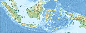
Location map of Indonesia.
Equirectangular projection. Strechted by 100.0%. Geographic limits of the map:
- N: 6.5° N
- W: 94.5° E
- E: 141.5° E
- S: -11.5° N


