Escragnolles
| Escragnolles | ||
|---|---|---|
 |
| |
| Staat | ||
| Region | Provence-Alpes-Côte d’Azur | |
| Département (Nr.) | Alpes-Maritimes (06) | |
| Arrondissement | Grasse | |
| Kanton | Grasse-1 | |
| Gemeindeverband | Pays de Grasse | |
| Koordinaten | 43° 44′ N, 6° 47′ O | |
| Höhe | 400–1644 m | |
| Fläche | 25,48 km² | |
| Einwohner | 621 (1. Januar 2022) | |
| Bevölkerungsdichte | 24 Einw./km² | |
| Postleitzahl | 06460 | |
| INSEE-Code | 06058 | |
Escragnolles ist eine französische Gemeinde im Département Alpes-Maritimes in der Region Provence-Alpes-Côte d’Azur. Sie gehört zum Kanton Grasse-1 im Arrondissement Grasse.
Geografie
In der Gemeindegemarkung entspringt der Fluss Siagne. Escragnolles ist eine Streusiedlung. Sie wird von der Route Napoléon passiert, die dort mit der heutigen Départementsstraße D6085 identisch ist. Vom Norden kommt der Bach „Ravin de Chalvagne“. Wenn er den Dorfkern passiert, wechselt er seinen Namen in „Vallon de Briasq“ und fließt dann in Richtung Südwesten.
Die Gemeinde liegt im Regionalen Naturpark Préalpes d’Azur. Nachbargemeinden sind Caille, Andon, Saint-Vallier-de-Thiey, Saint-Cézaire-sur-Siagne, Mons und Séranon.
Bevölkerungsentwicklung
| 1962 | 1968 | 1975 | 1982 | 1990 | 1999 | 2006 | 2016 |
|---|---|---|---|---|---|---|---|
| 117 | 119 | 110 | 193 | 326 | 384 | 505 | 612 |
 Dolmen des Claps
 Kapelle Saint-Martin
 Obere Siagne
 Baumes du Bail
Literatur
- Le Patrimoine des Communes des Alpes-Maritimes. Flohic Editions, Band 2, Paris 2000, ISBN 2-84234-071-X, S. 878–883.
Weblinks
Auf dieser Seite verwendete Medien

(c) Karte: NordNordWest, Lizenz: Creative Commons by-sa-3.0 de
Positionskarte von Frankreich mit Regionen und Départements


Autor/Urheber:
This illustration was made by (User:Royonx) and released under the license(s) stated above. You are free to use it for any purpose as long as you credit me and follow the terms of the license.
Example : © Michel Royon / Wikimedia Commons
If you use this image outside of the Wikimedia projects, I would be happy to hear from you par courriel (![]() royonx
royonx ![]() gmail.com). Thanks !
gmail.com). Thanks !
Ce message en français
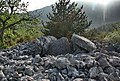
Escragnolles : caves in Baïl, under Napoleon way the false)

Autor/Urheber:
This illustration was made by (User:Royonx) and released under the license(s) stated above. You are free to use it for any purpose as long as you credit me and follow the terms of the license.
Example : © Michel Royon / Wikimedia Commons
If you use this image outside of the Wikimedia projects, I would be happy to hear from you par courriel (![]() royonx
royonx ![]() gmail.com). Thanks !
gmail.com). Thanks !
Ce message en français
Siagne karst spring of Garbo

Autor/Urheber:
This illustration was made by (User:Royonx) and released under the license(s) stated above. You are free to use it for any purpose as long as you credit me and follow the terms of the license.
Example : © Michel Royon / Wikimedia Commons
If you use this image outside of the Wikimedia projects, I would be happy to hear from you par courriel (![]() royonx
royonx ![]() gmail.com). Thanks !
gmail.com). Thanks !
Ce message en français
Saint-Martin Chapel in Escragolles (06) on the real Napoleon's way

Autor/Urheber:
This illustration was made by (User:Royonx) and released under the license(s) stated above. You are free to use it for any purpose as long as you credit me and follow the terms of the license.
Example : © Michel Royon / Wikimedia Commons
If you use this image outside of the Wikimedia projects, I would be happy to hear from you par courriel (![]() royonx
royonx ![]() gmail.com). Thanks !
gmail.com). Thanks !
Ce message en français
Dolmen des Claps in Escragnolles (06)
Autor/Urheber: Chatsam, Lizenz: CC BY-SA 3.0
blason de la commune de Escragnolles : D’or au sautoir de sinople cantonné en chef d’un roc d’échiquier du même.