Ensenada Ramos
| Ensenada Ramos | ||
|---|---|---|
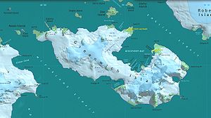
Karte von Greenwich Island mit der „Ramos Cove“ in der Discovery Bay | ||
| Gewässer | Discovery Bay | |
| Landmasse | Greenwich Island, Südliche Shetlandinseln | |
| Geographische Lage | 62° 30′ 18″ S, 59° 43′ 44″ W | |
Die Ensenada Ramos (spanisch; englisch inoffiziell Ramos Cove) ist eine Nebenbucht der Discovery Bay von Greenwich Island im Archipel der Südlichen Shetlandinseln. Sie liegt zwischen den Landspitzen Fierro Point und Correa Point im Südteil der Bucht.
Wissenschaftler der 1. Chilenischen Antarktisexpedition (1946–1947) benannten sie nach einem Signalgast, der zur Besatzung auf der Iquique bei dieser Forschungsreise gehört hatte.
Weblinks
- Ramos, Ensenada im Composite Gazetteer of Antarctica (englisch und spanisch)
Auf dieser Seite verwendete Medien
Autor/Urheber: NordNordWest, Lizenz: CC BY-SA 3.0
Positionskarte der Südlichen Shetlandinseln
Autor/Urheber: Antarctic Place-names Commission of Bulgaria, Lizenz: GPL
L.L. Ivanov et al., Antarctica: Livingston Island, South Shetland Islands (from English Strait to Morton Strait, with illustrations and ice-cover distribution), 1:100000 scale topographic map, Antarctic Place-names Commission of Bulgaria, Sofia, 2005 (Fragment) Fragment released in the public domain by the Antarctic Place-names Commission of Bulgaria.


