Easton (Maryland)
| Easton | ||
|---|---|---|
 | ||
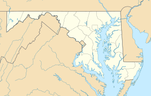
| Lage in Maryland | ||
| Basisdaten | ||
| Gründung: | 1790 | |
| Staat: | Vereinigte Staaten | |
| Bundesstaat: | Maryland | |
| County: | Talbot County | |
| Koordinaten: | 38° 46′ N, 76° 4′ W | |
| Zeitzone: | Eastern (UTC−5/−4) | |
| Einwohner: – Metropolregion: | 17.101 (Stand: 2020) 37.526 (Stand: 2020) | |
| Haushalte: | 7.387 (Stand: 2020) | |
| Fläche: | 10,7 km2 (ca. 4 mi²) davon 10,6 km2 (ca. 4 mi²) Land | |
| Bevölkerungsdichte: | 1.613 Einwohner je km2 | |
| Höhe: | 7 m | |
| Postleitzahlen: | 21601, 21606 | |
| Vorwahl: | +1 410 | |
| FIPS: | 24-24475 | |
| GNIS-ID: | 0584235 | |
| Website: | www.town-eastonmd.com | |
| Bürgermeisterin: | Megan Cook[1] | |
Easton ist eine Stadt (City) und Sitz der Countyverwaltung (County Seat) des Talbot Countys auf der Delmarva-Halbinsel im US-Bundesstaat Maryland. Das U.S. Census Bureau hat bei der Volkszählung 2020 eine Einwohnerzahl von 17.101[2] ermittelt.
Der Ort ist Sitz des Senders WKHZ und das lokale Baseball-Team Easton LL mehrfacher Teilnehmer der Little League Baseball World Series.
Persönlichkeiten
- Isaac Ambrose Barber (1852–1909), Politiker und Abgeordneter im Repräsentantenhaus
- Robert Bauman (* 1937), Politiker und Abgeordneter im Repräsentantenhaus
- Birch Bayh (1928–2019), Politiker, Senator und US-Präsidentschaftskandidat
- Helen Beebe (1908–1989), Pädagogin
- James Harry Covington (1870–1942), Politiker, Abgeordneter im Repräsentantenhaus und Bundesrichter
- Skip Etchells (1911–1998), Yachtkonstrukteur
- Charles Hopper Gibson (1842–1900), Politiker und Senator
- Robert Henry Goldsborough (1779–1836), Politiker und Senator
- Samuel Hambleton (1812–1886), Politiker und Abgeordneter im Repräsentantenhaus
- William Hayward (1787–1836), Politiker und Abgeordneter im Repräsentantenhaus
- Leslie Holdridge (1907–1999), Biologe, Klimatologe und Tropenwaldforscher
- Harry Hughes (1926–2019), Politiker und Gouverneur von Maryland
- Edward Olson Hulburt (1890–1982), Geophysiker und Direktor am United States Naval Research Laboratory
- John Bozman Kerr (1809–1878), Politiker und amerikanischer Gesandter in Nicaragua
- John Leeds Kerr (1780–1844), Politiker, Abgeordneter im Repräsentantenhaus und Senator
- Richard Lankford (1914–2003), Politiker und Abgeordneter im Regisseur
- Lee Lawrie (1877–1963), Bildhauer
- Bobby Lea (* 1983), Bahn- und Straßenradrennfahrer
- James Lloyd (1745–1820), Politiker und Senator
- Edward Tylor Miller (1895–1968), Politiker und Abgeordneter im Repräsentantenhaus
- William Oswald Mills (1924–1973), Politiker und Abgeordneter im Repräsentantenhaus
- Rogers Morton (1914–1979), Politiker, Innenminister und Handelsminister der Vereinigten Staaten
- Joseph Hopper Nicholson (1770–1817), Politiker, Jurist und Abgeordneter im Repräsentantenhaus
- John Blake Rice (1809–1874), Politiker und Bürgermeister von Chicago
- Maggie Rogers (* 1994), Musikerin
- Philip F. Thomas (1810–1890), Politiker, Gouverneur von Maryland und amerikanischer Finanzminister
Weblinks
Einzelnachweise
- ↑ eastonmd.gov. (abgerufen am 26. Januar 2025).
- ↑ US Census Bureau: Search Results Total Population in Easton town, Maryland. Abgerufen am 16. Januar 2024 (amerikanisches Englisch).
Auf dieser Seite verwendete Medien
Autor/Urheber: Alexrk2, Lizenz: CC BY 3.0
Diese Landkarte wurde mit GeoTools erstellt.
Image of a market day in en:Easton, Maryland. This image is of the Market House in the town square of Easton. Market Days were held every week, and farmers brought produce, craftsmen brought goods to sell, and, yes, sometimes slave sales were held there. This image is of the outside of the building. It is impossible to see the inside, and to know what is being sold. While it may be more exciting to believe this is a slave sale, the facts are that no one can determine from the image what is being sold in the building.
This is a locator map showing Talbot County in Maryland. For more information, see Commons:United States county locator maps.


