Eagle Mountain (Minnesota)
| Eagle Mountain | ||
|---|---|---|
 Eagle Mountain mit Whale Lake im Vordergrund | ||
| Höhe | 701 m | |
| Lage | Minnesota, USA | |
| Gebirge | Misquah Hills | |
| Dominanz | 703,44 km → Kidder County High Point | |
| Schartenhöhe | 402 m ↓ Browns Valley | |
| Koordinaten | 47° 53′ 51″ N, 90° 33′ 36″ W | |
| Besonderheiten | höchster Berg von Minnesota | |

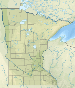
Der Eagle Mountain ist ein Berg im US-Bundesstaat Minnesota. Mit einer Höhe von 701 Metern ist er die höchste Erhebung des Bundesstaates. Er liegt im Nordosten des Staates im Cook County.
Der Eagle Mountain ist Teil der Misquah Hills im Kanadischen Schild. Er ist in den Naturschutzgebieten der Boundary Waters Canoe Area Wilderness und des Superior National Forest gelegen und kann mit einem Höhenunterschied von 168 Metern über einen rund 5,6 Kilometer langen, ausgewiesenen Wanderweg erreicht werden.
Der mit einer Höhe von 185 Metern niedrigste Punkt von Minnesota, der Obere See, ist lediglich 24 Kilometer vom Eagle Mountain entfernt.
Siehe auch
Weblinks
- Eagle Mountain auf Peakbagger.com (englisch)
Auf dieser Seite verwendete Medien
View from near the top of Eagle Mountain, the highest point in Minnesota. Visible are the surrounding Misquah Hills and the North Branch of the Cascade River. Eagle Lake can be seen at the right of the photo, and Shrike Lake at the left. Photo taken by Douglas Kaye in 2006, from the last clear view near the end of the trail to the peak.
Autor/Urheber: Skye Marthaler, Lizenz: CC BY-SA 3.0
The highest natural point in Minnesota, at 2,301 feet (701 m). It is located in northern Cook County.
Autor/Urheber: SANtosito, Lizenz: CC BY-SA 4.0
Relief location map of Minnesota, USA
Geographic limits of the map:
- N: 49.6° N
- S: 43.3° N
- W: 97.4° W
- E: 89.3° W
"Mount Rainier towers over all surrounding mountains, lit by the sunset and wreathed in clouds."


