Dschalil
Siedlung städtischen Typs
| |||||||||||||||||||||||||||||
| |||||||||||||||||||||||||||||
| |||||||||||||||||||||||||||||
| Liste großer Siedlungen in Russland | |||||||||||||||||||||||||||||
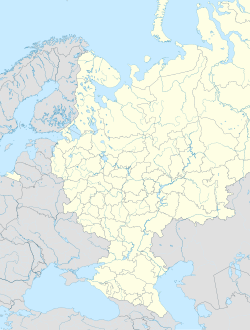
Dschalil (russisch Джалиль; tatarisch Җәлил, Cəlil bzw. Cälil) ist eine Siedlung städtischen Typs mit 13.937 Einwohnern (Stand 14. Oktober 2010)[1] in der Republik Tatarstan in der Russischen Föderation, etwa 300 km südöstlich von Kasan.

Der Ort im Rajon Sarmanowo wurde 1964 gegründet und erhielt 1968 den Status einer Siedlung städtischen Typs. Er ist nach dem tatarischen Dichter Musa Cälil (russisch Муса Джалиль/Mussa Dschalil) benannt. Haupterwerbszweig ist die Erdölförderung.
Bevölkerungsentwicklung
| Jahr | Einwohner |
|---|---|
| 1970 | 3.856 |
| 1979 | 7.671 |
| 1989 | 11.298 |
| 2002 | 14.769 |
| 2010 | 13.937 |
Anmerkung: Volkszählungsdaten
Einzelnachweise
- ↑ a b Itogi Vserossijskoj perepisi naselenija 2010 goda. Tom 1. Čislennostʹ i razmeščenie naselenija (Ergebnisse der allrussischen Volkszählung 2010. Band 1. Anzahl und Verteilung der Bevölkerung). Tabellen 5, S. 12–209; 11, S. 312–979 (Download von der Website des Föderalen Dienstes für staatliche Statistik der Russischen Föderation)
Weblinks
- Eintrag in der Tatarskaja enziklopedija (russisch)
Auf dieser Seite verwendete Medien
Autor/Urheber: Uwe Dedering, Lizenz: CC BY-SA 3.0
Location map of European_Russia.
- Projection: Lambert azimuthal equal-area projection.
- Area of interest:
- N: 75.0° N
- S: 40.0° N
- W: 25.0° E
- E: 60.0° E
- Projection center:
- NS: 57.5° N
- WE: 42.5° E
- GMT projection: -JA42.5/57.5/20c
- GMT region: -R25.450860698632475/38.37411418933942/86.79037939442836/70.79910933370674r
- GMT region for grdcut: -R-2.0/38.0/87.0/76.0r
- Made with Natural Earth. Free vector and raster map data @ naturalearthdata.com.
Position map of the Republic of Tatarstan ~
Equiangular projection, stretching - 175%. Coordinates of the edges:
- North - 56.8° C
- South - 53.9° C
- East - 54.5° B
- West - 47.0° V


