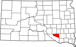
Douglas County (South Dakota)
 Douglas County Courthouse in Armour | |
| Verwaltung | |
|---|---|
| US-Bundesstaat: | South Dakota |
| Verwaltungssitz: | Armour |
| Gründung: | 1873 |
| Demographie | |
| Einwohner: | 2.835 (Stand: 2020) |
| Bevölkerungsdichte: | 2,53 Einwohner/km2 |
| Geographie | |
| Fläche gesamt: | 1124 km² |
| Wasserfläche: | 2 km² |
| Karte | |
Douglas County[1], ein County im Bundesstaat South Dakota der Vereinigten Staaten, ist benannt nach dem Politiker Stephen A. Douglas Hier leben 3458 Einwohner.
Armour, der Verwaltungssitz (County Seat) des County, wurde 1885 gegründet. Er ist benannt nach dem Fleischfabrikanten Philip Danforth Armour Sr. (1832–1901) und hatte bei der Volkszählung 2010 699 Einwohner.
Geographie
Das County hat eine Fläche von 1845 Quadratkilometern; davon sind 2 Quadratkilometer (0,14 Prozent) Wasserflächen. Es ist in 14 Townships eingeteilt: Belmont, Chester, Clark, East Choleau, Garfield, Grandview, Holland, Independence, Iowa, Joubert, Lincoln, Valley, Walnut Grove und Washington.
Geschichte

Acht Bauwerke und Stätten des Countys sind im National Register of Historic Places (NRHP) eingetragen (Stand 31. Juli 2018).[2]
Bevölkerungsentwicklung
| Bevölkerungsentwicklung | |||
|---|---|---|---|
| Census | Einwohner | ± rel. | |
| 1900 | 5012 | — | |
| 1910 | 6400 | 27,7 % | |
| 1920 | 6993 | 9,3 % | |
| 1930 | 7236 | 3,5 % | |
| 1940 | 6348 | −12,3 % | |
| 1950 | 5636 | −11,2 % | |
| 1960 | 5113 | −9,3 % | |
| 1970 | 4569 | −10,6 % | |
| 1980 | 4181 | −8,5 % | |
| 1990 | 3746 | −10,4 % | |
| 2000 | 3458 | −7,7 % | |
| 2010 | 3002 | −13,2 % | |
| 2020 | 2.835 | −5,6 % | |
| 1900–1990[3] 2000[4] | |||
Städte und Gemeinden
Städte (cities)
- Armour
- Corsica
- Delmont
- Harrison
- New Holland
Weblinks
Einzelnachweise
- ↑ Douglas County. In: Geographic Names Information System. United States Geological Survey (englisch).. Abgerufen am 22. Februar 2011
- ↑ Suchmaske Datenbank im National Register Information System. National Park Service, abgerufen am 31. Juli 2018.
- ↑ Auszug aus Census.gov. Abgerufen am 28. Februar 2011
- ↑ Auszug aus factfinder.census.gov (Seite nicht mehr abrufbar, Suche in Webarchiven) Info: Der Link wurde automatisch als defekt markiert. Bitte prüfe den Link gemäß Anleitung und entferne dann diesen Hinweis. Abgerufen am 28. Februar 2011
Koordinaten: 43° 23′ N, 98° 22′ W
Auf dieser Seite verwendete Medien
Autor/Urheber: Ammodramus, Lizenz: CC0
Masonic Temple at northeast corner of 3rd and Main Streets in Armour, South Dakota; seen from the west. The building is a non-contributing property in the Armour Historic District, listed in the National Register of Historic Places.
Autor/Urheber: Sdgjake, Lizenz: CC BY-SA 3.0
The Douglas County courthouse in Armour, South Dakota.
This is a locator map showing Douglas County in South Dakota. For more information, see Commons:United States county locator maps.


