Departamentos in Honduras
Honduras gliedert sich in 18 Verwaltungsbezirke (Departamentos).
Das flächenmäßig größte Departamento ist Olancho – nach der Einwohnerzahl ist es Francisco Morazán, wo sich auch die Hauptstadt des Landes Tegucigalpa befindet. Das kleinste Departamento sowohl nach Fläche als auch Einwohnerzahl ist Islas de la Bahía.
Die Departamentos in Honduras sind ihrerseits wiederum in insgesamt 298 Gemeinden (Municipalidades) unterteilt. Für statistische Zwecke werden die Gemeinden weiter untergliedert in 3.731 aldeas, und diese weiter in 30.591 caserios. Auf der niedrigsten Ebene werden einige caserios weiter in barrios oder colonias untergliedert.[1]
| # | Departamento | Hauptstadt | |
|---|---|---|---|
| 1 | Atlántida | La Ceiba | |
| 2 | Choluteca | Choluteca | |
| 3 | Colón | Trujillo | |
| 4 | Comayagua | Comayagua | |
| 5 | Copán | Santa Rosa de Copán | |
| 6 | Cortés | San Pedro Sula | |
| 7 | El Paraíso | Yuscarán | |
| 8 | Francisco Morazán | Tegucigalpa | |
| 9 | Gracias a Dios | Puerto Lempira | |
| 10 | Intibucá | La Esperanza | |
| 11 | Islas de la Bahía | Roatán | |
| 12 | La Paz | La Paz | |
| 13 | Lempira | Gracias | |
| 14 | Ocotepeque | Nueva Ocotepeque | |
| 15 | Olancho | Juticalpa | |
| 16 | Santa Bárbara | Santa Bárbara | |
| 17 | Valle | Nacaome | |
| 18 | Yoro | Yoro |
Entstehung der Departamentos
- 1825: Honduras wird in sieben Departamentos eingeteilt: Comayagua, Santa Bárbara, Tegucigalpa, Choluteca, Yoro, Olancho, und Gracias.
- 1869: Teilung der sieben bestehenden Departamentos und Gründung neuer: La Paz (aus Comayagua), El Paraíso (aus Tegucigalpa und Olancho), Copán (aus Gracias), und La Mosquitia (aus Yoro).
- 1872: Gründung des Departamentos Islas de la Bahía (die Inselgruppe wurde 1860 von Großbritannien an Honduras abgetreten).
- 1881: Teile der Departamentos Yoro und La Mosquitia werden zum Departamento Colón.
- 1883: Intibucá entsteht aus Teilen der Departamentos La Paz und Gracias.
- 1893: Die Departamentos Valle (aus Choluteca) und Cortés (aus Santa Bárbara) entstehen.
- 1902: Teile der Departamentos Yoro und Colón werden zum Departamento Atlántida.
- 1906: Teile des Departamentos Ocotepeque werden zum Departamento Copán.
- 1957: Teile des Departamentos Colón werden zum Departamento Gracias a Dios.
Siehe auch
- Liste der Städte in Honduras
Quellen
Auf dieser Seite verwendete Medien
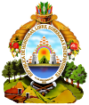
The coat of arms of Honduras was created on October 3, 1825. Dionisio Herrera, as the Head of State of Honduras, decreed through his initiative, Honduras acquired its own national shield, one which represents Honduran history and the rich variety of national resources that it possesses and which should be protected and conserved. The National Congress thereby declared in its decree #16 and article 142, designated the shield as a national symbol for all uses, in a clear and general manner. The National Congress approved this in Tegucigalpa on January 10, 1935. (http://www.honduras.com/official/)
The National Congress decrees:
Article 1 - The National Coat of Arms that shall be used is an equilateral triangle. On its base is a volcano between two castles, over them is a rainbow and below it [and] behind the volcano a sun rises spreading light. The triangle [is] placed over land which appears to be bathed by both seas [Atlantic and Pacific]. Around it an oval containing in gold lettering: "REPUBLICA DE HONDURAS, LIBRE, SOBERANA E INDEPENDIENTE. 15 DE SEPTIEMBRE DE 1821" [Republic of Honduras, Free, Sovereign and Independent. 15th September 1821] On the top part of the oval there is a quiver full of arrows from which hang horns of plenty joined with a knot resting over a mountain range from which clearly stand three oak trees on the right hand side and three pine trees on the left, and mines, a bar, a drill, a wedge, a sledgehammer and a hammer [all] distributed as appropriate. (http://flagspot.net/flags/hn).html)


