Dek (Insel)
| Dek ደቅ ደሴት | ||
|---|---|---|
 | ||
| Gewässer | Tanasee | |
| Geographische Lage | 11° 55′ 0″ N, 37° 16′ 11″ O | |
| ||
| Fläche | 16 km² | |
| Einwohner | 4816 (2007) 301 Einw./km² | |
 | ||
Dek (amharisch ደቅ ደሴትDäq Däset) ist die größte Insel im Tanasee in Äthiopien. Die Insel ist 16 km² groß. Auf ihr leben ca. 5000 Einwohner. Die Insel bildet eine Kebele. Diese gehört zur Woreda Bahir Dar Zuria in der Zone Mirab Gojjam (West-Gojjam) in der Region Amhara.
Auf Dek befinden sich die Dörfer Gurer, Narga, Korebet, Kota, Woba, Gadena, Kola und Zibed. Hauptort ist Gurer im Südwesten der Insel. Es gibt zwei achtklassige Schulen: die Dek-Primärschule (in Woba) und die kleinere Gurer-Primärschule. Die Sekundärschule befindet sich auf dem Festland in Bahir Dar. Die Fähre Bahir Dar–Gorgora der Lake Tana Transport Enterprise (LTTE) läuft Dek an und verbindet sie mit dem Festland.
Auf Dek befinden sich mehrere Kirchen der Äthiopisch-Orthodoxen Kirche: Narga Selassie, Kidist Arsema, Kotamariam, Zibed Medehanyalem, Djoga Yohannes und Gadena Giorgi.
Die kleine Insel Daga mit dem Kloster Daga Estifanos (ደጋ እስጢፋኖስ) ist Dek südöstlich vorgelagert.
Auf dieser Seite verwendete Medien
(c) Karte: NordNordWest, Lizenz: Creative Commons by-sa-3.0 de
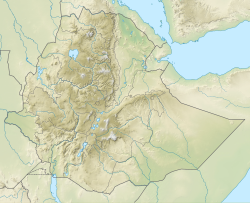
Positionskarte von Äthiopien
An astronaut aboard the International Space Station took this photograph of Dek and Daga Islands in Lake Tana, Ethiopia. Both islands are volcanic in origin, as is the lake itself.
Situated in the Amhara Region of the Ethiopian Highlands, Lake Tana is the largest lake in Ethiopia and acts as the headwaters of the Blue Nile River. Dek Island—at 7 kilometers or 4.4 miles from north to south—is the largest island in Lake Tana. The murky green color of the water results from algal blooms, which that live on nutrients supplied from fertilizer fields, wastewater, and other sources of runoff that create nutrient pollution.
The dark green areas in the photo are patches of forest, while the lighter-toned and darker, salmon-colored patches are agricultural fields, which cover 70 percent of Dek Island. It is a prime area for farming because of high-quality volcanic soils, as well as heavy rains due to its location in the Intertropical Convergence Zone (ITCZ). Some of the more common crops are corn and millet, which are mostly consumed by the islanders. Coffee and mangos are the economic mainstays and are shipped to markets on the mainland.
Both islands are home to monasteries of the Coptic Church, most famously Narga Selassie on Dek Island and Dega Estefanos on Dega Island. For hundreds of years, the islands have helped protect the monasteries during times of war. Dega Estefanos is the resting place of mummified emperors who ruled Ethiopia (once known as Abyssinia) centuries ago.
This long-lens image illustrates the level of detail possible from a handheld digital camera shooting from the space station: the numerous white specks are the reflective tin roofs of houses and buildings.Autor/Urheber: A. Davey from Where I Live Now: Pacific Northwest, Lizenz: CC BY 2.0
Late 18th century.
Dek Island, Lake Tana, Ethiopia.


