Deer Park (New York)
Deer Park ist ein Census-designated place in der nordwestlichen Ecke der Town of Babylon im Suffolk County, im Bundesstaat New York (USA). Die Volkszählung von 2020 ergab 28.837 Einwohner.
Geographie
Der Ort liegt auf Long Island, südlich des Long Island Expressway (Interstate 495) und rund 65 km östlich von Manhattan. Die New York State Route 231 verläuft in Nord-Süd-Richtung durch die Siedlung.
Nach den Angaben des United States Census Bureaus hat Deer Park eine Fläche von rund 16,2 Quadratkilometern.
Geschichte
Der später „Deer Park“ genannte Ort wurde im Jahr 1666 besiedelt. Seinen heutigen Namen erhielt die Ortschaft durch das nach dem Jahr 1808 hier eröffnete „Deer Park Hotel“.
Weblinks
Auf dieser Seite verwendete Medien
Autor/Urheber: TUBS
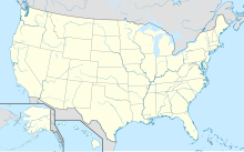
Location map of the USA (Hawaii and Alaska shown in sidemaps).
Main map: EquiDistantConicProjection : Central parallel :
* N: 37.0° N
Central meridian :
* E: 96.0° W
Standard parallels:
* 1: 32.0° N
* 2: 42.0° N
Made with Natural Earth. Free vector and raster map data @ naturalearthdata.com.
Formulas for x and y:
x = 50.0 + 124.03149777329222 * ((1.9694462586094064-({{{2}}}* pi / 180))
      * sin(0.6010514667026994 * ({{{3}}} + 96) * pi / 180))
y = 50.0 + 1.6155950752393982 * 124.03149777329222 * 0.02613325650382181
      - 1.6155950752393982  * 124.03149777329222 *
     (1.3236744353715044  - (1.9694462586094064-({{{2}}}* pi / 180))
      * cos(0.6010514667026994 * ({{{3}}} + 96) * pi / 180))
Hawaii side map: Equirectangular projection, N/S stretching 107 %. Geographic limits of the map:
- N: 22.4° N
- S: 18.7° N
- W: 160.7° W
- E: 154.6° W
Alaska side map: Equirectangular projection, N/S stretching 210.0 %. Geographic limits of the map:
- N: 72.0° N
- S: 51.0° N
- W: 172.0° E
- E: 129.0° W
This is a locator map showing Suffolk County in New York. For more information, see Commons:United States county locator maps.


