Darvel Bay
| Darvel Bay | ||
|---|---|---|
 Satellitenbild der Bucht, 27. Juli 1980 | ||
| Gewässer | Celebessee | |
| Landmasse | Borneo | |
| Geographische Lage | 5° N, 118° O | |
| Breite | ca. 60 km | |
| Tiefe | ca. 80 km | |
 Inseln in der Darvel Bay | ||
Die Darvel Bay (malaiisch Teluk Darvel) ist eine große Bucht an der Ostküste der Insel Borneo. Sie gehört zum Staat Sabah, Malaysia. Sie ist die größte, halb von Landmassen umgebene Bucht an der Ostküste von Borneo und öffnet sich zur Sulawesisee. Verwaltungstechnisch gehört sie zur Tawau Division mit den Distrikten Lahad Datu an der Nordseite, Kunak in der Mitte und Semporna im Süden der Bucht. Innerhalb der Darvel Bay gibt es weitere, kleinere Buchten, z. B. die Lahad Datu Bay.
Geographie
Weite Küstengebiete der Darvel Bay bestehen aus Mangrovensümpfen.[1] Innerhalb der Bucht gibt er unzählige Inseln; die größte, Pulau Timbun Mata, befindet sich nahe der südlichen Küste.
Geschichte
Das Gebiet rund um die Darvel Bay ist bereits seit über 20.000 Jahren besiedelt.[2] Auf dem Festland und den Inseln entdeckte Kalksteinhöhlen wurden in prähistorischer Zeit für Begräbnisse benutzt.[2]
Ende des 19. Jahrhunderts war die Darvel Bay ein bevorzugtes Versteck von Piraten.[3] Zu den berühmtesten Piraten seiner Zeit gehörte Datu Kudunding.[4] Die Briten nutzten das Gebiet zum Anbau von Tabak. Die Darvel Bay Tobacco Plantations Ltd im Lahad Datu Distrikt wurde im Dokumentarfilm Urban Bioscope Expedition through Borneo vom H. M. Lomas verewigt.[5]
Literatur
- Saleh, Ejria et al. (June 2007) „Water circulation in Darvel Bay, Sabah, Malaysia“ Abstract In: Institute of Electrical and Electronics Engineers (June 2007) Oceans 2007 – Europe Marine Technology Society, Oceanic Engineering Society (U.S.), Columbia, Maryland, Seiten 1–6, ISBN 0-933957-35-1
Einzelnachweise
- ↑ United States Navy Publication 163, Kapitel 10, prepared by the National Imagery and Mapping Agency (PDF; 615 kB)
- ↑ a b Hutton, Wendy (1993) East Malaysia and Brunei Passport Books, Lincolnwood, Illinois, p.77, ISBN 0-8442-9890-5
- ↑ Tregonning, K. G. (1965) A History of Modern Sabah (North Borneo, 1881–1963) (2nd ed.) published for the University of Singapore by the University of Malaya Press, Singapore, p.191 OCLC 410956
- ↑ Black, Ian (1983) A Gambling Style of Government: The Establishment of the Chartered Company's rule in Sabah, 1878–1915 Oxford University Press, Kuala Lumpur, p.23, ISBN 0-19-582535-7
- ↑ Herbert, Stephen (2000) A History of Early Film Routledge, London, p.180-181, ISBN 0-415-21152-2
Auf dieser Seite verwendete Medien
Autor/Urheber: Cccefalon, Lizenz: CC BY-SA 3.0
Sabah: Scheme of Islands in the Darvel Bay
Autor/Urheber: Uwe Dedering, Lizenz: CC BY-SA 3.0
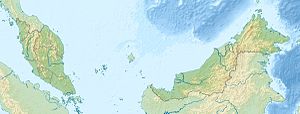
Location map of Malaysia.
Equirectangular projection. Strechted by 100.0%. Geographic limits of the map:
* N: 8.0° N
* S: 0.0° N
* W: 99.0° E
* E: 120.0° E
Made with Natural Earth. Free vector and raster map data @ naturalearthdata.com.
USGS satellite photo of Darvel Bay, eastcoast of Sabah, Malaysia.
Flag of the Malaysian state Sabah. Based on a GIF from a government website, colors from a photo. Drawn by Mysid. The flag was adopted September 16, 1988.
- The mountain on the left is Mount Kinabalu.
Per the Constitution of the State of Sabah:
"The State Flag is in a rectangular shape and is in the proportion of 1:2. The canton which extends at the head half way to the fly and 2/3 at the hoist to the foot is in Icicle Blue (C1T9) as the background to a graphic silhouette of Mount Kinabalu which is in Royal Blue (B10) positioned at ¼ of the height of the canton from end to end. The fly of the flag is divided equally into three bands of colours the foot division of which extends right to the hoist. The top band is in Zircon Blue (C5T5) the second band is in white and the third band is in Chili Red (S6R4)."


