Curepipe
| Curepipe | ||
|---|---|---|
 Rathaus von Curepipe | ||
| Basisdaten | ||
| Region: | Plaines Wilhems | |
| Koordinaten: | 20° 19′ S, 57° 31′ O | |
| Höhe: | 400–600 ü. d. M. | |
| Gründungsjahr: | 1866 | |
| Fläche: | 23,8 km² | |
| Einwohner: | 78.920 | |
| Zeitzone: | UTC +4 | |
| Telefonvorwahl: | NA | |
| Website: | www.municipal-curepipe.org | |
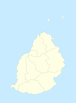
| Geographische Lage auf Mauritius | ||
Curepipe ist mit 84.200 Einwohnern (Stand 2005) die viertgrößte Stadt auf der Insel Mauritius und liegt auf einer Hochebene im Zentrum der Insel im Bezirk Plaines Wilhems.
Für den Namen gibt es keine verbürgte Erklärung. Eine der Erklärungen ist die, dass Reisende vom Hafen in Mahébourg nach Port Louis hier eine Pause machten, um ihre Pfeifen zu putzen. Daher „Cure“ und „Pipe“ (frz. curer sa pipe). Über die Jahre hinweg bildete sich dort eine kleine Stadt. In ihrer Mitte liegt der erloschene Vulkankrater Trou aux Cerfs (deutsch Hirschloch, 200 m Durchmesser, 85 m tief), der von einem Aussichtspunkt mit angeschlossenem Parkplatz aus besichtigt werden kann. Etwa fünf Kilometer südlich befindet sich das größte Wasserreservoir der Insel, das Mare aux Vacoas.
Persönlichkeiten
- Lise de Baissac (1905–2004), britische Agentin
- Denis Wiehe (* 1940), Bischof
- Jacques-Désiré Périatambée (* 1975), Fußballspieler
- Natacha Rigobert (* 1980), Beachvolleyballspielerin
- Aurélie Halbwachs (* 1986), Radrennfahrerin
- Fabienne St. Louis (* 1988), Triathletin
- Enzo Couacaud (* 1995), französischer Tennisspieler
- Georges Paul (* 1996), Badmintonspieler
- Christopher Rougier-Lagane (* 1998), Radrennfahrer
Bevölkerungsentwicklung
- 1982: 57.200
- 2003: 81.600
- 2005: 84.200 (geschätzt)
Weblinks
Auf dieser Seite verwendete Medien
Autor/Urheber: Yashveer Poonit, Lizenz: CC BY-SA 3.0
The armorial ensigns and supporters of Mauritius are described as:
(a) for arms-
- Quarterly azure and or.
- In the first quarter a lymphad or.
- In the second, 3 palm trees vert.
- In the third, a key in pale the wards downwards gules.
- In the issuant, from the base a pile, and in chief a mullet argent.
(b) for the supporters-
- On the dexter side, a dodo per bend sinister embattled gules and argent, and
- On the sinister side, a sambur deer per bend embattled argent and gules, each supporting a sugar cane erect proper,
Autor/Urheber: sharri @ flickr - https://www.flickr.com/photos/sharri/, Lizenz: CC BY 2.0
Hôtel de ville (Town hall), Curepipe, Mauritius
(c) Uwe Dedering in der Wikipedia auf Deutsch, CC BY-SA 3.0
Location map of Mauritius
Equirectangular projection. Stretched by 106.0%. Geographic limits of the map:
- N: -19.7° N
- S: -20.6° N
- W: 57.21° E
- E: 57.91° E


