Concord Mountains
| Concord Mountains | ||
|---|---|---|
| Lage | Viktorialand, Ostantarktika | |
| Teil des | Transantarktischen Gebirges | |
| Koordinaten | 71° 35′ S, 165° 10′ O | |
Die Concord Mountains sind ein verästeltes System von Gebirgszügen im Nordwesten des ostantarktischen Viktorialands, das aus der Everett Range, der Mirabito Range, der King Range, dem Leitch-Massiv der East Quartzite Range und der West Quartzite Range besteht.
Kartografisch erfasst wurde das Gebiet durch Vermessungsarbeiten des United States Geological Survey und mithilfe von Luftaufnahmen der United States Navy zwischen 1960 und 1963. Die Nordgruppe einer Kampagne im Rahmen der New Zealand Geological Survey Antarctic Expedition, die das Gebiet zwischen 1963 und 1964 erkundete, benannte das Gebirge nach der bei der Erforschung des Gebiets zwischen fünf Nationen vorherrschenden Eintracht (englisch: concord).
Weblinks
- Concord Mountains auf geographic.org (englisch)
- Concord Mountains. In: Geographic Names Information System. United States Geological Survey, United States Department of the Interior, archiviert vom (englisch).
- Concord Mountains und Admiralitätsberge
- Concord Mountains am rechten Kartenrand
Auf dieser Seite verwendete Medien
Autor/Urheber: Alexrk2, Lizenz: CC BY-SA 3.0
Physische Positionskarte Antarktis, Mittabstandstreue Azimutalprojektion
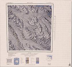
1:250,000-scale topographic reconnaissance map of the Ebbe Glacier area in the Admiralty Range from 165°-168°E to 71°-72°S in Antarctica, including Greenwell, Lillie and Tucker Glacier. Mapped, edited and published by the U.S. Geological Survey in cooperation with the National Science Foundation.
1:250,000-scale topographic reconnaissance map of the Bowers Mountains area from 162°-165°E to 71°-72°S in Antarctica, including Mount Soza and Rennick and Lillie Glaciers. Mapped, edited and published by the U.S. Geological Survey in cooperation with the National Science Foundation.


