Collingswood
| Collingswood | ||
|---|---|---|
 Der historische Handelsbezirk von Collingswood | ||
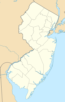
| Lage in New Jersey | ||
| Basisdaten | ||
| Gründung: | 22. Mai 1888 | |
| Staat: | Vereinigte Staaten | |
| Bundesstaat: | New Jersey | |
| County: | Camden County | |
| Koordinaten: | 39° 55′ N, 75° 5′ W | |
| Zeitzone: | Eastern (UTC−5/−4) | |
| Einwohner: | 14.186 (Stand: 2020) | |
| Haushalte: | 6.227 (Stand: 2020) | |
| Fläche: | 4,980 km² (ca. 2 mi²) davon 4,721 km² (ca. 2 mi²) Land | |
| Bevölkerungsdichte: | 3.005 Einwohner je km² | |
| Postleitzahl: | 08108 | |
| Vorwahl: | +1 856 | |
| FIPS: | 34-14260 | |
| GNIS-ID: | 885191 | |
| Website: | www.collingswood.com | |
| Bürgermeister: | James „Jim“ Maley | |
Collingswood ist eine Gemeinde im Camden County im US-Bundesstaat New Jersey. Die Einwohnerzahl lag 2020 bei 14.186.
Zweijährig hat die Collingswood High School seit 1989 ein Austauschprogramm mit dem Gymnasium Zitadelle Jülich, NRW.[1]
Galerie
- Altes Collingswood Theater
- Collingswood PATCO Bahnhof
- Historisches Stokes-Lee House
Weblinks
Einzelnachweise
- ↑ Austauschfahrten | Gymnasium Zitadelle Jülich. Abgerufen am 16. April 2018 (deutsch).
Auf dieser Seite verwendete Medien
Autor/Urheber: Saucemaster, Lizenz: CC BY-SA 3.0
View of Collingswood Theatre, 843 Haddon Ave. Collingswood, New Jersey, looking northeast across Haddon Avenue.
Autor/Urheber: Alexrk, cropped by NordNordWest, Lizenz: CC BY 3.0
Positionskarte von New Jersey, USA
Autor/Urheber: DevinHouse, Lizenz: CC BY-SA 3.0
Stokes-Lee House, 615-617 Lees Ave. Collingswood
Autor/Urheber: Thingscouldbebetter, Lizenz: CC BY-SA 3.0
Early-morning picture of the Collingswood PATCO High Speed Line station in Collingswood, New Jersey
This is a locator map showing Camden County in New Jersey. For more information, see Commons:United States county locator maps.
Autor/Urheber: Saucemaster, Lizenz: CC BY-SA 3.0
View of Collingswood Commercial Historic District, Collingswood, New Jersey, looking north from approximately 923 Haddon Avenue.


