Ciudad General Escobedo
| Ciudad General Escobedo | |||
|---|---|---|---|
| |||
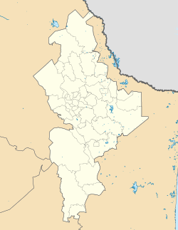
 Lage von Ciudad General Escobedo in Mexiko | |||
| Koordinaten | 25° 48′ 30″ N, 100° 19′ 36″ W | ||
| Basisdaten | |||
| Staat | Mexiko | ||
| Bundesstaat | Nuevo León | ||
| Municipio | General Escobedo | ||
| Stadtgründung | 1604 | ||
| Einwohner | 481.213 (2020) | ||
| – im Ballungsraum | 5.341.171 | ||
| Stadtinsignien | |||
 | |||
| Detaildaten | |||
| Fläche | 207 km2 | ||
| Bevölkerungsdichte | 2.325 Ew./km2 | ||
| Höhe | 510 m | ||
| Postleitzahl | 66050 – 66085 | ||
| Vorwahl | +52 (0) 81 | ||
| Zeitzone | UTC−6 | ||
| Stadtvorsitz | César Cavazos Caballero | ||
| Website | |||
 | |||
Ciudad General Escobedo ist eine Industriestadt im mexikanischen Bundesstaat Nuevo León. General Escobedo hat 352.444 Einwohner (Zensus 2010) und liegt in der Zona Metropolitana de Monterrey.
Geschichte
Die Stadt wurde am 25. April 1604 durch José de Treviño gegründet. Erst am 24. Februar 1868 wurde sie nach General Mariano Escobedo benannt. 1982 erhielt sie den Status einer Stadt und durfte sich amtlich Ciudad General Escobedo nennen.
Auf dieser Seite verwendete Medien
Locator map of the Municipality of General Escobedo (red) within the state of Nuevo León, México.
- Dark gray surrounding the Municipality shows the Monterrey Metropolitan Area.
View of the Municipal Palace of the Municipality of General Escobedo, in the metropolitan Monterrey region, Nuevo León state, Northeastern México.
Autor/Urheber:
- Original: MikSed
- INEGI map: Addicted04
Location Map of Nuevo Leon.
EPSG:3857 projection, Geographic limits of the map:
- N: 28° N
- S: 23° N
- W: 102° W
- E: 97.70° W
Autor/Urheber: JRIG-DISEÑO, Lizenz: CC BY-SA 3.0
Escudo de Armas de Escobedo NL


