Chasma Boreale
| Graben auf dem Mars | ||
|---|---|---|
| Chasma Boreale | ||
 | ||
| 3D-Karte, berechnet aus Daten aufgenommen durch Mars Global Surveyor | ||
| ||
| Position | 83° 0′ N, 47° 6′ O | |
| Ausdehnung | 460 km | |
Chasma Boreale ist ein 560 Kilometer langer Canyon in der nördlichen Polkappe des Planeten Mars. Es liegt im Planum Boreum auf 83° nördlicher Breite 47,1° westlicher Länge (bzw. auf 312,9° Länge).
Etymologie
Chasma Boreale leitet sich ab vom lateinischen Substantiv chasma (Schlucht, tiefe Spalte, Abgrund) und dem Adjektiv borealis (nördlich, winterlich), somit Schlucht des Nordens. Chasma wiederum, altgriechisch χάσμα, stammt vom Verb χάσκειν bzw. χαίνειν (chainein – sich weit öffnen, gähnen) ab und borealis seinerseits vom griechischen Gott des Nordwinds Βορέας – Boreas.
Beschreibung


Das rund 100 Kilometer breite, und 1400 Meter tiefe Chasma Boreale hat sich 460 Kilometer tief in die nördliche Eiskappe eingeschnitten. Seine Mündung ist 120 Kilometer breit und verjüngt sich im weiteren Verlauf.[1] Dadurch wurden an den Seitenwänden die aus dem späten Amazonium stammenden Schichtablagerungen (areologische Einheit Apu) freigelegt. Die Schichtablagerungen sind eine Wechselfolge aus Wassereis und staubreichen Lagen, welche auf wiederkehrende Staubstürme zurückzuführen sind. Die Staublagen sind meist dunkel bis schwarz gefärbt, können aber auch markante, rote Farbtöne aufweisen. Für die Rekonstruktion des Paläoklimas auf dem Mars dürften diese Wechsellagen aus Eis und Staub wertvolle Hinweise liefern.
Auf dem Talboden sind als besondere Sedimentstrukturen vom Wind geformte Dünen, stromlinienförmige Objekte und Kanäle zu erkennen. Sehr auffällig sind zwei kraterförmige Depressionen am proximalen Ende des Chasmas (bei 84° N und 0° Länge), die durch ein lokales Vorrücken der Eiskappe voneinander getrennt werden. Die Krater haben die Hesperische Schichtformation Hpu freigelegt, die offensichtlich den bis zum Talausgang leicht abschüssigen Talboden unterliegt. Das distale Ende des Talbodens (bei 79° N und 55° Länge) bildet einen Lobus, dessen Rand sich 300 Meter über die vorlagernde, Polygone bildende Vastitas-Boreale-Formation des nördlichen Tieflands erhebt. Der Lobus dringt 100 bis 150 Kilometer ins Vorland vor. Ihm vorgelagert sind mehrere Kegelstrukturen, die von Garvin als Vulkane angesprochen wurden,[2] sowie einige Sicheldünenfelder der Einheit lApd.
Entstehung
Fishbaugh und Head (2001b) deuten Chasma Boreale als Gletscherlaufstruktur, die dann in ihrem Spätstadium von den katabatischen Fallwinden der Eiskappe und Sublimationsprozessen morphologisch überprägt wurde.[3] Zur Verflüssigung der Eissohle führende Schmelzprozesse waren bereits von Clifford (1987) in Erwägung gezogen worden.[4] Spekulativ bleibt die Ursache des Schmelzvorgangs, in Betracht kommen Vulkanismus, Meteoritenbombardement, gravitatives, durch die Überlast des Eises bedingtes Aufschmelzen oder eine mögliche Kombination dieser Faktoren. Der Schmelzwasserdurchbruch muss jedenfalls gigantisch gewesen sein. Mit Erreichen des vorlagernden Tieflandes verlangsamte sich der Wassereisstrom und breitete sich fächerförmig aus. Der Fluss kam schließlich aufgestaut in einem riesigen See im Vorland zum Stehen und setzte eine mehrere Meter dicke Sedimentlage ab. Mehrere kleinere Chasmata in der Nachbarschaft werden als vergleichbar in ihrer Entstehung angesehen. Katabatische Prozesse haben sicherlich ihre Bedeutung, jedoch wohl mehr bei der letztlichen Ausformung der Spiralfurchen auf der Eiskappe selbst und bei der Gestaltung der Dünenfelder im Chasma und im Vorland.[5]
Dem widersprechen jedoch Warner und Farmer (2008a), die einen vorwiegend äolischen Entstehungsmechanismus befürworten.[6] Auch Tanaka u. a. (2008) sehen keinerlei Indiz für Schmelzwasserausbrüche und setzen ihrerseits auf Ablation im Verbund mit Winderosion und gravitativen Massenbewegungen.[7]

Stromlinienförmige Objekte auf dem Talboden von Chasma Boreale, HiRISE-Aufnahme

Kanäle in Chasma Boreale, HiRISE-Aufnahme
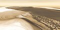
Computersimulation von Chasma Boreale, basierend auf dem THEMIS-Instrument von Mars Odyssey
Literatur
- K. E. Fishbaugh, J. W. Head: Comparison of North and South Polar Caps of Mars: New Observations from MOLA Data and Discussion of Some Outstanding Questions. In: Icarus. Band 154, 2001, S. 145–161 (englisch).
Weblinks
Einzelnachweise
- ↑ Dorling Kindersley Verlag GmbH: Die Planeten Eine visuelle Reise durch unser Sonnensystem. Dorling Kindersley, München 2015, ISBN 978-3-8310-2830-6.
- ↑ J. Garvin: Topographic evidence for geologically recent near-polar volcanism on Mars. In: Icarus. Band 145, 2000, S. 148–152.
- ↑ K. Fishbaugh, J. Head: The morphology of Chasma Boreale, Mars using MOLA data: Investigating mechanisms of formation. In: Journal of Geophysical Research. 2001.
- ↑ S. Clifford: Polar basal melting on Mars. In: Journal of Geophysical Research. Band 92, 1987, S. 9135–9152.
- ↑ A. Howard: The role of eolian processes in forming surface features of the martian polar layered deposits. In: Icarus. Band 144, 2000, S. 267–288.
- ↑ N. H. Warner, J. D. Farmer: Importance of aeolian processes in the origin of the north polar chasmata, Mars. In: Icarus. Band 196, 2008, S. 368–384.
- ↑ K. L. Tanaka u. a.: North polar region of Mars: Advances in stratigraphy, structure, and erosional modification. In: Icarus. Band 196, 2008, S. 318–358.
Auf dieser Seite verwendete Medien

Chasma Boreale Channels, as seen by hirise. Location is 80.6 North and 300.5 East. Image was taken by the Mars Reconnaissance Orbiter's HiRISE. The HiRISE camera was built by Ball Aerospace and Technology Corporation and is operated by the University of Arizona.
Chasma Boreale, as seen by hirise. Location is 84.4 degrees north latitude and 343.5 degrees east longitude. Image was taken by the Mars Reconnaissance Orbiter's HiRISE. The HiRISE camera was built by Ball Aerospace and Technology orporation and is operated by the University of Arizona. Image courtesy NASA/JPL/University of Arizona.
This false-color subframe shows the north polar layered deposits at top and darker materials at bottom exposed in a scarp at the head of Chasma Boreale, a large canyon eroded into the layered deposits. The polar layered deposits appear red because of dust mixed within them, but are ice-rich as indicated by previous observations. The water ice in the layered deposits is probably responsible for the pattern of fractures seen near the top of the scarp. The darker material below the layered deposits may have been deposited as sand dunes, as indicated by the cross-bedding (truncation of curved lines) seen near the middle of the scarp. It appears that brighter, ice-rich layers were deposited between the dark dunes in places. Image PSP_001334_2645 was taken by the High Resolution Imaging Science Experiment (HiRISE) camera onboard the Mars Reconnaissance Orbiter spacecraft on November 8, 2006. The complete image is centered at 84.4 degrees latitude, 343.5 degrees East longitude. The range to the target site was 317.4 km (198.4 miles). At this distance the image scale ranges from 31.8 cm/pixel (with 1 x 1 binning) to 63.5 cm/pixel (with 2 x 2 binning). The image shown here [below] has been map-projected to 25 cm/pixel. The image was taken at a local Mars time of 1:38 PM and the scene is illuminated from the west with a solar incidence angle of 67 degrees, thus the sun was about 23 degrees above the horizon. At a solar longitude of 132.3 degrees, the season on Mars is Northern Summer.
This first three-dimensional picture of Mars' north pole enables scientists to estimate the volume of its water ice cap with unprecedented precision, and to study its surface variations and the heights of clouds in the region for the first time.
Approximately 2.6 million of these laser pulse measurements were assembled into a topographic grid of the North pole with a spatial resolution of 0.6 miles (one kilometer) and a vertical accuracy of 15-90 feet (5-30 meters). The principal investigator for MOLA is Dr. David E. Smith of Goddard.
The MOLA instrument was designed and built by the Laser Remote Sensing Branch of the Laboratory for Terrestrial Physics at Goddard. The Mars Global Surveyor Mission is managed by NASA's Jet Propulsion Laboratory, Pasadena, CA, for the NASA Office of Space Science, Washington, DC.
Chasma Boreale Streamined Feature, as seen by hirise. Location is 84.7 North and 341.9 East. Image was taken by the Mars Reconnaissance Orbiter's HiRISE. The HiRISE camera was built by Ball Aerospace and Technology Corporation and is operated by the University of Arizona. Image courtesy NASA/JPL/University of Arizona.

Carte de Mars reconstituée à partir des mesures de Mars Global Surveyor (MOLA) et des observations de Viking.

Chasma Boreale, a long, flat-floored valley, cuts deep into Mars' north polar icecap. Its walls rise about 1,400 meters, above the floor. Where the edge of the ice cap has retreated, sheets of sand are emerging that accumulated during earlier ice-free climatic cycles. Winds blowing off the ice have pushed loose sand into dunes and driven them down-canyon in a westward direction. This scene combines images taken during the period from December 2002 to February 2005 by the Thermal Emission Imaging System instrument on NASA's Mars Odyssey was part of a special series of images marking the orbiter as the longest-working Mars spacecraft in history.