Chandler (Arizona)
| Chandler | |
|---|---|
 | |
 | |
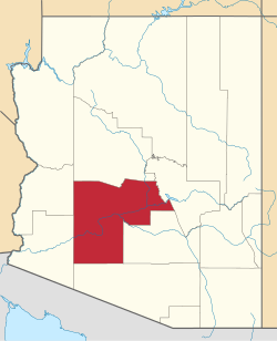
| Lage in Arizona | |
| Basisdaten | |
| Gründung: | 1912 |
| Staat: | Vereinigte Staaten |
| Bundesstaat: | Arizona |
| County: | Maricopa County |
| Koordinaten: | 33° 18′ N, 111° 50′ W |
| Zeitzone: | Mountain Standard Time (UTC−7) |
| Einwohner: – Metropolregion: | 275.987 (Stand: 2020) 4.845.832 (Stand: 2020) |
| Haushalte: | 93.887 (Stand: 2020) |
| Fläche: | 150,2 km2 (ca. 58 mi²) davon 149,9 km2 (ca. 58 mi²) Land |
| Bevölkerungsdichte: | 1.841 Einwohner je km2 |
| Höhe: | 370 m |
| Vorwahl: | +1 480 |
| FIPS: | 04-12000 |
| GNIS-ID: | 0002748 |
| Website: | www.chandleraz.gov |
| Bürgermeister: | Kevin Hartke[1] |
Chandler ist eine Stadt im Maricopa County im US-Bundesstaat Arizona mit 275.987 Einwohnern (Volkszählung 2020, U.S. Census Bureau).[2][3]
Chandler stellt eine principal city der Metropolregion Phoenix dar und liegt in einem sehr weitflächigen Städteverbund, in dem die Stadtgrenzen ineinander übergehen. Dazu gehören Tempe, Mesa, Glendale, Gilbert und Phoenix.
Chandler ist eine der am schnellsten wachsenden Städte der USA. Am Stellar Airpark (FAA Ident P19) ist der Hubschrauberhersteller RotorWay International beheimatet.
Einwohnerentwicklung
| Jahr | Einwohner[4] |
|---|---|
| 1980 | 29.673 |
| 1990 | 89.862 |
| 2000 | 176.581 |
| 2010 | 236.123 |
| 2020 | 275.987 |
Verkehr
Südlich von Chandler verlaufen die Arizona State Routes 87 und 202 und im Westen der Stadt führt die Arizona State Route 101 entlang.
Söhne und Töchter der Stadt
- Roy Nichols (1932–2001), Country-Musiker
- Shawn Michaels (* 1965), Wrestler
- Calvin Elfring (* 1976), Eishockeyspieler
- Terrell Suggs (* 1982), Footballspieler
- Kylee (* 1994), Sängerin
Weblinks
Einzelnachweise
- ↑ www.chandleraz.gov. (abgerufen am 9. Mai 2022).
- ↑ Explore Census Data Chandler city, Arizona. Abgerufen am 23. Oktober 2022.
- ↑ U.S. Census Bureau QuickFacts: Chandler city, Arizona. Abgerufen am 25. August 2021 (englisch).
- ↑ 1980–2010: Volkszählungsergebnisse
Auf dieser Seite verwendete Medien
Autor/Urheber: Ixnayonthetimmay, Lizenz: CC BY-SA 3.0
Photograph of the downtown area of Chandler, Arizona. Taken from the west side of the sidewalk about 100 feet north of the intersection of Boston Street and Arizona Avenue. The light-colored building is the Chandler Office Center. This photograph was taken by me and modified using Photoshop.
The flag of Chandler, Arizona. Adoption date is unknown. Though locals believe the logo seen on the flag was adopted in the mid 1980s.
This map shows the incorporated areas and Indian reservation boundaries in Maricopa County, Arizona, along with water bodies and major highways and roads.
- The City of Chandler is highlighted in red.
- Other incorporated cities are shown in gray, planning area borders for these cities and Indian reservation borders are shown as solid black lines.
- Changes from Previous Version: Updated the maps to include water bodies and to make "less boring" than the plain black/white/gray maps. Format was updated to match standards laid out by WikiProject Maps/Conventions. Map data is based on data from the following Webpage: Maricopa County Interactive GIS Map. I created this map in Inkscape.


