Cerro del Pinacate
| Cerro del Pinacate | ||
|---|---|---|
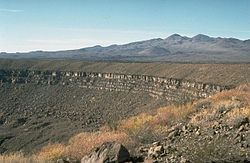
 Maar Elegante mit den Pinacate Peaks im Hintergrund | ||
| Höhe | 1190 m | |
| Lage | Sonora, Mexiko | |
| Gebirge | Sierra del Pinacate | |
| Koordinaten | 31° 46′ 21″ N, 113° 29′ 54″ W | |
| Typ | Vulkanfeld | |
Der Cerro del Pinacate ist ein Berg im mexikanischen Bundesstaat Sonora. Der Berg ist 1190 m hoch und damit die höchste Erhebung der Pinacate Peaks (auch Sierra del Pinacate). Er liegt in der Sonora-Wüste zwischen dem Golf von Kalifornien und dem US-Bundesstaat Arizona.
Weblinks
- Cerro Pinacate auf summitpost
- Cerro del Pinacate im Global Volcanism Program der Smithsonian Institution (englisch)
Auf dieser Seite verwendete Medien
Autor/Urheber:
- derivative work: Milenioscuro
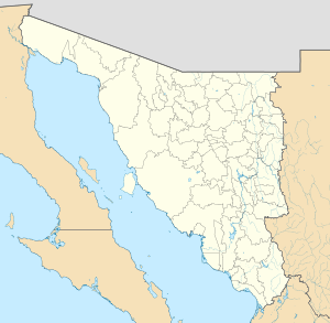
Location map of Sonora with the urban areas.
EPSG:3857 projection, Geographic limits of the map:
- N: 32.80° N
- S: 26.00° N
- W: 115.50° W
- E: 107.50° W
The Pinacate volcanic field is a roughly 55 x 60 km area containing numerous maars, tuff rings, and cinder cones in NW México near the head of the Gulf of California.
- The crater rim in the center of the photo is that of Crater Elegante, a 1.6-km-wide maar.
- Part of El Pinacate y Gran Desierto de Altar Biosphere Reserve — Sonora.


