Cerro Azul (Ecuador)
| Cerro Azul | ||
|---|---|---|
 Ein Tuffkegel in der Gipfelcaldera | ||
| Höhe | 1640 m | |
| Lage | Galápagos-Insel Isabela | |
| Koordinaten | 0° 55′ 0″ S, 91° 24′ 30″ W | |
| Typ | Schildvulkan | |
| Letzte Eruption | 2008 | |
Der Cerro Azul liegt am Südwestende der Galápagosinsel Isabela. Der Vulkan wird von einer steilwandigen Caldera mit einem Durchmesser von 4 × 5 Kilometern und einer maximalen Tiefe von 650 Metern beherrscht.
Der Cerro Azul ist mit 1640 Metern Höhe der zweithöchste aller Vulkane des Galapagos-Archipels. Jüngere Lavaströme bedecken einen Großteil des Grundes der Caldera. Der Cerro Azul ist einer der aktivsten Vulkane der Galapagos-Inseln. Bekannte Ausbrüche des Vulkans: 1850, 1932, 1940 (Ostflanke), April 1943, Juni 1948, 1951, 29. Juni 1959 (Ostflanke), 29. Januar 1979, 15. September bis 21. Oktober 1998 (Nord- und West-Seite der Caldera, Südostflanke, Ausstoß von 110 Millionen Kubikmetern Lava), 29. Mai bis 17. Juni 2008 (Gipfel und Südostflanke).
Weblinks
- Cerro Azul im Global Volcanism Program der Smithsonian Institution (englisch)
Auf dieser Seite verwendete Medien
Autor/Urheber: Hellerick, Lizenz: CC BY-SA 4.0
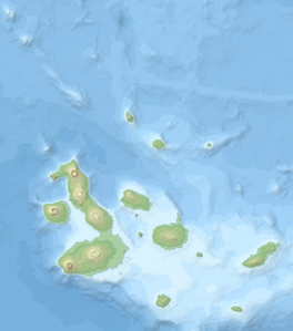
Topographic and bathymetric map of the Galápagos Islands, Ecuador.
A large tuff cone occupies the ENE side of the summit caldera of Cerro Azul volcano at the SW tip of Isabela Island. A small caldera bench is seen above the cone at the upper right, and a larger bench on the northern side of the caldera is outlined by the light-colored line below the horizon at the upper left. The 4 x 5 km wide caldera is one of the smallest of the Galápagos shield volcanoes, but its 650 m depth makes it one of the deepest. Youthful dark-colored lava flows at the left cover much of the caldera floor.


