Cautley Spout
| Cautley Spout | ||
|---|---|---|
(c) Rudi Winter, CC BY-SA 2.0 Wasserfall Cautley Spout | ||
| Koordinaten | 54° 22′ 20,5″ N, 2° 29′ 30,5″ W | |
| ||
| Ort | Cumbria, England | |
| Anzahl der Fallstufen | 1 | |
| Fallender Wasserlauf | mehrere unbenannte | |
| Mündungsgewässer | River Rawthey | |
Cautley Spout ist der höchste oberirdische Wasserfall Englands und liegt in Cumbria. Der Wasserfall entsteht aus verschiedenen kleinen Bächen auf einem Bergplateau, das von The Calf und Bram Rigg Top gebildet wird. Das Wasser fällt über 4 Stufen insgesamt 198 m. Am Fuß des Falls fließt das Wasser durch ein kurzes enges Tal und mündet dann in den River Rawthey.
Quellen
Auf dieser Seite verwendete Medien
(c) Rudi Winter, CC BY-SA 2.0
Cautley Spout. The upper section of the waterfall. The line of the stream turns by 90 degrees below this point and continues to cascade. The following lower section can be seen from quite a distance away: 243597.
Contains Ordnance Survey data © Crown copyright and database right, CC BY-SA 3.0
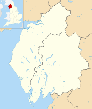
Map of Cumbria, UK with districts from 2023 shown.
Equirectangular map projection on WGS 84 datum, with N/S stretched 170%
Geographic limits:
- West: 3.80W
- East: 2.10W
- North: 55.20N
- South: 54.02N


