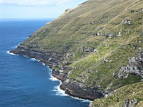
Cape Lovitt
| Cape Lovitt | ||
 Blick auf Cape Lovitt | ||
| Geographische Lage | ||
| Koordinaten | 50° 48′ S, 165° 52′ O | |
| Lage | westlichster Punkt von Auckland Island | |
| Gewässer | Südlicher Pazifischer Ozean | |
| Länge | 600 m | |
| Breite | 375 m | |
| Höhe | 160 m | |
 Auckland Islands mit Cape Lovitt als westlichsten Punkt | ||
Cape Lovitt ist ein Kap auf Auckland Island, einer der Inseln der Offshore Islands von Neuseeland.
Geographie
Cape Lovitt befindet sich an der Westküste der Hauptinsel der Auckland Islands. Das Kap stellt den westlichsten Punkt von Auckland Island und der gesamten Inselgruppe dar.[1] Gleichzeitig bildet das Kap inklusive der vorgelagerten 12-Seemeilen-Zone, die westlichste territoriale Grenze Neuseelands.
Die Klippen des Kaps sind extrem steil und erheben sich bis auf rund 160 m Höhe. Landeinwärts steigen die Berge zunächst mit dem Finger Rocks auf 411 m an und etwas weiter östlich mit dem Fleming Plateau auf 552 m.[1]
Einzelnachweise
- ↑ a b Auckland Islands. (JPG 5,7 MB) Land Information New Zealand, archiviert vom (nicht mehr online verfügbar) am 28. Oktober 2005; abgerufen am 28. Juni 2018 (englisch).
Auf dieser Seite verwendete Medien
Autor/Urheber: Rosso Robot, Lizenz: CC BY-SA 3.0
Positionskarte von Neuseeland
Quadratische Plattkarte, N-S-Streckung 150 %, Geographische Begrenzung der Karte:
- N: −43° S
- S: −56° S
- W: 158.4° O
- O: −174.6° W
STS089-743-5 Auckland Islands, New Zealand January 1998.
The barren, mountainous landscape of the Auckland Islands can be seen in this spectacular west-looking view. The uninhabited Auckland Islands are 290 miles (461 km) south of South Island, New Zealand in the southern Pacific Ocean. The total area of the islands is 234 square miles (377 square km). Auckland Island is the largest of the group and is 27 miles (44 km) long and 15 miles (24 km) wide. Mountains on the island rise up to over 2000 feet (610 meters) above sea level. The islands have several good harbors especially the one at Port Ross, which is situated at the northern tip of the island and is considered to be one of the best natural harbors in the world. The government of New Zealand maintains a depot on Auckland Island with supplies for shipwrecked sailors. During the STS-89 mission (1/29/98) there was a report of about 700 rare New Zealand seal lion pups found dead on the beaches of Dundas Island in the Auckland Island group. As of this this writing, results of autopsies conducted by biologists of the New Zealand Department of Conservation are not yet known. The animals had not been caught in nets or injured by trawlers; possible causes of death include a virus, bacteria, or a toxic algae bloom.Auckland Island - looking towards Cape Lovitt, the westernmost point of New Zealand


