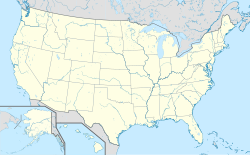
Booker T. Washington National Monument
| Booker T. Washington National Monument | ||
|---|---|---|
| Booker T. Washington National Monument | ||
| Lage: | Virginia, Vereinigte Staaten | |
| Nächste Stadt: | Rocky Mount | |
| Fläche: | 0,9 km² | |
| Gründung: | 2. April 1956 | |
| Besucher: | 19.321 (2002) | |
Das Booker T. Washington National Monument ist eine ehemalige Tabakfarm in der Nähe der Ortschaft Hardy (Franklin County) im US-Bundesstaat Virginia. Auf ihr wurde 1856 der Pädagoge und Schwarzenrechtler Booker T. Washington als Sklave geboren. Anlässlich seines 100. Geburtstages wurde das Areal 1956 zu einer Gedenkstätte vom Typ eines National Monuments erklärt.
Weblinks
- National Park Service: Booker T. Washington National Monument (offizielle Seite; englisch)
Auf dieser Seite verwendete Medien
Autor/Urheber: TUBS
Location map of the USA (Hawaii and Alaska shown in sidemaps).
Main map: EquiDistantConicProjection : Central parallel :
* N: 37.0° N
Central meridian :
* E: 96.0° W
Standard parallels:
* 1: 32.0° N
* 2: 42.0° N
Made with Natural Earth. Free vector and raster map data @ naturalearthdata.com.
Formulas for x and y:
x = 50.0 + 124.03149777329222 * ((1.9694462586094064-({{{2}}}* pi / 180))
      * sin(0.6010514667026994 * ({{{3}}} + 96) * pi / 180))
y = 50.0 + 1.6155950752393982 * 124.03149777329222 * 0.02613325650382181
      - 1.6155950752393982  * 124.03149777329222 *
     (1.3236744353715044  - (1.9694462586094064-({{{2}}}* pi / 180))
      * cos(0.6010514667026994 * ({{{3}}} + 96) * pi / 180))
Hawaii side map: Equirectangular projection, N/S stretching 107 %. Geographic limits of the map:
- N: 22.4° N
- S: 18.7° N
- W: 160.7° W
- E: 154.6° W
Alaska side map: Equirectangular projection, N/S stretching 210.0 %. Geographic limits of the map:
- N: 72.0° N
- S: 51.0° N
- W: 172.0° E
- E: 129.0° W
Autor/Urheber: Patriarca12, Lizenz: CC BY-SA 3.0
Booker T. Washington National Monument in Franklin County, Virginia, USA


