Bingkor
| Bingkor | ||
|---|---|---|
| Koordinaten | 5° 24′ N, 116° 12′ O | |
| Basisdaten | ||
| Staat | Malaysia | |
| Bundesstaat | Sabah | |
| ISO 3166-2 | MY-12 | |
| Einwohner | 51 (2010[1]) | |
Bingkor oder Bingkur ist eine Siedlung im Distrikt Keningau im malaysischen Bundesstaat Sabah. Bingkor liegt 123 Kilometer Fahrstrecke von Kota Kinabalu entfernt und gehört zur Interior Division. Laut Bevölkerungsstatistik von 2010 hat Bingkor 51 Einwohner.[1] O.K.K. Gunsanad Kina führte in Bingkor den Anbau von Naturkautschuk ein.[2]
Geschichte
Ab 1936 wurde auf Anweisung von Sir Jardine, dem britischen Gouverneur von Britisch-Nordborneo, versuchsweise eine indigene Selbstverwaltung in der Keningauebene eingeführt. Aufbauend auf seinen positiven Erfahrungen in Tanganjika wollte Jardine damit die schlechte Ertragslage aus der Kopfsteuer verbessern. Dazu wurde in Bingkor ein von Einheimischen geführtes Verwaltungszentrum errichtet, das für zwölf kampung mit einer Gesamtbevölkerung von 2.700 Einwohnern zuständig war und unter die Leitung des allseits respektierten Häuptlings Sedoman gestellt wurde. Bingkor war die erste Siedlung, die von der North Borneo Chartered Company volle finanzielle Eigenständigkeit zuerkannt bekannt.[3] Damit dieses Experiment nicht gestört wurde, war den katholischen Kirchen jegliche missionarische Arbeit in diesem Verwaltungsgebiet untersagt.[4]
Die Erfahrungen mit Bingkor’s Selbstverwaltung waren eine wesentliche Grundlage für den Aufbau der Native Administration in Britisch-Nordborneo. Diese Übertragung hoheitlicher Rechte auf die Ebene traditioneller indigener Rechtsprechung ist im heutigen Sabah durch das Native Courts Enactment 1992 gesetzlich verankert.[5]
Literatur
- K. G. Tregonning: A History Of Modern Sabah (North Borneo 1881–1963). 2. Ausgabe. University of Malaya Press, Kuala Lumpur 1965, Reprint 1967.
Einzelnachweise
- ↑ a b statistics.gov.my:Population Distribution by Local Authority Areas and Mukims, 2010 (Census 2010) ( vom 27. Februar 2012 im Internet Archive; PDF; 359 kB)
- ↑ Malaysia Today:Hari-hari terakhir seorang Ketua Menteri ( vom 4. August 2012 im Webarchiv archive.today) (malaiisch)
- ↑ Tregonning, S. 127
- ↑ John Rooney: Khabar Gembira: History of the Catholic Church in East Malaysia and Brunei, 1880-1976, 1981, Seite 189, Burns and Oates Ltd Wellwood North Farm rd, Turnbridge Wells Kent, ISBN 978-0-86012-122-0
- ↑ Native Courts Enactment 1992. ( des vom 25. Oktober 2012 im Internet Archive) Info: Der Archivlink wurde automatisch eingesetzt und noch nicht geprüft. Bitte prüfe Original- und Archivlink gemäß Anleitung und entferne dann diesen Hinweis. (PDF) lawnet.sabah.gov.my; abgerufen am 17. Juni 2012
Auf dieser Seite verwendete Medien
Autor/Urheber: Uwe Dedering, Lizenz: CC BY-SA 3.0
Location map of Malaysia.
Equirectangular projection. Strechted by 100.0%. Geographic limits of the map:
* N: 8.0° N
* S: 0.0° N
* W: 99.0° E
* E: 120.0° E
Made with Natural Earth. Free vector and raster map data @ naturalearthdata.com.
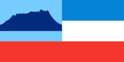
Flag of the Malaysian state Sabah. Based on a GIF from a government website, colors from a photo. Drawn by Mysid. The flag was adopted September 16, 1988.
- The mountain on the left is Mount Kinabalu.
Per the Constitution of the State of Sabah:
"The State Flag is in a rectangular shape and is in the proportion of 1:2. The canton which extends at the head half way to the fly and 2/3 at the hoist to the foot is in Icicle Blue (C1T9) as the background to a graphic silhouette of Mount Kinabalu which is in Royal Blue (B10) positioned at ¼ of the height of the canton from end to end. The fly of the flag is divided equally into three bands of colours the foot division of which extends right to the hoist. The top band is in Zircon Blue (C5T5) the second band is in white and the third band is in Chili Red (S6R4)."

