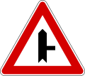
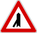
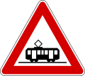
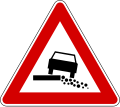
Bildtafel der Verkehrszeichen in Slowenien

Dieser Artikel wurde auf der Qualitätssicherungsseite des Portals Transport und Verkehr eingetragen.
Bitte hilf mit, ihn zu verbessern, und beteilige dich an der Diskussion. (+)
Die Bildtafel der Verkehrszeichen in Slowenien zeigt eine Auswahl wichtiger Verkehrszeichen in Slowenien. Die Verkehrszeichen wurden entsprechend dem Wiener Übereinkommen über Straßenverkehrszeichen gestaltet. Aus Gründen der Verständlichkeit bestehen die Verkehrszeichen überwiegend aus allgemein bekannten Piktogrammen, nur in wenigen Fällen werden Begriffe in slowenischer Sprache verwendet.
Warnzeichen
- Kurve links
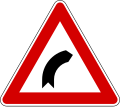
- Kurve rechts
- Doppelkurve (zunächst links)
- Doppelkurve (zunächst rechts)
- Gefälle (hier 23 %)
- Steigung (hier 23 %)
- Verengte Fahrbahn
- Einseitig (rechts) verengte Fahrbahn
- Einseitig (links) verengte Fahrbahn
- Bewegliche Brücke
- Ufer
- Unebene Fahrbahn
- Vertiefungen in der Fahrbahn
- gewölbte Fahrbahn
- Schleuder- oder Rutschgefahr
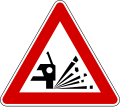
- Splitt, Schotter
- Steinschlag von rechts
- Steinschlag von links
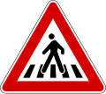
- Fußgängerüberweg
- Kinder
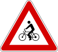
- Radverkehr
- Viehtrieb
- Wildwechsel
- Baustelle
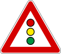
- Ampel
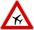
- Flughafen
- Seitenwind von links
- Seitenwind von rechts
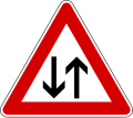
- Gegenverkehr
- Tunnel
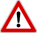
- Allgemeine Gefahrstelle
- Kreuzung oder Einmündung mit Vorfahrt von rechts
- Vorfahrt
- Vorfahrt – Einmündung von links (im rechten Winkel)
- Vorfahrt – Einmündung von rechts (im rechten Winkel)
- Vorfahrt – Einmündung von links (im spitzen Winkel)
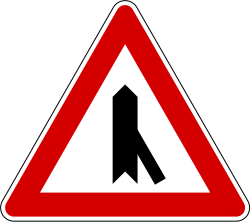
- Vorfahrt – Einmündung von rechts (im spitzen Winkel)
- Kreisverkehr
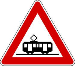
- Straßenbahn
- Glättegefahr bei Kälte
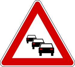
- Staugefahr
- unbefestigtes Bankett
- erhöhte Brandgefahr
- beschrankter Bahnübergang
- unbeschrankter Bahnübergang
- Andreaskreuz: Bahnübergang
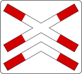
- Andreaskreuz: Bahnübergang mehrgleisig
- Andreaskreuz: Bahnübergang
- Andreaskreuz: Bahnübergang mehrgleisig
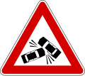
- erhöhte Unfallgefahr
Vorrangzeichen
- Vorfahrt achten
- Beginn einer Vorfahrtsstraße
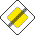
- Ende einer Vorfahrtsstraße
Verbots- und Beschränkungszeichen
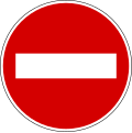
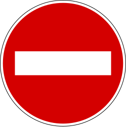
- Einfahrt verboten
- Fahrverbot in beiden Richtungen
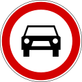
- Fahrverbot für Kraftfahrzeuge
- Fahrverbot für alle Kraftfahrzeuge, ausgenommen Mopeds und Motorräder
- Fahrverbot für Motorräder
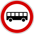
- Fahrverbot für Busse
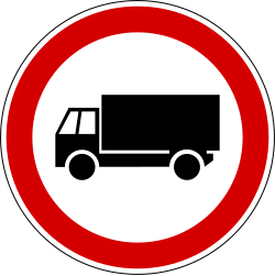
- Fahrverbot für LKW
- Fahrverbot für LKW mit einem auf der Tafel gezeigten Gesamtgewicht in Tonnen
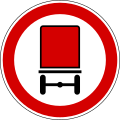
- Fahrverbot für Kraftfahrzeuge mit Wassergefährdenden Schadstoffen
- Fahrverbot für Kraftfahrzeuge mit explosiven oder brennbaren Stoffen
- Fahrverbot für Kraftfahrzeuge mit Gefahrgut
- Fahrverbot für Kraftfahrzeuge mit Anhänger, ausgenommen Sattelauflieger und leichte Anhänger
- Fahrverbot für Kraftfahrzeuge mit Sattelauflieger
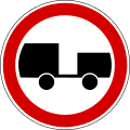
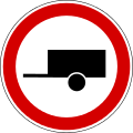
- Fahrverbot für Kraftfahrzeuge mit Anhänger
- Fahrverbot für Traktoren
- Fahrverbot für Mopeds
- Fahrverbot für Fahrräder
- Fahrverbot für Fuhrwerke
- Fahrverbot für Handkarren
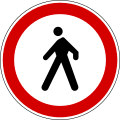
- Verbot für Fußgänger
- Fahrverbot für Kraftfahrzeuge und Fuhrwerke
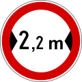
- Fahrverbot für Fahrzeuge über angegebener Breite
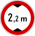
- Fahrverbot für Fahrzeuge über angegebener Höhe
- Fahrverbot für Fahrzeuge mit mehr als dem angegebenen Gesamtgewicht
- Fahrverbot für Fahrzeuge mit mehr als der angegebenen Achslast
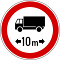
- Fahrverbot für Fahrzeuge mit mehr als der angegebenen Länge
- Mindestabstand zum vorausfahrenden Fahrzeug 100 m
- links abbiegen verboten
- rechts abbiegen verboten
- Wendeverbot
- Überholverbot
- Überholverbot für LkW
- zulässige Höchstgeschwindigkeit
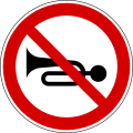
- Hupen verboten
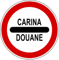
- Zoll
- Polizei
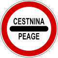
- Maut
- Gegenverkehr hat Vorrang
- absolutes Halteverbot
- eingeschränktes Halteverbot
- Halteverbot an ungeraden Tagen
- Halteverbot an geraden Tagen
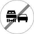
- Ende des Überholverbotes
- Ende des Überholverbotes für LKW
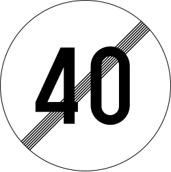
- Ende einer zulässigen Höchstgeschwindigkeit
- Ende aller Streckenverbote
Gebotszeichen
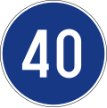
- Mindestgeschwindigkeit
- Ende der vorgeschriebenen Mindestgeschwindigkeit
- Schneekettenpflicht
- Fahrradweg
- Fußgängerweg
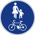
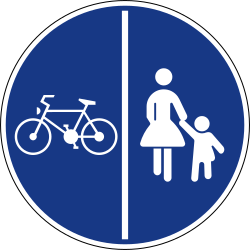
- geteilter Fußgänger- und Fahrradweg
- gemeinsamer Fußgänger- und Fahrradweg
- Reitweg
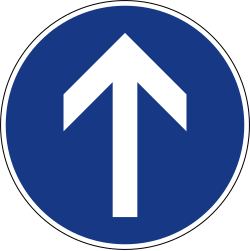
- geradeaus fahren
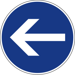
- hier links
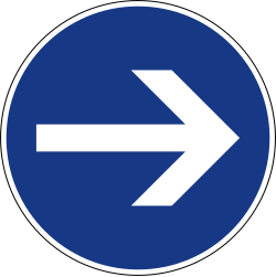
- hier rechts
- links abbiegen
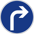
- rechts abbiegen
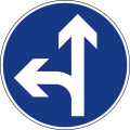
- geradeaus fahren oder links abbiegen
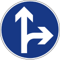
- geradeaus fahren oder rechts abbiegen
- links oder rechts abbiegen
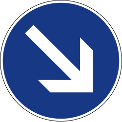
- rechts vorbeifahren
- links vorbeifahren
- Kreisverkehr
Hinweis- und Servicezeichen
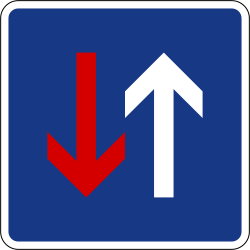
- Vorrang vor dem Gegenverkehr
- Einbahnstraße
- Einbahnstraße
- Einbahnstraße
- Radüberweg
- Fußgängerüberweg
- Raduberweg und Fussgangeruberweg
- Unter- oder -überführung
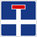
- Sackgasse
- Blockumfahrung
- Autobahn
- Autobahn Ende
- Kraftfahrstraße
- Kraftfahrstraße Ende
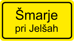
- Beginn einer geschlossenen Ortschaft
- Beginn einer offenen Ortschaft
- Ende einer geschlossenen Ortschaft
- Ende einer offenen Ortschaft
- Beginn einer Halteverbotszone
- Halteverbotszone Ende
- Beginn einer geschwindigkeitsbeschränkten Zone
- Ende einer geschwindigkeitsbeschränkten Zone
- Fußgängerzone Beginn
- Fußgängerzone Ende
- verkehrsberuhigte Zone Beginn
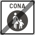
- verkehrsberuhigte Zone Ende
- Parkplatz
- Parkhaus
- kostenpflichtiger Parkplatz (mit Parkschein)
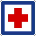
- Krankenhaus
- Krankenhaus/Arztpraxis
- Werkstatt
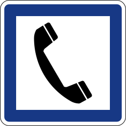
- Telefon
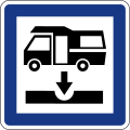
- Wohnmobilablassplatz
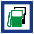
- Tankstelle
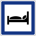
- Hotel/Motel
- Restaurant
- Kiosk
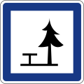
- Picknickplatz
- Zeltplatz
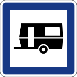
- Campingplatz für Wohnwagen
- Zelt- und Wohnwagenplatz
- Jugendherberge
- Toilette
- WC
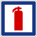
- Feuerlöscher
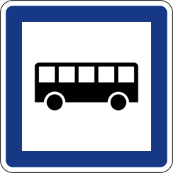
- Bushaltestelle
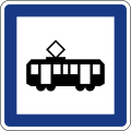
- Straßenbahnhaltestelle
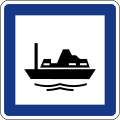
- Hafengebiet
- Hafen
- Park und Reisen
- Park und Reisen
- Fremdenverkehrsbüro oder Auskunftsstelle
- Waschanlage
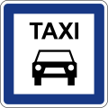
- Taxi
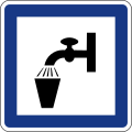
- Trinkwasser
- Straßenzustand
- Höhe
- Tunnel (mit Längenangabe)
- Brücke (mit Längenangabe)
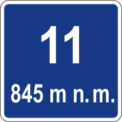
- Passstraße: Höhe des Passes
- Fluss
- Polizei
- Richtgeschwindigkeit
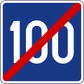
- Richtgeschwindigkeit Ende
- Bussonderfahrstreifen
- Bussonderfahrstreifen (Zeitliche Beschränkung)
- Bussonderfahrstreifen Ende
- Radioinformation
- Informationstafel an Grenzübergangsstellen
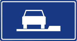
- Fahrstreifentafel
- Fahrstreifentafel (Ende)
- Wasserschutzzone
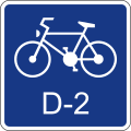
- Fahrradroute
Wegweisungs- und Orientierungszeichen
- Europastraße
- Autobahn
- Schnellstraße
- Landesstraße
- Fahrradroute
- Vorwegweiser
- Fahrstreifentafel
- Vorwegweiser auf Landesstraßen
- Wegweiser zur Autobahn
- Wegweiser zur Kraftfahrstraße
- Wegweiser zur Landesstraße
- Wegweiser zu einem innerörtlichen Ziel
- Wegweiser zu einem historischen Ziel
- Tabellenwegweiser
- Ausfahrt (1. Vorankündigung)
- Ausfahrtsankündigung (Tabellenwegweiser)
- Wegweiser auf der Autobahn
- Ausfahrt
- Wegweiser auf der Landesstraße
- Abfahrtsnummer
- Abfahrt als Ankündigung
- Autobahnkreuz, bzw. Autobahndreieck
- Entfernungstafel
- Rasthof in 1000 m
- Rasthof in 500 m
- Rasthof
- Wegweiser „zum Rasthof“
- Hinweis auf eine Mautstelle in 1000 m
- mehrsprachiger Hinweis auf eine Mautstelle in 500 m
- Fahrstreifentafel an Mautstellen
- Orientierungstafel an Mautstellen
- Zusatzzeichen: „Nur Anwohner“
- Zusatzzeichen, KFZ über 3,5 t
- Hinweis auf eine Tankstelle in 38 km
- undefined
- undefined
- undefined
- undefined
- undefined
- undefined
- parken nur zu hälfte auf dem Gehweg
- parallel halb auf dem Gehweg parken
- undefined
- auf dem Gehweg parken
- längs neben dem Gehweg parken
- parallel zum Gehweg auf der Straße parken
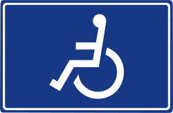
- Behindertenparkplatz
- Zusatztafel „Fahrzeuge werden abgeschleppt“
- Zusatzzeichen „bei Regen“
- Zusatzzeichen „bei Schnee“
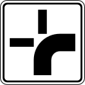
- abknickende Vorfahrt (1. Beispiel)
- abknickende Vorfahrt (2. Beispiel)
- Arbeiten an der Fahrbahnmarkierung
- Krötenwanderung
- Spurrillen auf 3 km
- Zusatztafel mit Richtungsangabe
- Zusatztafel an Bussen „Schulbus“
- Winterdienst
- Orientierungstafel an Mautstellen „Barzahler“
- Zusatzzeichen „nur LKW und Busse“
- Nothaltebucht
- Kilometertafel an Landesstraßen (1. Beispiel)
- Kilometertafel an Autobahnzubringern
- Kilometertafel an Landesstraßen (2. Beispiel)
- Kilometertafel an sonstigen Straßen (mit Ortsangabe)
- Kilometertafel an Fahrradwegen
- Zusatzzeichen "Slowenische Straße"
- Leittafel links, schwarz
- Leittafel rechts, schwarz
- Leittafel links, rot
- Leittafel rechts, rot
- große Leittafel links, schwarz
- Leittafel rechts, schwarz
- Einfädeln lassen
- Bei schlechter Sicht (unter 50 m) max. 50 km/h
- Schülerlotsen
- Planskizze einer Umleitung
- Fahrbahntafel (1. Beispiel)
- Fahrbahntafel (2. Beispiel)
- Fahrbahntafel (3. Beispiel)
- Fahrbahntafel (4. Beispiel)
- Reißverschluss in 300 m (von links)
- Reißverschluss in 300 m (von Rechts)
- undefined
- undefined
- undefined
- undefined
- undefined
- undefined
- undefined
- undefined
- undefined
- undefined
- linke Spur für Fahrzeuge bis max. 2,2 m Breite
- Verkehrslotsen
- Fahrbahntafel mit Breitenangabe
- undefined
- Spurfreigabe für bestimmte KFZ, zweispurig
- LKW geradeaus fahren
- Gefahrguttransporte links abbiegen
- Absolutes Halteverbot "Kreuzung"
- Warntafel "Schule", rechter Fahrbahnrand
- Warntafel "Schule" linker Fahrbahnrand
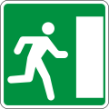
- Notausgang links
- Notausgang rechts
- Wegweiser zum Notausgang (1. Beispiel)
- Wegweiser zum Notausgang (2. Beispiel)
- Geschwindigkeitskontrolle
- undefined
- Zusatztafel "in 600 m"
- Zusatztafel >>STOP in 100 m<<
- Zusatztafel "auf 600 m"
- undefined
- undefined
- Zusatztafel "von 6 bis 22 Uhr"
Warnzeichen
Weblinks
- Verordnungen über die Verkehrszeichen in der Straßenverkehrsordnung Sloweniens (slowenisch; PDF)
Auf dieser Seite verwendete Medien
Lane movement regulation.
Railway crossing ahead without gates or barriers.
Caravan grounds.
Falling rocks on left side of the road.
Hazard marker.
Traffic lane management.
Road closed to motor vehicles towing a trailer, except for a semi-trailer or light residential trailer.
Bus lane.
Hazard marker.
Toll lane reserved for ABC collection system or cash fares.
Direction signpost.
Emergency bay.
School zone.
Priority route diagram.
Curve marker.
Road closed to trucks.
Detour sign.
Curve marker.
Equestrian path.
End of village.
Motorway.
Maltese road sign for Roadworks (I.F3)
Traffic cone.
Caravan waste station.
U-turn prohibited.
Wild animals on the road.
Turn left ahead.
Expressway number.
Direction table.
Radio information.
Traffic lane management.
Mandatory direction for vehicle class.
Primary road number.
Turn right ahead.
Police station.
Park & Ride facilities.
Hazard marker.
Two-way traffic.
Road closed to pedestrians.
Tow-away zone.
Traffic lane management.
Priority route diagram.
End bus lane.
No stopping or parking.
Road closed to motor vehicles exceeding the maximum permissible length.
Motorway number.
Curve marker.
Road closed to all traffic in both directions.
No overtaking by trucks.
Road closed to motorcycles.
Road closed to motor vehicles towing a trailer, except for a semi-trailer.
Roundabout ahead.
Services signboard.
Right turn prohibited.
Rutted road.
Slippery roadway.
Slow vehicle lane.
Traffic lane management.
Crosswind from the right.
Toilet.
Pedestrian zone.
One-way street.
Customs (passing without stopping first prohibited).
Parking or stopping prohibited in the direction of the additional plate. Ued with the No Parking and No Stopping signs.
Road narrows on the right side.
Above sign effective ahead in the direction and distance shown.
Village.
End maximum speed limit.
End motorway.
Road distance marker.
Give way to oncomming traffic.
Priority road.
Alternative day parking - even numbered days.
St. Andrew's Cross.
Motorway confirmation sign.
Traffic lane management.
Traffic lane management.
Road closed to motor vehicles towing a trailer.
Turn right.
Refreshment bar.
Road narrows.
Curve marker.
Roundabout mandatory.
Traffic calmed area.
Crossing with minor road on right, at an angle.
Street name sign.
Additional explanation plate.
Bus stop.
Motorway exit sign.
Marina.
Electronic signboard.
Motorway interchange sign.
Trafic queues likely ahead.
End advisory speed.
Dangerous descent.
Traffic lane management.
Road closed to motor vehicles exceeding the maximum width in metres.
How to park your vehicle.
Double bend or more consecutive turns, first to the left.
Traffic lane management.
Traffic lane management.
Snow removal.
Campground.
Bike path.
Direction signpost.
Limited access road.
Direction signpost.
Direction table.
Parking or stopping prohibited in the direction of the additional plate. Used with the No Parking and No Stopping signs.
St. Andrew's Cross.
Select toll collection lanes.
Curve marker.
Road distance marker.
Crossing with minor road on left.
Autor/Urheber:
- File:Human-preferences-desktop.svg: Pander / *abgeleitetes Werk Ju gatsu mikka
Unprotected riverbank or quay.
Left turn prohibited.
Speed limit during reduced visibility.
Mechanic.
Mandatory direction for vehicle class.
Traffic lanes segregated by vehicle class.
St. Andrew's Cross.
Above sign effective after the distance shown.
Minimum speed limit.
Autor/Urheber: Augustasci, Lizenz: CC0
Pedestrian and cyclist crossing
Emergency escape.
Restaurant.
Information.
Priority over oncoming traffic.
Direction table.
Road closed in this direction.
Viaduct sign.
Road distance marker.
Proceed straight or turn left.
Parking.
Road narrows on the left side.
End of village.
Hazard marker.
Emergency escape.
Disabled parking.
Bend to the left.
End overtaking restriction.
Toll lane reserved for ABC collection system.
No sounding your horn.
General Speed Limits sign used at border crossings into Slovenia.
Above sign effective ahead during the times shown.
Segregated path for pedestrians and bicycles.
Parking or stopping prohibited in the direction of the additional plate. Used with the No Parking and No Stopping signs.
Bus lane.
Crossing with minor road.
Give way to major road.
Road closed to trucks over the shown maximum permissible weight in metric tonnes.
Other danger.
Toilet.
Road closed to all motor vehicles, except mopeds and motorcylces.
Above sign valid during rainy weather.
Above sign effective ahead in the direction and distance shown.
Traffic signals ahead.
Traffic accident.
Metered parking.
How to park your vehicle.
Hazard marker.
Mountain cottage.
Pedestrian crossing ahead.
Road closed to motor vehicles exceeding the maximum height in metres.
Road closed to trolleys and carts.
Traffic lane management.
St. Andrew's Cross.
River sign.
Toll lane reserved buses and trucks.
Crosswind from the left.
How to park your vehicle.
Domestic animals on the road.
Traffic island marker.
End overtaking restriction for trucks.
Services signboard.
End speed limit zone.
Direction table.
Children in the road.
E Route number.
Traffic lane management.
Emergency escape.
Services signboard.
Taxi stop.
Additional explanation plate.
Drinking water.
Direction signpost.
Road closed to vehicles carrying explosives or inflammable substances.
How to park your vehicle.
Water protection zone.
Emergency station.
Electronic signboard.
Tunnel.
Falling rocks on right side of the road.
Electronic signboard.
Alternative day parking - odd numbered days.
Parking or stopping prohibited in the direction of the additional plate. Used with the No Parking and No Stopping signs.
Road closed to tractors.
Traffic lane management.
Petrol station.
First aid post.
Drawbridge.
Številka serpentine.
Two-way bike path.
Manual traffic control.
End slow vehicle lane.
One-way street.
Proceed straight.
Maintain passage.
End no parking zone.
Uneven roadway.
Proceed straight or turn left.
Road closed to vehicles carrying dangerous goods.
Direction signpost.
Road closed to bicycles.
Traffic calmed area.
Uneven roadway.
Uneven roadway.
Road closed to buses.
Railway crossing ahead with gates or barriers.
Curve marker.
Crossroads.
Turn left.
School zone.
Traffic lane management.
Speed radar.
Pedestrian path.
Traffic lane management.
Car wash.
Tunnel entrance sign.
Fire service.
Direction table.
Snow chains mandatory.
Stop sign ahead after the distance shown.
End limited access road.
Hotel or motel.
Minimum safe driving distance between vehicles.
Underground or elevated pedestrian crossing.
Merge using the zipper rule.
Road marking painting.
End minimum speed limit.
Direction table.
Crossing with minor road on right.
Tram stop.
Pedestrian crossing.
Traffic lane management.
Extreme risk of fire.
Loose road surface.
Road closed to motor vehicles exceeding the maximum permissible weight per axle.
One-way street.
No parking zone.
Dead end road.
Road distance marker.
Proceed straight or turn left.
Left turn prohibited ahead, follow alternative route.
Road closed to animal-drawn vehicles.
Dangerous ascent.
Camping and caravan grounds.
Hazard marker.
Advance sign for toll.
Bend to the right.
Emergency escape.
Toll (passing without stopping first prohibited).
Tramway.
Hazard marker.
Road closed for all motor vehicles.
Park & Ride facilities.
How to park your vehicle.
No parking.
Cyclist crossing.
Harbour / Port.
How to park your vehicle.
Picnic area.
Keep left.
Above sign valid during winter weather.
Road distance marker.
Direction table.
Additional explanation plate.
Cyclists on the road.
Roadworks signage.
Advance sign for toll.
Parking or stopping prohibited in the direction of the additional plate. Used with the No Parking and No Stopping signs.
Parking or stopping prohibited in the direction of the additional plate. Ued with the No Parking and No Stopping signs.
Road closed to motor vehicles exceeding the maximum weight in metric tonnes.
Maximum speed limit.
Traffic island marker.
Bike route number.
Low-flying aircraft nearby.
School patrol.
Road closed for all motor vehicles and animal-drawn vehicles.
Advisory speed.
Double bend or more consecutive turns, first to the right.
Keep right.
Services signboard.
Road closed to mopeds.
End priority road.
Traffic lane management.
Roadworks signage.
Frogs on the road.
Bike route.
Parking garage.
Above sign effective for the duration of the distance shown.
Motorway exit sign.
Children near or in the road.
End pedestrian zone.
Direction table.
Hazard marker.
Speed limit zone.
Traffic lane management.
Village.
Hazard marker.
No overtaking.
Telephone.
Police (passing without stopping first prohibited).
Soft road shoulder.
Road closed to tanker trucks carrying dangerous water pollutants.
Traffic lane management.
Traffic lane management.
Shared path for pedestrians and bicycles.
Crossing with minor road on left, at an angle.
Road closure and tyre requirement information board.
End all restrictions.

