Bharatpur (Division)
| Bharatpur Division भरतपुर मंडल | ||
|---|---|---|
| Bundesstaat: | Rajasthan | |
| Koordinaten | 27° 13′ N, 77° 29′ O | |
| Sitz der Verwaltung: | ? | |
| Fläche: | 18.723 km² | |
| Einwohner: | 5.405.619 | |
| Bevölkerungsdichte: | 289 Einwohner/km² | |
| Distrikte: | 4 | |
Bharatpur ist eine Division im indischen Bundesstaat Rajasthan.
Distrikte
Die Division Bharatpur umfasst vier Distrikte:
| Distrikt | Hauptstadt | Fläche in km² | Einwohner (Stand: 2001) | Bev.-Dichte in E/km² |
|---|---|---|---|---|
| Bharatpur | Bharatpur | 5.066 | 2.101.142[1] | 415 |
| Dholpur | Dholpur | 3.084 | 982.815 | 324 |
| Karauli | Dholpur | 5.530 | 1.205.631 | 218 |
| Sawai Madhopur | Sawai Madhopur | 5.043[2] | 1.116.031[2] | 248 |
| gesamt | 18.723 | 5.405.619 | 289 |
Einzelnachweise
- ↑ Offizielle Website des Distrikts Bharatpur ( vom 14. Juli 2009 im Internet Archive) Abgerufen am 12. März 2010
- ↑ a b Offizielle Website des Distrikts Sawai Madhopur ( vom 20. Mai 2013 im Internet Archive) Abgerufen am 12. März 2010
Auf dieser Seite verwendete Medien
India location map2.svg
Autor/Urheber: AshwiniKalantri, Lizenz: CC BY-SA 3.0
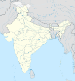
Location map of India. Equirectangular projection. Strechted by 106.0%. Geographic limits of the map: * N: 37.5° N * S: 5.0° N * W: 67.0° E * E: 99.0° E Made with Natural Earth. Free vector and raster map data @ naturalearthdata.com.
Autor/Urheber: AshwiniKalantri, Lizenz: CC BY-SA 3.0
Location map of India. Equirectangular projection. Strechted by 106.0%. Geographic limits of the map: * N: 37.5° N * S: 5.0° N * W: 67.0° E * E: 99.0° E Made with Natural Earth. Free vector and raster map data @ naturalearthdata.com.

