Beale Air Force Base
| Beale Air Force Base | ||
|---|---|---|
 | ||
| Kenndaten | ||
| ICAO-Code | KBAB | |
| IATA-Code | BAB | |
| Koordinaten | 39° 8′ 10″ N, 121° 26′ 11″ W | |
| Höhe über MSL | 34 m (112 ft) | |
| Verkehrsanbindung | ||
| Entfernung vom Stadtzentrum | 10 km östlich von Marysville | |
| Basisdaten | ||
| Eröffnung | 1942 | |
| Betreiber | United States Air Force | |
| Fläche | 93.000 ha | |
| Beschäftigte | 4000 | |
| Start- und Landebahn | ||
| 13/33 | 3658 m Beton | |

Die Beale Air Force Base (kurz: Beale AFB, IATA-Code: BAB, ICAO-Code: KBAB) ist ein Militärflugplatz der United States Air Force nahe Marysville, Kalifornien. Der ICAO-Code lautet KBAB, der IATA-Code BAB. Der Stützpunkt wurde nach dem Pionier Edward Fitzgerald Beale (1822–1893) benannt. Seit 1992 untersteht Beale dem Air Combat Command.
Die Basis stellt zudem einen census-designated place (CDP) dar, der zum Zeitpunkt der Volkszählung 2020 insgesamt 1303 Einwohner hatte.
Geschichte
Camp Beale wurde 1942 als Trainingsstützpunkt der United States Army für die 13th Armored und die 81st und 96th Infantry Division eingerichtet. Während des Zweiten Weltkrieges lebten 60.000 US-Soldaten auf der Basis, außerdem wurde dort ein 1000-Betten-Hospital eingerichtet und es wurde als Lager für Kriegsgefangene genutzt. Nach Kriegsende wurde es 1948 von der Army an die Air Force übergeben, die dort Trainingsziele für ihre Bomber nutzte, später dann auch zum Training von Bodencrews.
Im Jahr 1958 wurde die Start- und Landebahn errichtet, ein Jahr später wurden die ersten Tanker des Typs Boeing KC-135 nach Beale verlegt. Im Jahr 1964 teilte das Department of Defense mit, das neue Überschall-Aufklärungsflugzeug Lockheed SR-71 Blackbird auf der Beale AFB zu stationieren. Das 4200th Strategic Reconnaissance Wing wurde 1965 geschaffen, 1966 kam die erste von zwei Blackbirds auf die kalifornische Luftwaffenbasis. Diese wurden im Sommer 1966 dem 9th Strategic Reconnaissance Wing, ebenfalls auf Beale, zugewiesen. Im Jahr 1976 wurden die Aufklärungskapazitäten durch Lockheed U-2 ergänzt, die von der Davis-Monthan Air Force Base kamen. Im Jahr 1990 wurden die SR-71 deaktiviert, 1994 gingen auch die Tanker des 350th Air Refueling Squadron, diese wurden auf die McConnell Air Force Base verlegt.
Im Jahr 1998 kamen wieder Tanker des Reserve-Geschwaders 940th Air Refueling Wing, 2001 dann Aufklärungseinheiten des 12th Reconnaissance Squadron. Diese betreibt von Beale aus U-2, Trainingsjets Northrop T-38 Talon und die Drohne RQ-4A Global Hawk.

Auf der Beale Air Force Base unterhält das Air Force Space Command zudem eine Radarstation des PAVE-PAWS-Netzwerkes zur Erfassung von Starts von Submarine-launched ballistic missiles im Pazifik.
Weblinks
- Homepage der Beale AFB (englisch)


Auf dieser Seite verwendete Medien
Autor/Urheber: TUBS
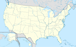
Location map of the USA (Hawaii and Alaska shown in sidemaps).
Main map: EquiDistantConicProjection : Central parallel :
* N: 37.0° N
Central meridian :
* E: 96.0° W
Standard parallels:
* 1: 32.0° N
* 2: 42.0° N
Made with Natural Earth. Free vector and raster map data @ naturalearthdata.com.
Formulas for x and y:
x = 50.0 + 124.03149777329222 * ((1.9694462586094064-({{{2}}}* pi / 180))
      * sin(0.6010514667026994 * ({{{3}}} + 96) * pi / 180))
y = 50.0 + 1.6155950752393982 * 124.03149777329222 * 0.02613325650382181
      - 1.6155950752393982  * 124.03149777329222 *
     (1.3236744353715044  - (1.9694462586094064-({{{2}}}* pi / 180))
      * cos(0.6010514667026994 * ({{{3}}} + 96) * pi / 180))
Hawaii side map: Equirectangular projection, N/S stretching 107 %. Geographic limits of the map:
- N: 22.4° N
- S: 18.7° N
- W: 160.7° W
- E: 154.6° W
Alaska side map: Equirectangular projection, N/S stretching 210.0 %. Geographic limits of the map:
- N: 72.0° N
- S: 51.0° N
- W: 172.0° E
- E: 129.0° W
Emblem of the USAF Air Combat Command
Autor/Urheber: Frank Schulenburg, Lizenz: CC BY-SA 4.0
Colonel Geoffrey I. Church, the Installation Commander and the 9th Reconnaissance Wing Commander, Beale Air Force Base, California, presenting at the Rotary Club of Chico on May 23, 2023
Global Hawk flies first Beale ACC sortie
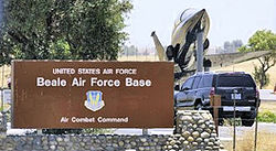
Beale's newly-arrived RQ-4 Global Hawk Remotely Piloted Aircraft took off from Beale Tuesday for its first operational Air Combat Command flightBeale AFB California main gate sign
This is a locator map showing Yuba County in California. For more information, see Commons:United States county locator maps.
Flag of California. This version is designed to accurately depict the standard print of the bear as well as adhere to the official flag code regarding the size, position and proportion of the bear, the colors of the flag, and the position and size of the star.
Autor/Urheber: NordNordWest, Lizenz: CC BY 3.0
Positionskarte von Kalifornien, USA
USGS digital orthophoto of Beale Air Force Base in Marysville, California, United States.


