Barker Range
| Barker Range | ||
|---|---|---|
| Lage | Viktorialand, Ostantarktika | |
| Teil der | Victory Mountains, Transantarktisches Gebirge | |
| Koordinaten | 72° 32′ S, 166° 10′ O | |
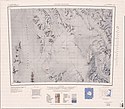
 Karte der Freyberg Mountains und des Evans-Firnfeldes, am rechten Kartenrand Monteath Hills, Millen Range und Barker Range | ||
Die Barker Range ist ein Gebirgszug im ostantarktischen Viktorialand. Sie erstreckt sich in nordwestlich-südöstlicher Richtung an der Südwestseite der Millen Range in den Victory Mountains. Zu ihr gehören der Jato-Nunatak, Mount Watt, Mount McCarthy und Mount Burton.
Das New Zealand Antarctic Place-Names Committee benannte den Gebirgszug nach Major James Richard Millton Barker (* 1926), kommandierender Offizier auf der Scott Base von 1970 bis 1971 und Manager des New Zealand Antarctic Program von 1970 bis 1986.
Weblinks
- Barker Range. In: Geographic Names Information System. United States Geological Survey, United States Department of the Interior, archiviert vom (englisch).
- Barker Range auf geographic.org (englisch)
Auf dieser Seite verwendete Medien
Autor/Urheber: Alexrk2, Lizenz: CC BY-SA 3.0
Physische Positionskarte Antarktis, Mittabstandstreue Azimutalprojektion
1:250,000-scale topographic reconnaissance map of the Freyberg Mountains area from 162°-163°30'E to 72°-73°S in Antarctica, including the Evans Névé. Mapped, edited and published by the U.S. Geological Survey in cooperation with the National Science Foundation.


