Ballyhaunis
| Ballyhaunis Béal Átha hAmhnais Ballyhaunis | ||
|---|---|---|
| ||
| Koordinaten | 53° 46′ 0″ N, 8° 46′ 0″ W | |
| Basisdaten | ||
| Staat | Irland | |
| Provinz | Connacht | |
| Grafschaft | Mayo | |
| ISO 3166-2 | IE-MO | |
| Höhe | 89 m | |
| Fläche | 2 km² | |
| Einwohner | 2773 (2022[1]) | |
| Dichte | 1.400,5 Ew./km² | |
| Telefonvorwahl | +353 (0)94 | |
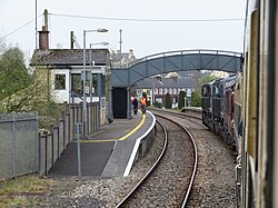
(c) Gareth James, CC BY-SA 2.0 Bahnhof Ballyhaunis | ||
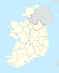
Ballyhaunis (irisch Béal Átha hAmhnais) ist eine Landstadt in Irland. Sie liegt im Osten des County Mayo in der Provinz Connacht, an der Kreuzung von N60 und N83. Beim Census 2022 wurde die Einwohnerzahl des Ortes mit 2773 Menschen ermittelt.[1]
Geschichte
Der Kiltullagh Hill ist ein Kalksteinhügel südöstlich von Ballyhaunis, auf dem eisenzeitliche und frühchristliche Funde gemacht wurden. Im Jahr 1348 wurde das Kloster St. Mary’s Abbey des Augustinerordens gegründet.[2] In dessen Umgebung entwickelte sich die Stadt, in der der River Clare entspringt.
Einwohnerentwicklung
Die Bevölkerungsanzahl hat sich in den letzten 30 Jahren nahezu verdoppelt. Dabei wurde ziemlich genau die Hälfte der Einwohner außerhalb der Republik Irland geboren.[1]
| 1996 | 2002 | 2006 | 2011 | 2016 | 2022 |
|---|---|---|---|---|---|
| 1287 | 1381 | 1708 | 2312 | 2366 | 2373 |
Verkehr
Ballyhaunis liegt an der Kreuzung der Nationalstraßen N60 (Castlebar–Roscommon) und N83 (Tuam–Ballyhaunis–(Charlestown)). Am 1. Oktober 1861 erhielt die Stadt einen Bahnhof an der Hauptstrecke Dublin–Westport.
Sehenswürdigkeiten
- St. Mary’s Abbey
Persönlichkeiten
- Bill Naughton (1910–1992), Autor
- Seán Flanagan (1922–1993), Politiker der Fianna Fáil
- Jim Higgins (* 1945), Politiker
Weblinks
Einzelnachweise
- ↑ a b c Ballyhaunis (Ireland) auf citypopulation.de, abgerufen am 17. Juli 2023
- ↑ St Mary's Abbey, Ballyhaunis Co. Mayo, in the West of Ireland | mayo-irelan. Abgerufen am 21. Mai 2023 (englisch).
Auf dieser Seite verwendete Medien
(c) Karte: NordNordWest, Lizenz: Creative Commons by-sa-3.0 de
Positionskarte von Irland
Autor/Urheber: National Library of Ireland on The Commons, Lizenz: No restrictions
To Mayo, God help us, this morning with a view of a typical Irish town.
It is thought that the town grew up around St Mary's Augustinian Friary (popularly referred to as "the Abbey"), which was founded in 1348, according to local tradition. The town and the surrounding hinterland is steeped in history and contains an extraordinary concentration of megalithic monuments.
Photographer: Robert French
Collection: <a href="http://catalogue.nli.ie/Collection/vtls000313414" rel="nofollow">The Lawrence Photograph Collection</a>
Date: between ca. 1865-1914
NLI Ref: L_CAB_08344
You can also view this image, and many thousands of others, on the NLI’s catalogue at catalogue.nli.ie
Autor/Urheber: JohnArmagh, Lizenz: CC BY-SA 3.0
Photograph of Ballyhaunis Friary, Co. Mayo, Ireland
(c) Gareth James, CC BY-SA 2.0
Ballyhaunis station. Ballyhaunis station, seen from the Railway Preservation Society of Ireland's West Awake railtour, with 071 class locomotives No. 075 and No. 082 in charge.


