Baath-Talsperre
| Baath-Talsperre | ||
|---|---|---|
 | ||
| Lage | ||
| Koordinaten | 35° 52′ 57″ N, 38° 45′ 20″ O | |
| Land | ||
| Ort | Gouvernement ar-Raqqa | |
| Gewässer | Euphrat | |
| Kraftwerk | ||
| Betriebsbeginn | 1987 | |
| Technik | ||
| Engpassleistung | 75 Megawatt | |
| Turbinen | 3 | |
| Sonstiges | ||
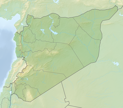
Die Baath-Talsperre, arabisch سد البعث, staut den Euphrat. Sie befindet sich 22 Kilometer flussaufwärts von Ar-Raqqah, Syrien. Sie wurde von 1983 bis 1986 errichtet.
Absperrbauwerk
Die Höhe des Absperrbauwerks beträgt 14 m.[1]
Kraftwerk
Das Kraftwerk verfügt über eine installierte Leistung von 75 MW. Die erste Maschine wurde 1987 in Betrieb genommen, die beiden anderen 1988.[1]
Infolge der Türkischen Militäroffensive in Nordsyrien 2019 wurde die Baath-Talsperre von der Syrischen Armee übernommen.
Siehe auch
Weblinks
Einzelnachweise
- ↑ a b Baath Hydroelectric Power Project Syria. Global Energy Observatory, abgerufen am 22. Oktober 2017 (englisch).
Auf dieser Seite verwendete Medien
Das Bild dieser Flagge lässt sich leicht mit einem Rahmen versehen
Flag of Syria. Originally flag of the Syria Revolution (from 2011), de facto flag of Syria beginning December 2024, official beginning March 2025.
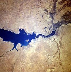
Completed in 1973, the Tabaqah Dam (center of image) on the Euphrates River can be seen in this near-nadir view. The Tabaqah Dam is an earth filled dam nearly 197 feet (60 meters) high and 3 miles (5 km) long. The dam holds the waters of Lake Assad (center to left center of the image), a 50-mile (80 km) long and 5-mile (8 km) wide reservoir. Lake Assad and the Tabaqah Dam have not only provided increased hydroelectric power but the lake has doubled Syria’s irrigated land. Actual crop production has not reached the goals set by the Syrian government due to a number of problems including the gypsum subsoil of the region, and whether or not farmers could be attracted back to this scarsely populated area from urban areas or more crowded agricultural areas in other parts of the country. Also the water levels within Lake Assad remain low due mostly in part to construction of the Keban and Ataturk Dams in Turkey, which have reduced the water flow of the Euphrates River in Syria.


