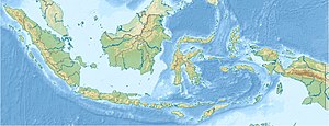
Ayau-Inseln
| Ayau-Inseln | ||
|---|---|---|
 | ||
| Gewässer | Halmaherasee | |
| Archipel | Raja Ampat | |
| Geographische Lage | 0° 28′ N, 131° 7′ O | |
| Anzahl der Inseln | ca. 10 | |
| Hauptinsel | Ayau | |
Die Ayau-Inseln, auch als Ayu-Inseln (indonesisch Pulau-pulau Ayu)[1] bekannt, sind eine indonesische Inselgruppe im Norden des Raja-Ampat-Archipels.
Die Gruppe besteht aus etwa zehn Inseln, die von zwei nahegelegenen Korallenriffen umgeben sind. Die gleichnamige Hauptinsel Ayau liegt im Süden der Inselgruppe. Administrativ bildet die Hauptinsel einen eigenen Distrikt (Kabupaten), während die anderen Inseln als Distrikt Ayauinseln (Kepulauan Ayau) zusammengefasst werden.
Inseln
![]() Karte mit allen Koordinaten: OSM | WikiMap
Karte mit allen Koordinaten: OSM | WikiMap
| Inselname | Aliasname | Koordinaten | Fläche | Einwohner |
|---|---|---|---|---|
| Ayau | Ayu | 00° 22′ N, 131° 03′ O | … | – |
| Mios Kuan | 00° 24′ N, 131° 08′ O | … | – | |
| Baba | 00° 24′ N, 130° 58′ O | … | – | |
| Abdon | 00° 30′ N, 131° 07′ O | … | – | |
| Rutton | 00° 34′ N, 131° 11′ O | … | – | |
| Reni | 00° 35′ N, 131° 12′ O | … | – | |
| Kanobe | 00° 36′ N, 131° 08′ O | … | – | |
| Pandaranger | 00° 37′ N, 131° 07′ O | … | – | |
| Mios Mandung | 00° 37′ N, 131° 07′ O | … | – |
Einzelnachweise
- ↑ Pulau-pulau Ayu. In: geonames.org. Abgerufen am 19. September 2021 (englisch).
Auf dieser Seite verwendete Medien
Autor/Urheber: Uwe Dedering, Lizenz: CC BY-SA 3.0
Location map of Indonesia.
Equirectangular projection. Strechted by 100.0%. Geographic limits of the map:
- N: 6.5° N
- W: 94.5° E
- E: 141.5° E
- S: -11.5° N
Autor/Urheber: Sentinel-2 cloudless 2016 by EOX IT Services GmbH is licensed under a Creative Commons Attribution 4.0 International License., Lizenz: CC BY-SA 4.0
Ayau Islands, Indonesia, Raja Ampat


