Autoroute A 30
| Autoroute A30 in Frankreich | ||||||||||||||||||||||||||||||||||||||||||||||||||||||||||||||||||||||
 | ||||||||||||||||||||||||||||||||||||||||||||||||||||||||||||||||||||||
| | ||||||||||||||||||||||||||||||||||||||||||||||||||||||||||||||||||||||
| Basisdaten | ||||||||||||||||||||||||||||||||||||||||||||||||||||||||||||||||||||||
| Betreiber: | DIR Est | |||||||||||||||||||||||||||||||||||||||||||||||||||||||||||||||||||||
| Gesamtlänge: | 51 km | |||||||||||||||||||||||||||||||||||||||||||||||||||||||||||||||||||||
| davon in Betrieb: | 25 km | |||||||||||||||||||||||||||||||||||||||||||||||||||||||||||||||||||||
| davon in Planung: | 26 km | |||||||||||||||||||||||||||||||||||||||||||||||||||||||||||||||||||||
 | ||||||||||||||||||||||||||||||||||||||||||||||||||||||||||||||||||||||
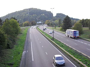
| Die A 30 bei Florange | ||||||||||||||||||||||||||||||||||||||||||||||||||||||||||||||||||||||
Straßenverlauf
| ||||||||||||||||||||||||||||||||||||||||||||||||||||||||||||||||||||||
Die Autoroute A 30, auch als Autoroute de la vallée de la Fensch bezeichnet, ist eine französische Autobahn mit Beginn in Richemont und aktuellem Ende in Aumetz. Ihre Länge beträgt heute 25 km.
Mit der weiteren Planung der Autobahn bis zur belgischen Grenze bei Mont-Saint-Martin sollen weitere 26 km hinzukommen.
Geschichte
- 7. Dezember 1963: Eröffnung Richemont - Uckange (A 31 - Abfahrt 1)
- 3. Dezember 1967: Eröffnung Uckange - Fameck (Abfahrt 1)
- 12. April 1980: Eröffnung Fameck - Knutange (Abfahrt 4)
- 25. Juni 1990: Eröffnung Knutange - Boulange (Abfahrt 4 – 6)
- ?. Dezember 1998: Eröffnung Boulange - Aumetz (Abfahrt 6 – 7)
Weblinks
- Autoroute A 30 in deutscher und französischer Fassung des SARATLAS
- Autoroute A 30 auf WikiSara (frz.)
Auf dieser Seite verwendete Medien
This is the national flag of Belgium, according to the Official Guide to Belgian Protocol. It has a 13:15 aspect ratio, though it is rarely seen in this ratio.
Its colours are defined as Pantone black, Pantone yellow 115, and Pantone red 032; also given as CMYK 0,0,0,100; 0,8.5,79,0; and 0,94,87,0.Autor/Urheber: Eigenes Werk, Lizenz: CC BY-SA 3.0
Motorway A30, in Florange, Moselle, France.
Autobahnanschlussstelle (Icon) in schwarz.
French motorway A31
French motorway A30
Tabliczka belgijskiej autostrady
French E-road shield


