Australian National Heritage List
In der Australian National Heritage List (deutsch: Australische Denkmal- und Naturschutzliste) werden australische Kultur- und Naturdenkmale eingetragen, die nach einem Eintrag gesetzlichen Schutz genießen. In Australien gilt für den Kultur- und Naturschutz das Environment Protection and Biodiversity Conservation Act 1999, ein Gesetz, das insbesondere den Schutz der Umwelt, des Naturerbes und der Biodiversität hervorhebt. Das Ziel des Denkmal- und Naturschutzes ist es sich für eine dauerhafte Erhaltung und Sicherung einzusetzen, nichts zu verfälschen, beschädigen, beeinträchtigen oder zerstören, damit das Kulturgüter und Naturerbe dauerhaft gesichert werden. Höchste Priorität haben Eintragungen, die darüber hinaus in die Liste des UNESCO-Welterbes eingetragen sind.
In Australien wird das nationale Kulturerbe und Naturerbe in unterschiedlichen Listen, neben den Listen des Welterbes bei der UNESCO, geführt und eingetragen: National Heritage List, Commonwealth Heritage List der Bundesländer (New South Wales, Victoria, Queensland, South Australia, Western Australia, Tasmania, Northern Territory, Australian Capital Territory), List of Overseas Places of Historic Significance to Australia (z. B. das ANZAC-Denkmal in Gallipoli), ehemalige Register of the National Estate und Australian National Shipwreck Database (Schiffswracks an den Küsten Australiens).
Nachfolgend sind die Objekte aufgeführt, die in der nationalen Australian National Heritage List eingetragen sind:
| Nr. | Bild | Ort/Objekt/Ensemble/Bauwerk/Nationalpark | Staat | Eintragungsdatum | Koordinaten | Bemerkungen |
|---|---|---|---|---|---|---|
| 1 |  | Adelaide Park Lands and City Layout (Ernennung) | South Australia | 7. November 2008 | 34° 56′ 4,8″ S, 138° 37′ 0,1″ O | |
| 2 | 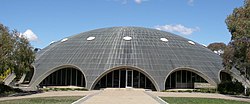 | Australian Academy of Science Building (Ernennung) | Australian Capital Territory | 21. November 2005 | 35° 17′ 1,2″ S, 149° 7′ 21,4″ O | |
| 3 |  | Australian Alps National Parks and Reserves - Alpine National Park (Ernennung) | Victoria | 7. November 2008 | 36° 29′ 59″ S, 148° 3′ 50″ O | |
| Australian Alps National Parks and Reserves - Avon Wilderness (Ernennung) | Victoria | 37° 36′ 45″ S, 146° 50′ 34″ O | ||||
 | Australian Alps National Parks and Reserves - Baw-Baw-Nationalpark (Ernennung) | Victoria | 37° 45′ 50″ S, 146° 13′ 23″ O | |||
 | Australian Alps National Parks and Reserves - Bimberi Nature Reserve (Ernennung) | New South Wales | 35° 34′ 54″ S, 148° 45′ 4″ O | |||
 | Australian Alps National Parks and Reserves - Brindabella-Nationalpark (Ernennung) | New South Wales | 35° 13′ 54″ S, 148° 46′ 44″ O | |||
 | Australian Alps National Parks and Reserves - Kosciuszko National Park (Ernennung) | New South Wales | 36° 4′ 20″ S, 148° 20′ 55″ O | |||
 | Australian Alps National Parks and Reserves - Mount-Buffalo-Nationalpark (Ernennung) | Victoria | 36° 44′ 18″ S, 146° 46′ 30″ O | |||
 | Australian Alps National Parks and Reserves - Namadgi National Park (Ernennung) | Australian Capital Territory | 35° 40′ 0″ S, 148° 57′ 0″ O | |||
| Australian Alps National Parks and Reserves - Scabby Range Nature Reserve (Ernennung) | New South Wales | 35° 45′ 55″ S, 148° 52′ 4″ O | ||||
(c) Tirin, CC BY-SA 3.0 | Australian Alps National Parks and Reserves - Snowy-River-Nationalpark (Ernennung) | Victoria | 37° 16′ 30″ S, 148° 33′ 12″ O | |||
 | Australian Alps National Parks and Reserves - Tidbinbilla-Naturreservat (Ernennung) | Australian Capital Territory | 35° 27′ 47″ S, 148° 54′ 38″ O | |||
| 4 |  | Australian Convict Sites - Brickendon Estate (Ernennung) | Tasmanien | 23. Juni 2007 | 41° 37′ 1″ S, 147° 7′ 39″ O | UNESCO-Welterbe 2010 |
 | Australian Convict Sites - Cascades Female Factory and Yard 4 North (Ernennung) | Tasmanien | 1. August 2007[1] | 42° 53′ 37″ S, 147° 17′ 57″ O | ||
 | Australian Convict Sites - Coal Mines Historic Site (Ernennung) | Tasmanien | 1. August 2007 | 42° 59′ 1″ S, 147° 42′ 59″ O | ||
 | Australian Convict Sites - Cockatoo Island (Ernennung) | New South Wales | 1. August 2007 | 33° 50′ 48,6″ S, 151° 10′ 16,1″ O | ||
 | Australian Convict Sites - Darlington Probation Station (Ernennung) | Tasmanien | 1. August 2007 | 42° 34′ 54″ S, 148° 4′ 12″ O | ||
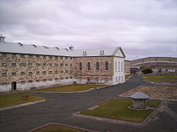
| Australian Convict Sites - Fremantle Prison (Ernennung) | Western Australia | 1. August 2005 | 32° 3′ 18″ S, 115° 45′ 13″ O | |||
| Australian Convict Sites - Great North Road (Ernennung) | New South Wales | 1. August 2007 | 33° 22′ 42″ S, 150° 59′ 40″ O | |||
(c) Citation of source, CC BY-SA 2.5 | Australian Convict Sites - Hyde Park Barracks (Ernennung) | New South Wales | 1. August 2007 | 33° 52′ 10″ S, 151° 12′ 45″ O | ||
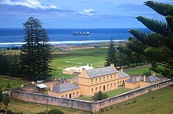 | Australian Convict Sites - Kingston and Arthurs Vale Historic Area (Ernennung) | Norfolk Island | 1. August 2007 | 29° 3′ 12″ S, 167° 57′ 31″ O | ||
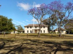
(c) Yewenyi, CC BY-SA 3.0 | Australian Convict Sites - Old Government House and Government Domain (Ernennung) | New South Wales | 1. August 2007 | 33° 48′ 35″ S, 150° 59′ 42″ O | ||
| Australian Convict Sites - Port Arthur Historic site (Ernennung) | Tasmanien | 3. Juni 2005 | 43° 8′ 52″ S, 147° 51′ 5″ O | |||
 | Australian Convict Sites - Woolmers Estate (Ernennung) | Tasmanien | 23. November 2007 | 41° 37′ 1″ S, 147° 7′ 48″ O | ||
| 5 |  | Australian Fossil Mammal Sites (Naracoorte) (Ernennung) | South Australia | 21. Mai 2007[2] | 36° 57′ 0″ S, 140° 45′ 0″ O | UNESCO-Welterbe 1994 |
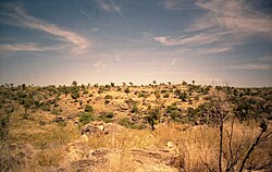 | Australian Fossil Mammal Sites (Riversleigh) (Ernennung) | Queensland | 19° 4′ 58,8″ S, 138° 43′ 1,2″ O | UNESCO-Welterbe 1994 | ||
| 6 | Australian War Memorial and the Memorial Parade (Ernennung) | Australian Capital Territory | 25. April 2006 | 35° 16′ 49,8″ S, 149° 8′ 56,6″ O | ||
| 7 | 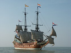 | Batavia Shipwreck Site and Survivor Camps Area 1629, Houtman Abrolhos (Ernennung) | Western Australia | 6. April 2006 | 28° 29′ 25″ S, 113° 47′ 36″ O | |
| 8 |  | Bondi Beach (Ernennung) | New South Wales | 25. Januar 2008 | 33° 53′ 27,6″ S, 151° 16′ 40,1″ O | |
| 9 |  | Bonegilla Migrant Reception and Training Centre (Ernennung) | Victoria | 7. Dezember 2007 | 36° 7′ 51,6″ S, 147° 0′ 49″ O | |
| 10 | Brewarrina Aboriginal Fish Traps (Baiames Ngunnhu) (Ernennung) | New South Wales | 3. Juni 2005 | |||
| 11 | Budj Bim National Heritage Landscape - Tyrendarra Area (Ernennung) | Victoria | 20. Juli 2004 | 38° 12′ 0″ S, 141° 46′ 0″ O | ||
| Budj Bim National Heritage Landscape - Mount Eccles/Lake Condah Area (Ernennung) | 38° 4′ 0″ S, 141° 55′ 0″ O | |||||
| 12 | 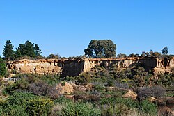 | Castlemaine Diggings National Heritage Park (Ernennung) | Victoria | 27. Januar 2005 | ||
| 13 |  | Cyprus Hellene Club – Australian Hall (Ernennung) | New South Wales | 20. Mai 2008 | Veranstaltungsort des Day of Mourning in 1938 | |
| 14 |  | Dampier-Archipel (Ernennung) | Western Australia | 3. Juli 2007 | 20° 34′ 51,6″ S, 116° 48′ 28,8″ O | |
| 15 | Dirk Hartog Landing Site 1616 - Cape Inscription Area (Ernennung) | Western Australia | 6. April 2006 | |||
| 16 |  | Dinosaur Stampede National Monument (Ernennung) | Queensland | 20. Juli 2004 | 23° 0′ 58″ S, 142° 24′ 41″ O | |
| 17 |  | Echuca Wharf (Ernennung) | Victoria | 26. April 2007 | 36° 7′ 11,6″ S, 144° 44′ 50,3″ O | |
| 18 |  | Ediacara Fossilienfundstätte - Nilpena (Ernennung) | South Australia | 11. Januar 2007 | 30° 48′ 28″ S, 138° 8′ 15″ O | |
| 19 | Elizabeth Springs (Ernennung) | Queensland | 4. August 2009 | |||
| 20 |  | Eureka Stockade Gardens (Ernennung) | Victoria | 8. Dezember 2004 | 37° 33′ 3″ S, 143° 51′ 30″ O | |
| 21 | 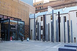 | First Government House Site, Sydney (Ernennung) | New South Wales | 19. August 2005 | ||
| 22 |  | Flemington Racecourse (Ernennung) | Victoria | 7. November 2006 | 37° 47′ 25″ S, 144° 54′ 45″ O | |
| 23 |  | Glass House Mountains National Landscape (Ernennung) | Queensland | 3. August 2006 | 26° 50′ 51″ S, 152° 57′ 15″ O | |
| 24 |  | Glenrowan Heritage Precinct (Ernennung) | Victoria | 5. Juli 2005 | 36° 28′ 0″ S, 146° 14′ 0″ O | Ort der Belagerung und Gefangennahme von Ned Kelly |
| 25 | 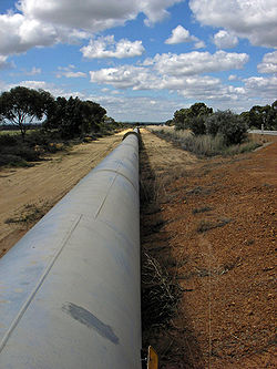 | Goldfields Water Supply Scheme (Ernennung) | Western Australia | 23. Juni 2011 | ||
| 26 |  | Gondwana-Regenwälder Australiens - Barrington Tops Gebiet (Ernennung) | New South Wales | 21. Mai 2007[2] | 32° 3′ 10″ S, 151° 29′ 37″ O | UNESCO-Welterbe 1986 |
 | Gondwana-Regenwälder Australiens - Focal Group Group (Ernennung) | NSW, Qld | 28° 55′ 0″ S, 152° 45′ 0″ O | |||
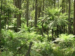 | Gondwana-Regenwälder Australiens - Hastings-Macleay Group (Ernennung) | New South Wales | 31° 11′ 0″ S, 152° 29′ 0″ O | |||
 | Gondwana-Regenwälder Australiens - Iluka Nature Reserve (Ernennung) | New South Wales | 29° 24′ 0″ S, 153° 22′ 0″ O | |||
 | Gondwana-Regenwälder Australiens - Main-Range-Nationalpark (Ernennung) | NSW, Qld | 27° 48′ 57″ S, 152° 15′ 56″ O | |||
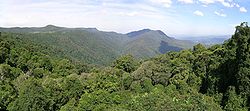 | Gondwana-Regenwälder Australiens - New-England-Nationalpark (Ernennung) | New South Wales | 30° 35′ 0″ S, 152° 27′ 0″ O | |||
 | Gondwana-Regenwälder Australiens - Shield Volcano Group (Ernennung) | NSW, Qld | 28° 9′ 0″ S, 153° 7′ 0″ O | |||
 | Gondwana-Regenwälder Australiens - Washpool und Gibraltar Range (Ernennung) | New South Wales | 29° 20′ 49″ S, 152° 19′ 58″ O | |||
| 27 |  | Grampians-Nationalpark (Gariwerd) (Ernennung) | Victoria | 15. Dezember 2006 | 37° 12′ 28″ S, 142° 23′ 59″ O | |
| 28 |  | Great Barrier Reef (Ernennung) | Queensland | 21. Mai 2007[2] | 18° 17′ 10″ S, 147° 42′ 0″ O | UNESCO-Welterbe 1981 |
| 29 | 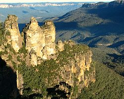 | Greater Blue Mountains Area (Ernennung) | New South Wales | 21. Mai 2007[2] | 33° 43′ 5″ S, 150° 18′ 38″ O | UNESCO-Welterbe 2000 |
| 30 |  | HMVS Cerberus (Ernennung) | Victoria | 14. Dezember 2005 | 37° 58′ 3″ S, 145° 0′ 28,4″ O | |
| 31 |  | Heard und McDonaldinseln (Ernennung) | Australische Außengebiete | 21. Mai 2007[2] | 53° 6′ 0″ S, 73° 31′ 0″ O | UNESCO-Welterbe 1997 |
| 32 |  | Hermannsburg Historischer Bezirk (Ernennung) | Northern Territory | 13. April 2006 | 23° 56′ 34,6″ S, 132° 46′ 40,5″ O | |
| 33 |  | High Court of Australia (former) (Ernennung) | Victoria | 11. Juli 2007 | ||
| 34 |  | High Court - National Gallery precinct (Ernennung) | Australian Capital Territory | 23. November 2007 | 35° 18′ 1″ S, 149° 8′ 12″ O | |
| 35 |  | HMAS Sydney II (Ernennung) | Western Australia | 14. März 2011 | 26° 14′ 39″ S, 111° 12′ 48″ O | Schiffswrack in 2470 m Tiefe, 290 km von der Küste entfernt |
| 36 | 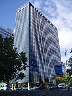 | ICI House bzw. Orica House (Ernennung) | Victoria | 21. September 2005 | 37° 48′ 32,4″ S, 144° 58′ 24,4″ O | |
| 37 | 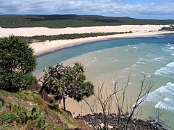 | K’gari (ehem. Fraser Island) (Ernennung) | Queensland | 21. Mai 2007[2] | 25° 13′ 0″ S, 153° 8′ 0″ O | UNESCO-Welterbe 1992 |
| 38 |  | Ku-ring-gai-Chase-Nationalpark, Lion Island, Long Island and Spectacle Island Nature Reserves (Ernennung) | New South Wales | 15. Dezember 2006 | 33° 39′ 4″ S, 151° 12′ 4″ O | |
| 39 |  | Kakadu National Park (Ernennung) | Northern Territory | 21. Mai 2007[2] | UNESCO-Welterbe 1981 | |
| 40 | Kormoran (Ernennung) | Western Australia | 14. März 2011 | Schiffswrack in 2560 m Tiefe, 22 km von der HMAS Sydney entfernt | ||
| 41 |  | Kurnell Peninsula Headland (Ernennung) | New South Wales | 20. September 2004 | 34° 0′ 42″ S, 151° 12′ 24″ O | Ort der Landung von James Cook von 1770 |
| 42 | 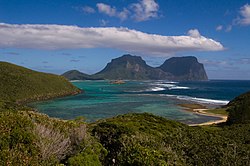 | Lord Howe Island Group (Ernennung) | New South Wales | 21. Mai 2007[2] | 31° 33′ 0″ S, 159° 5′ 0″ O | UNESCO-Welterbe 1982 |
| 43 |  | Macquarie Island (Ernennung) | Tasmanien | 21. Mai 2007[2] | 54° 37′ 0,1″ S, 158° 51′ 0″ O | UNESCO-Welterbe 1997 |
| 44 |  | Mawsons Huts and Mawsons Huts Historic site (Ernennung) | Australian Antarctic Territory | 27. Januar 2005 | 67° 0′ 30″ S, 142° 39′ 40″ O | |
| 45 | 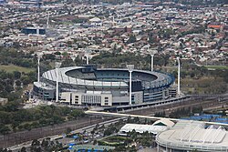 | Melbourne Cricket Ground (Ernennung) | Victoria | 26. Dezember 2005 | 37° 49′ 12″ S, 144° 59′ 0″ O | |
| 46 |  | Mount William Stone Hatchet Quarry (Ernennung) | Victoria | 25. Februar 2008 | ||
| 47 | Myall-Creek-Massaker Gedächtnisstätte (Ernennung) | New South Wales | 7. Juni 2008 | 29° 45′ 20″ S, 150° 42′ 24″ O | ||
| 48 | 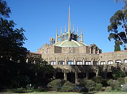 | Newman College (Ernennung) | Victoria | 21. September 2005 | 37° 47′ 42″ S, 144° 57′ 49″ O | |
| 49 |  | The Ningaloo Coast (Ernennung) | Western Australia | 6. Januar 2010 | 21° 56′ 3″ S, 113° 56′ 1″ O | |
| 50 |  | North Head (Ernennung) | New South Wales | 12. Mai 2006 | 33° 48′ 49,7″ S, 151° 17′ 50,6″ O | |
| 51 | 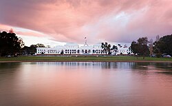 | Old Parliament House und Baulücke (Ernennung) | Australian Capital Territory | 20. Juni 2006 | 35° 18′ 7,5″ S, 149° 7′ 47,7″ O | |
| 52 |  | Point Cook Luftwaffenstützpunkt (Ernennung) | Victoria | 29. August 2007 | 37° 55′ 54″ S, 144° 45′ 12″ O | |
| 53 |  | Point Nepean Defence Sites and Quarantine Station Area (Ernennung) | Victoria | 16. Juni 2006 | 38° 18′ 7″ S, 144° 39′ 7″ O | |
| 54 | Porongurup-Nationalpark (Ernennung) | Western Australia | 4. August 2009 | 34° 40′ 46″ S, 117° 52′ 23″ O | ||
| 55 |  | Purnululu-Nationalpark (Ernennung) | Western Australia | 21. Mai 2007[2] | 17° 27′ 47″ S, 128° 33′ 51″ O | UNESCO-Welterbe 2003 |
| 56 |  | QANTAS hangar, Longreach (Ernennung) | Queensland | 2. Mai 2009 | 23° 26′ 11,3″ S, 144° 16′ 28,3″ O | |
| 57 | 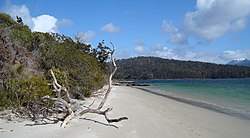 | Recherche Bay (North East Peninsula) Area (Ernennung) | Tasmanien | 7. Oktober 2005 | 43° 32′ 52″ S, 146° 54′ 10″ O | |
| 58 | Richmond Bridge (Ernennung) | Tasmanien | 25. November 2005 | 42° 44′ 1″ S, 147° 26′ 22″ O | ||
| 59 |  | Rippon Lea House and Gardens (Ernennung) | Victoria | 11. August 2006 | 37° 52′ 45,1″ S, 144° 59′ 58,2″ O | |
| 60 | 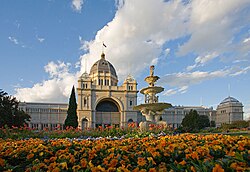 | Royal Exhibition Building and Carlton Gardens (Ernennung) | Victoria | 20. Juli 2004 | 37° 48′ 17″ S, 144° 58′ 16,4″ O | UNESCO-Welterbe 2004 |
| 61 |  | Royal National Park and Garawarra State Conservation Area (Ernennung) | New South Wales | 15. September 2006 | 34° 7′ 38″ S, 151° 3′ 48″ O | |
| 62 | 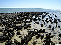 | Shark Bay (Ernennung) | Western Australia | 21. Mai 2007[2] | 25° 30′ 0″ S, 113° 30′ 0″ O | UNESCO-Welterbe Site 1991 |
| 63 |  | Sidney Myer Music Bowl (Ernennung) | Victoria | 21. September 2005 | 37° 49′ 23,8″ S, 144° 58′ 28″ O | |
| 64 | 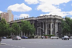 | Parliament House (Adelaide) (Ernennung) | South Australia | 26. Januar 2006 | 34° 55′ 16″ S, 138° 35′ 55″ O | |
| 65 | (c) Photographs by Gnangarra...commons.wikimedia.org, CC BY 2.5 au | Stirling Range National Park (Ernennung) | Western Australia | 15. Dezember 2006 | 34° 21′ 50″ S, 117° 59′ 20″ O | |
| 66 |  | Sydney Harbour Bridge (Ernennung) | New South Wales | 19. März 2007 | 33° 51′ 8″ S, 151° 12′ 38″ O | |
| 67 | 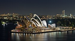 | Sydney Opera House (Ernennung) | New South Wales | 12. Juli 2005 | 33° 51′ 25″ S, 151° 12′ 55″ O | UNESCO-Welterbe 2007 |
| 68 | 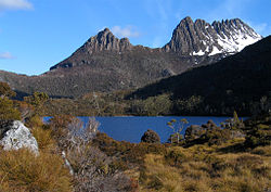 | Tasmanische Wildnis (Ernennung) | Tasmanien | 21. Mai 2007[2] | UNESCO-Welterbe 1982 | |
| 69 |  | Tree of Knowledge, Barcaldine (Ernennung) | Queensland | 26. Januar 2006 | Mit Pflanzenschutzmitteln 2006 vergiftet und 2007 gefällt | |
| 70 | 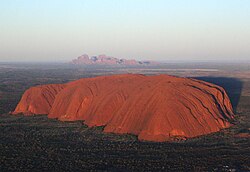 | Uluru-Kata Tjuta National Park (Ernennung) | Northern Territory | 21. Mai 2007[2] | 25° 20′ 42″ S, 131° 2′ 10″ O | UNESCO-Welterbe 1987 |
| 71 | 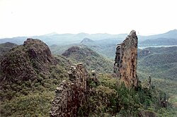 | Warrumbungle National Park (Ernennung) | New South Wales | 15. Dezember 2006 | 31° 13′ 54″ S, 149° 1′ 4″ O | |
| 72 | Wave Hill Walk Off Route (Ernennung) | Northern Territory | 9. August 2007 | |||
| 73 |  | Wet Tropics of Queensland (Ernennung) | Queensland | 21. Mai 2007[2] | 17° 30′ 0″ S, 145° 45′ 0″ O | UNESCO-Welterbe 1988 |
| 74 | (c) Photograph by Longhair, CC BY 2.5 | Willandra Lakes Region (Ernennung) | New South Wales | 21. Mai 2007[2] | 33° 39′ 55″ S, 143° 0′ 4″ O | UNESCO-Welterbe 1981 (einschl. Lake Mungo) |
| 75 |  | Witjira-Dalhousie Springs (Ernennung) | South Australia | 4. August 2009 | 26° 27′ 39″ S, 135° 31′ 23″ O | |
| 76 | Yea Flora Fossil Site (Ernennung) | Victoria | 11. Januar 2007 |
Siehe auch
- Australische Denkmalschutzliste nach Bundesländern
Einzelnachweise
Auf dieser Seite verwendete Medien
(c) Photograph by Longhair, CC BY 2.5
Photograph taken by myself, March 25, 2007, Mungo National Park, Australia.
The replica of the Batavia on the Markermeer during a filmshoot. The original ship, Batavia, was wrecked in 1629 off the Houtman Abrolhos islands about 50 km from the coast of Western Australia on its maiden voyage to the Dutch East Indies.
(c) Photographs by Gnangarra...commons.wikimedia.org, CC BY 2.5 au
Bluff Knoll, taken about 20 minutes prior to sunset to get maximum light on the face of Bluff Knoll
Autor/Urheber: John Stevens, Lizenz: CC BY-SA 3.0
Mount William Aboriginal stone axe quarry Victorian, Australia. Showing waste stone and blanks in primary reduction area.
(c) Conollyb in der Wikipedia auf Englisch, CC BY-SA 3.0
Aboriginal fish traps, Barwon River, Brewarrina, New South Wales Australia. The fish traps consist of river stones arranged to form small channels that direct the fish to a small area from which they can be readily plucked. The fish traps, which are believed to be many thousands of years old, are largely obscured by weed which sadly has been allowed to proliferate.
Autor/Urheber: Noodle snacks, Lizenz: CC BY-SA 3.0
Richmond Bridge, Richmond, Tasmania.
(c) Citation of source, CC BY-SA 2.5
Hyde Park Barracks, Sydney during Macquarie Night Lights from 23 November to 25 December 2006
Autor/Urheber: Mattinbgn, Lizenz: CC BY-SA 4.0
Wharf on the Murray River at Echuca, Victoria
Autor/Urheber: Bidgee, Lizenz: CC BY 3.0
Glass House Mountains viewed from Mary Cairncross Reserve.
Autor/Urheber: spud murphy from Sydney, Australia, Lizenz: CC BY-SA 2.0
Cockatoo Island, Sydney, Australia. Photographed from an aircraft.
(c) Kiwiteen123 at en.wikipedia, CC BY 3.0
The Australian War Memorial in Canberra from the bottom of the steps.
Autor/Urheber: JJ Harrison (https://www.jjharrison.com.au/), Lizenz: CC BY-SA 3.0
Du darfst es unter einer der obigen Lizenzen deiner Wahl verwenden.
Autor/Urheber: Peter Kovesi, Lizenz: CC BY-SA 4.0
Tetrodon Loop, Dirk Hartog Island, Shark Bay, Western Australia
Rymill Park, off East Terrace Adelaide, South Australia
Autor/Urheber: JJ Harrison (https://www.jjharrison.com.au/), Lizenz: CC BY-SA 3.0
Commissariat Store, Maria Island, Tasmania, Australia
Autor/Urheber: Collywolly, Lizenz: CC BY-SA 4.0
Cyprus Hellene Club - Australian Hall, 150-152 Elizabeth Street Sydney
Autor/Urheber: Happy Little Nomad, Lizenz: CC BY-SA 2.0
Hamelin Pool, on the way to Monkey Mia. They're responsible for a lot of the Earth's oxygen and the evolution of oxygen breathing lifeforms ie, us.
(c) Yewenyi, CC BY-SA 3.0
Picture taken and supplied by Brian Voon Yee Yap.
Government House in Parramatta.
en:Category:Images of SydneyFicus_watkinsiana_on_Syzygium_hemilampra-Iluka
Autor/Urheber: Alex Cohen, Lizenz: CC BY-SA 3.0
The summit of Mount Howitt taken from West Peak
Autor/Urheber: unknown, Lizenz: CC BY-SA 3.0
Autor/Urheber: Hullwarren, Lizenz: CC BY-SA 3.0
Macquarie Island isthmus after a snowfall
Autor/Urheber: Der ursprünglich hochladende Benutzer war Dimi juve in der Wikipedia auf Englisch, Lizenz: CC BY-SA 3.0
Author: Dimitri Koussa
Location: Royal National Park, Australia
Autor/Urheber: Adam.J.W.C., Lizenz: CC BY 3.0
Sydney Harbour Bridge
(c) Ghostieguide aus der englischsprachigen Wikipedia, CC BY-SA 3.0
The main cellblock taken by ghostieguide dec 22 2005
Pillbox at Point Nepean
Heard Island
Washpool (Main Camping Ground River)
Autor/Urheber: Alexis O'Connor, Lizenz: CC BY 2.0
Dalhousie Springs, South Australia
Autor/Urheber: user:SeanMack, Lizenz: CC BY 2.5
Pipeline, see en:Goldfields_Water_Supply_Scheme
Autor/Urheber: Die Autorenschaft wurde nicht in einer maschinell lesbaren Form angegeben. Es wird Matilda als Autor angenommen (basierend auf den Rechteinhaber-Angaben)., Lizenz: CC BY-SA 2.5
Goodradigbee river in the Brindabella valley, New South Wales, Australia
Picture taken by AYArktosOrica House, Melbourne. Photo taken on 24 December 2007
Autor/Urheber: Cgoodwin, Lizenz: CC BY 3.0
Tree ferns, Werrikimbe National Park, Walcha
Autor/Urheber: Photograph taken by Diliff and straightened by Ian Fieggen, Lizenz: CC BY 2.5
A view of the south-facing side of the Royal Exhibition Building in Melbourne, Australia. It was built in 1880 and is the first building to be given a World Heritage Site listing in Australia. This image was taken with a Canon 5D and 17-40mm f/4L lens on 13th of October, 2005.
Autor/Urheber: Mattinbgn, Lizenz: CC BY-SA 3.0
Sculpture at the Bonegilla Migrant Camp at en:Bonegilla, Victoria
AWM Caption: Aerial starboard bow view of the cruiser HMAS Sydney (II) (ex HMS Phaeton). Note the spar projecting forward of the bridge and single 4-inch AA guns amidships, which distinguished the Sydney from her two sisters. Her Seagull Amphibian is embarked.
Autor/Urheber: Ways, Lizenz: CC BY 3.0
HMVS Cerberus hulk in Half Moon Bay on the 16 Dec 2007.
(c) Conollyb in der Wikipedia auf Englisch, CC BY-SA 3.0
Cutting made by convict workers who would hammer a crowbar-like 'jumperbar' into the rock, fill the hole with gunpowder, plug the hole and ignite it. Visible are metre-long 'half holes' that remained after the rock face was blown away.
Autor/Urheber: Stanley Goodhew (via Miles Goodhew), Lizenz: CC BY-SA 2.0
Gwen Jack Leslie Bagnall Rupert Bimberi
Autor/Urheber: Diliff, Lizenz: CC BY-SA 3.0
A exposure blended photo of the Sydney Opera House, as viewed from the Sydney Harbour Bridge. Taken by myself with a Canon 5D and 100mm f/2.8 macro lens.
(c) Martin Pot (Martybugs at en.wikipedia), CC BY-SA 3.0
Penitentiary at Port Arthur, Tasmania.
Autor/Urheber: Cgoodwin, Lizenz: CC BY 3.0
Lutherische Kirche in Hermannsburg, Northern Territory, Australien.
- Description: A picture taken, of the view from the top of the en:Mount Ginini, en:Namadgi National Park.
- Source: Own work
- Date Taken: October 5th 2006
- Author: Dfrg.msc
- Uploader: Dfrg.msc
- Permission: Given
Mawson's Hut, Cape Denison, Antarctica..
Autor/Urheber: Mattinbgn, Lizenz: CC BY-SA 3.0
Historic Police station at en:Glenrowan, Victoria
Autor/Urheber: Cgoodwin, Lizenz: CC BY-SA 3.0
View from the skywalk, Dorrigo National Park
Autor/Urheber: me (w:User:pfctdayelise), Lizenz: CC BY-SA 2.5
The dome of the Dining building in Newman College, University of Melbourne, as seen from the courtyard.
Ruins at Saltwater Creek, Tasmania, Australia
Autor/Urheber: Tim Sabi, Lizenz: CC BY-SA 4.0
Sidney Myer Music Bowl aerial view including Melbourne skyline in background.
Autor/Urheber: Zoltan Olah, Lizenz: CC BY-SA 3.0
View of the Mt Buffalo plateau as seen from below the Horn.
(c) Bundesarchiv, Bild 146-1969-117-48 / CC-BY-SA 3.0
Dawn view of Uluru with Kata Tjuta in background, enhanced image
Autor/Urheber: Die Autorenschaft wurde nicht in einer maschinell lesbaren Form angegeben. Es wird Mbz1 als Autor angenommen (basierend auf den Rechteinhaber-Angaben)., Lizenz: CC BY-SA 3.0
The picture was taken at Ningaloo Reef, Indian Ocean of Exmouth, Western Australia by Brocken Inaglory
Autor/Urheber: Adam.J.W.C., Lizenz: CC BY-SA 2.5
Melbourne Cricket ground as seen from the worlds tallest residential building the Eureka Tower
Autor/Urheber: Robert Link from Manassas, US, Lizenz: CC BY-SA 2.0
City of Bunbury
Photo taken February 20, 1995
Conservation Building that protects the Lark Quarry trackways. The present Conservation Building that covers the trackways was constructed in 2002. This gives much better protection by; controlling the temperature and the humidity, preventing water running over the site after heavy rain, keeping out dust and grit and, preventing humans and animals from walking over the delicate site. Image taken from nearby trackway.
Cradle Mountain, Tasmanien, Australien
Autor/Urheber: Bidgee, Lizenz: CC BY-SA 3.0
Entrance of the High Court of Australia located in Parkes, Australian Capital Territory
Autor/Urheber: Ying-lung Lu, Lizenz: CC BY-SA 3.0
The main gate of Museum of Sydney, Cnr Bridge & Phillip Streets Circular Quay, Sydney
Lion Island at sunset
Looking south along the western side of Ships Stern
View westwards of Mount Mitchell.
Autor/Urheber: Original uploader was Rocky88 at en.wikipedia, Lizenz: CC BY-SA 3.0
Parliament House, Adelaide
Syzygium francisii & Argyrodendron trifoliolatum at Toonumbar National Park
Autor/Urheber: Tirin aka Takver - www.takver.com, Lizenz: CC BY-SA 3.0
A beach between Cockle Creek and Fishers Point on Recherche Bay, Tasmania
Autor/Urheber: Bidgee, Lizenz: CC BY-SA 2.5 au
Lockheed C-130A Hercules (A97-214) at the RAAF Museum in RAAF Williams Point Cook.
Autor/Urheber: Alex Cohen, Lizenz: CC BY-SA 3.0
The view across Gippsland from from Mt Baw Baw
Autor/Urheber: Alpha, Lizenz: CC BY-SA 2.0
Flemington Racecourse with Melbourne in the background.
(c) AndrewD MBarker at en.wikipedia, CC BY 2.5
Western view of Gibraltar Rock, Porongurup National Park, as seen from Bates Peak walk trail.
Autor/Urheber: Mattinbgn, Lizenz: CC BY-SA 3.0
Forrest Creek diggings, part of the Castlemaine Diggings National Heritage Park
Autor/Urheber: Willis Lim, Lizenz: CC BY-SA 2.0
Woolmers, Longford, Tasmania, Australia
Autor/Urheber: Fanny Schertzer, Lizenz: CC BY 2.5
View on Mount Lidgbird and Mount Gower from Mount Eliza.
Autor/Urheber: Sardaka 07:50, 23 February 2008 (UTC), Lizenz: CC BY-SA 3.0
Ripponlea, Melbourne, Australia (Kodachrome slide scanned at low res, originally taken c.1990)
Autor/Urheber: Der ursprünglich hochladende Benutzer war Tirin in der Wikipedia auf Englisch, Lizenz: CC BY-SA 3.0
Eureka Stockade 150th anniversary official commemoration at Dawn, December 3, 2005. Photo by Takver.
Autor/Urheber: Peterdownunder, Lizenz: CC BY-SA 3.0
Old farm buildings at Brickendon Estate, near Longford, Tasmania. Listed as a part of the World Heritage Australian Convict Sites
An intrepid hiker tests his nerve on the Balconies, formerly known as the "Jaws of Death" - Grampians National Park, Victoria, Australia
Autor/Urheber: Die Autorenschaft wurde nicht in einer maschinell lesbaren Form angegeben. Es wird Merikanto~commonswiki als Autor angenommen (basierend auf den Rechteinhaber-Angaben)., Lizenz: CC BY 2.5
Dickinsonia costata, an Ediacarian type animal.
Autor/Urheber: J Bar, Lizenz: CC BY-SA 3.0
Kurnell sandstone cliffs, view towards Pacific Ocean
Autor/Urheber: Camerong, Lizenz: CC BY-SA 3.0
The Tree of Knowledge at Barcaldine, 1997
A skeleton of a Marsupial Lion (Thylacoleo carnifex) in the Victoria Fossil Cave, Naracoorte Caves National Park

