Atlantische Hurrikansaison 1969
 Alle Stürme der Saison | |
| Bildung des ersten Sturms | 7. Juni |
|---|---|
| Auflösung des letzten Sturms | 25. November |
| Stärkster Sturm | Camille – 905 hPa (mbar), 165 kn (306 km/h) |
| Stürme | 18 |
| Hurrikane | 12 |
| Schwere Hurrikane (Kat. 3+) | 5 |
| Opferzahl gesamt | 364 |
| Gesamtschaden | 17 Milliarden $ (1969) |
| Atlantische Hurrikansaison 1967, 1968, 1969, 1970, 1971 | |
Die Hurrikan-Saison 1969 im Atlantik fing offiziell am 1. Juni 1969 an und dauerte bis 30. November 1969. Diese Daten grenzen üblicherweise die Periode des Jahres ab, in der sich im atlantischen Becken die meisten tropischen Wirbelstürme bilden.
Der stärkste Sturm des Jahres war Hurrikan Camille, der im atlantischen Bassin siebtstärkste Sturm und beim Landanfall in den Vereinigten Staaten der zweitstärkste jemals beobachtete Sturm. Camilles Landanfall war nahe der Bucht St. Louis, Mississippi. Dort traf er als Kategorie-5-Hurrikan auf der Saffir-Simpson-Hurrikan-Windskala auf Land und tötete 256 Menschen und verursachte Kosten von 1,4 Milliarden US-Dollar (9,2 Milliarden im Jahr 2005) an Sachschäden. Weitere bemerkenswerte Stürme waren Hurrikan Francelia, der schwere Überschwemmungen in Belize verursachte und 100 Menschen tötete, Hurrikan Inga, der fast 25 Tage dauerte und zu der Zeit der Hurrikan mit der zweitlängsten jemals beobachteten Dauer war, sowie Hurrikan Martha, der Überschwemmungen und Erdrutsche in Costa Rica und in Panama verursachte.
Aktivität der Saison
Die atlantische Hurrikansaison 1969 war mit 18 tropischen Wirbelstürmen, von denen 12 Hurrikanstatus erreichten, bis zur Atlantischen Hurrikansaison 2005 die aktivste seit Beginn der Aufzeichnungen, und sie ist immer noch die zweitaktivste Saison in diesem Becken. Der wahrscheinliche Grund für die erhöhte Tätigkeit waren die starken Luftdruckunterschiede infolge des La Niña, das auch die pazifische Hurrikansaison 1969 und die die pazifische Taifunsaison 1969 beeinflusste. Trotz der hohen Tätigkeit blieben die meisten tropischen Wirbelstürme entweder über dem Meer, oder der Landfall erfolgte mit minimaler Stärke.
Die Meteorologen hatten Ende der 1960er Jahre erst angefangen, den Zusammenhang zwischen tropischen und subtropischen Stürmen zu verstehen; eine Reihe der achtzehn Wirbelstürme der Saison 1969 wurde deswegen nicht benannt. Außerdem wurden einige der tropischen Stürme nachträglich als Hurrikane klassifiziert.
Stürme
Tropisches Tiefdruckgebiet Sieben
| Tropisches Tiefdruckgebiet | |||
|---|---|---|---|
| |||
| Dauer | 7. Juni – 9. Juni | ||
| Intensität | 25 kn (45 km/h) (1-minütig), 1002 hPa | ||
Tropischer Sturm Anna
| Tropischer Sturm | |||
|---|---|---|---|
| |||
| Dauer | 25. Juli – 3. August | ||
| Intensität | 60 kn (110 km/h) (1-minütig), 1002 hPa | ||

Hurrikan Blanche
| Kategorie-1-Hurrikan | |||
|---|---|---|---|
| |||
| Dauer | 11. August – 12. August | ||
| Intensität | 75 kn (140 km/h) (1-minütig), 997 hPa | ||
Hurrikan Camille
| Kategorie-5-Hurrikan | |||
|---|---|---|---|
| |||
| Dauer | 14. August – 22. August | ||
| Intensität | 165 kn (305 km/h) (1-minütig), 905 hPa | ||
- → Hauptartikel: Hurrikan Camille
Hurrikan Debbie
| Kategorie-3-Hurrikan | |||
|---|---|---|---|
| |||
| Dauer | 14. August – 25. August | ||
| Intensität | 105 kn (195 km/h) (1-minütig), 951 hPa | ||
- → Hauptartikel: Hurrikan Debbie (1969)
Tropischer Sturm Eve
| Tropischer Sturm | |||
|---|---|---|---|
| |||
| Dauer | 25. August – 27. August | ||
| Intensität | 50 kn (95 km/h) (1-minütig), 996 hPa | ||
Hurrikan Francelia
| Kategorie-3-Hurrikan | |||
|---|---|---|---|
| |||
| Dauer | 29. August – 4. September | ||
| Intensität | 100 kn (185 km/h) (1-minütig), 973 hPa | ||
_NOAA.JPG)
Hurrikan Gerda
| Kategorie-3-Hurrikan | |||
|---|---|---|---|
| |||
| Dauer | 6. September – 10. September | ||
| Intensität | 110 kn (205 km/h) (1-minütig), 979 hPa | ||
Hurrikan Holly
| Kategorie-1-Hurrikan | |||
|---|---|---|---|
| |||
| Dauer | 14. September – 21. September | ||
| Intensität | 75 kn (140 km/h) (1-minütig), 984 hPa | ||
Tropisches Tiefdruckgebiet Neunundzwanzig
| Tropisches Tiefdruckgebiet | |||
|---|---|---|---|
| |||
| Dauer | 19. September – 23. September | ||
| Intensität | 30 kn (55 km/h) (1-minütig), 1006 hPa | ||
Hurrikan Inga
| Kategorie-3-Hurrikan | |||
|---|---|---|---|
| |||
| Dauer | 20. September – 15. Oktober | ||
| Intensität | 100 kn (185 km/h) (1-minütig), 964 hPa | ||
- → Hauptartikel: Hurrikan Inga (1969)
Hurrikan Ten
| Kategorie-1-Hurrikan | |||
|---|---|---|---|
| |||
| Dauer | 21. September – 26. September | ||
| Intensität | 65 kn (120 km/h) (1-minütig), 985 hPa | ||
Tropischer Sturm Elf
| Tropischer Sturm | |||
|---|---|---|---|
| |||
| Dauer | 24. September – 30. September | ||
| Intensität | 60 kn (110 km/h) (1-minütig), 995 hPa | ||
Subtropischer Sturm Eins
| Subtropischer Sturm (SSHWS) | |||
|---|---|---|---|
| |||
| Dauer | 29. September – 3. Oktober | ||
| Intensität | 50 kn (95 km/h) (1-minütig), 996 hPa | ||
Tropischer Sturm Jenny
| Tropischer Sturm | |||
|---|---|---|---|
| |||
| Dauer | 1. Oktober – 6. Oktober | ||
| Intensität | 40 kn (75 km/h) (1-minütig), 1000 hPa | ||
Hurrikan Kara
| Kategorie-2-Hurrikan | |||
|---|---|---|---|
| |||
| Dauer | 7. Oktober – 18. Oktober | ||
| Intensität | 90 kn (165 km/h) (1-minütig), 978 hPa | ||
Hurrikan Laurie
| Kategorie-2-Hurrikan | |||
|---|---|---|---|
| |||
| Dauer | 17. Oktober – 27. Oktober | ||
| Intensität | 90 kn (165 km/h) (1-minütig), 973 hPa | ||
Tropischer Sturm Sechzehn
| Tropischer Sturm | |||
|---|---|---|---|
| |||
| Dauer | 28. Oktober – 31. Oktober | ||
| Intensität | 60 kn (110 km/h) (1-minütig), 990 hPa | ||
Hurrikan Siebzehn
| Kategorie-1-Hurrikan | |||
|---|---|---|---|
| |||
| Dauer | 30. Oktober – 7. November | ||
| Intensität | 65 kn (120 km/h) (1-minütig), 988 hPa | ||
Hurrikan Martha
| Kategorie-1-Hurrikan | |||
|---|---|---|---|
| |||
| Dauer | 21. November – 25. November | ||
| Intensität | 80 kn (150 km/h) (1-minütig), 979 hPa | ||
Martha war der am weitesten südlich gelegene Hurrikan der Geschichte. Kein anderer Hurrikan machte so weit südlich einen Landfall wie Martha am 24. November 1969 über Panama. Zudem war es der erste und bisher einzige Hurrikan der Landfall über Panama machte.
Sturmnamen
Die folgenden Namen wurden für Benennung der Stürme der atlantischen Hurrikansaison 1969 verwendet, wobei die Namen Blanche, Camille, Eve, Francelia, Holly, Kara, Laurie und Martha das erste Mal verwendet wurden. Auf der Liste der Namen tropischer Wirbelstürme für die Saison 1969 stand ursprünglich Carol,[1] wurde jedoch irgendwann nach Beginn der Saison vor dem 14. August durch Camille ersetzt.
Anna, Blanche, Camille, Debbie, Eve, Francelia, Gerda, Holly, Inga, Jenny, Kara, Laurie und Martha.
Nicht verwendet wurden die Sturmnamen Netty, Orva, Peggy, Rhoda, Sadie, Tanya, Virgy und Wenda.
Der Name Camille wurde später von der Liste der Namen tropischer Wirbelstürme gestrichen.
Weblinks
Einzelnachweise
- ↑ Reuters: It's time (June) to match for Anna… (PDF), The Daily Gleaner, 1. Juni 1969. Abgerufen am 28. Januar 2010 (englisch).
1492–1600 | 1601–1700 | 1701–1799 | 1800er | 1810er | 1820er | 1830er | 1840er | 1850er | 1860er | 1870er | 1880–1884 | 1885 | 1886 | 1887 | 1888 | 1889 | 1890 | 1891 | 1892 | 1893 | 1894 | 1895 | 1896 | 1897 | 1898 | 1899 | 1915 | 1916 | 1917 | 1918 | 1919 | 1928 | 1929 | 1930 | 1931 | 1932 | 1933 | 1934 | 1935 | 1936 | 1937 | 1938 | 1939 | 1940 | 1941 | 1942 | 1943 | 1944 | 1945 | 1946 | 1947 | 1948 | 1949 | 1950 | 1951 | 1952 | 1953 | 1954 | 1955 | 1956 | 1957 | 1958 | 1959 | 1960 | 1961 | 1969 | 1970 | 1971 | 1972 | 1973 | 1974 | 1975 | 1976 | 1977 | 1978 | 1979 | 1980 | 1981 | 1982 | 1983 | 1984 | 1985 | 1986 | 1987 | 1988 | 1989 | 1990 | 1991 | 1992 | 1993 | 1994 | 1995 | 1996 | 1997 | 1998 | 1999 | 2000 | 2001 | 2002 | 2003 | 2004 | 2005 | 2006 | 2007 | 2008 | 2009 | 2010 | 2011 | 2012 | 2013 | 2014 | 2015 | 2016 | 2017 | 2018 | 2019 | 2020 | 2021 | 2022 | 2023 | 2024
Auf dieser Seite verwendete Medien

Hurricane Laurie on October 21, 1969

Track map of Hurricane Gerda of the 1969 Atlantic hurricane season. The points show the location of the storm at 6-hour intervals. The colour represents the storm's maximum sustained wind speeds as classified in the (see below), and the shape of the data points represent the nature of the storm, according to the legend below.
Storm type

Track map of Subtropical Storm One of the 1969 Atlantic hurricane season. The points show the location of the storm at 6-hour intervals. The colour represents the storm's maximum sustained wind speeds as classified in the (see below), and the shape of the data points represent the nature of the storm, according to the legend below.
Storm type

Hurricane Wilma was a powerful Category 5 storm when the Moderate Resolution Imaging Spectroradiometer (MODIS) on NASA’s Terra satellite took this image at 12:40 p.m. Eastern Daylight Time, on October 19, 2005. Less than 24 hours before this image was taken, Wilma had rapidly grown into a record-breaking, powerful storm. Winds around the eyewall of the storm were raging at 280 kilometers per hour (175 miles per hour). Just hours before, National Oceanographic and Atmospheric Administration (NOAA) aircraft measured a record-low air pressure of 882 millibars in the center of Hurricane Wilma, making it the most intense hurricane ever observed in the Atlantic basin. Wilma also broke records for the fastest development of a storm, going from tropical storm status to Category 5 hurricane in less than 24 hours.
The high-resolution image provided above has a spatial resolution of 250 meters per pixel. The MODIS Rapid Response Team provides this image at additional resolutions.
Track map of Hurricane Laurie of the 1969 Atlantic hurricane season. The points show the location of the storm at 6-hour intervals. The colour represents the storm's maximum sustained wind speeds as classified in the (see below), and the shape of the data points represent the nature of the storm, according to the legend below.
Storm type

Kara as a tropical storm on October 14, 1969
This map shows the tracks of all tropical cyclones in the 1969 Atlantic hurricane season. The points show the location of each storm at 6-hour intervals. The colour represents the storm's maximum sustained wind speeds as classified in the Saffir-Simpson Hurricane Scale (see below), and the shape of the data points represent the type of the storm.

Track map of Hurricane Camille of the 1969 Atlantic hurricane season. The points show the location of the storm at 6-hour intervals. The colour represents the storm's maximum sustained wind speeds as classified in the (see below), and the shape of the data points represent the nature of the storm, according to the legend below.
Storm type

Track map of Hurricane Inga of the 1969 Atlantic hurricane season. The points show the location of the storm at 6-hour intervals. The colour represents the storm's maximum sustained wind speeds as classified in the (see below), and the shape of the data points represent the nature of the storm, according to the legend below.
Storm type

Track map of Tropical Storm Sixteen of the 1969 Atlantic hurricane season. The points show the location of the storm at 6-hour intervals. The colour represents the storm's maximum sustained wind speeds as classified in the (see below), and the shape of the data points represent the nature of the storm, according to the legend below.
Storm type

An October 2, 1969 satellite view of Hurricane Inga.

Track map of Hurricane Francelia of the 1969 Atlantic hurricane season. The points show the location of the storm at 6-hour intervals. The colour represents the storm's maximum sustained wind speeds as classified in the (see below), and the shape of the data points represent the nature of the storm, according to the legend below.
Storm type

Track map of Hurricane Debbie of the 1969 Atlantic hurricane season. The points show the location of the storm at 6-hour intervals. The colour represents the storm's maximum sustained wind speeds as classified in the (see below), and the shape of the data points represent the nature of the storm, according to the legend below.
Storm type

Track map of Tropical Storm Eve of the 1969 Atlantic hurricane season. The points show the location of the storm at 6-hour intervals. The colour represents the storm's maximum sustained wind speeds as classified in the (see below), and the shape of the data points represent the nature of the storm, according to the legend below.
Storm type

Track map of Tropical Storm Eleven of the 1969 Atlantic hurricane season. The points show the location of the storm at 6-hour intervals. The colour represents the storm's maximum sustained wind speeds as classified in the (see below), and the shape of the data points represent the nature of the storm, according to the legend below.
Storm type

Satellite view by en:ESSA-8 of Hurricane Debbie in the Atlantic on August 18, 1969.

Hurricane Camille in the Gulf.

Track map of Hurricane Martha of the 1969 Atlantic hurricane season. The points show the location of the storm at 6-hour intervals. The colour represents the storm's maximum sustained wind speeds as classified in the (see below), and the shape of the data points represent the nature of the storm, according to the legend below.
Storm type

Track map of Hurricane Ten of the 1969 Atlantic hurricane season. The points show the location of the storm at 6-hour intervals. The colour represents the storm's maximum sustained wind speeds as classified in the (see below), and the shape of the data points represent the nature of the storm, according to the legend below.
Storm type

Track map of Hurricane Blanche of the 1969 Atlantic hurricane season. The points show the location of the storm at 6-hour intervals. The colour represents the storm's maximum sustained wind speeds as classified in the (see below), and the shape of the data points represent the nature of the storm, according to the legend below.
Storm type

Hurricane Martha (1969) on November 21, 1969. The system was a strong tropical storm at this time. It attained hurricane intensity around 00Z on November 22.

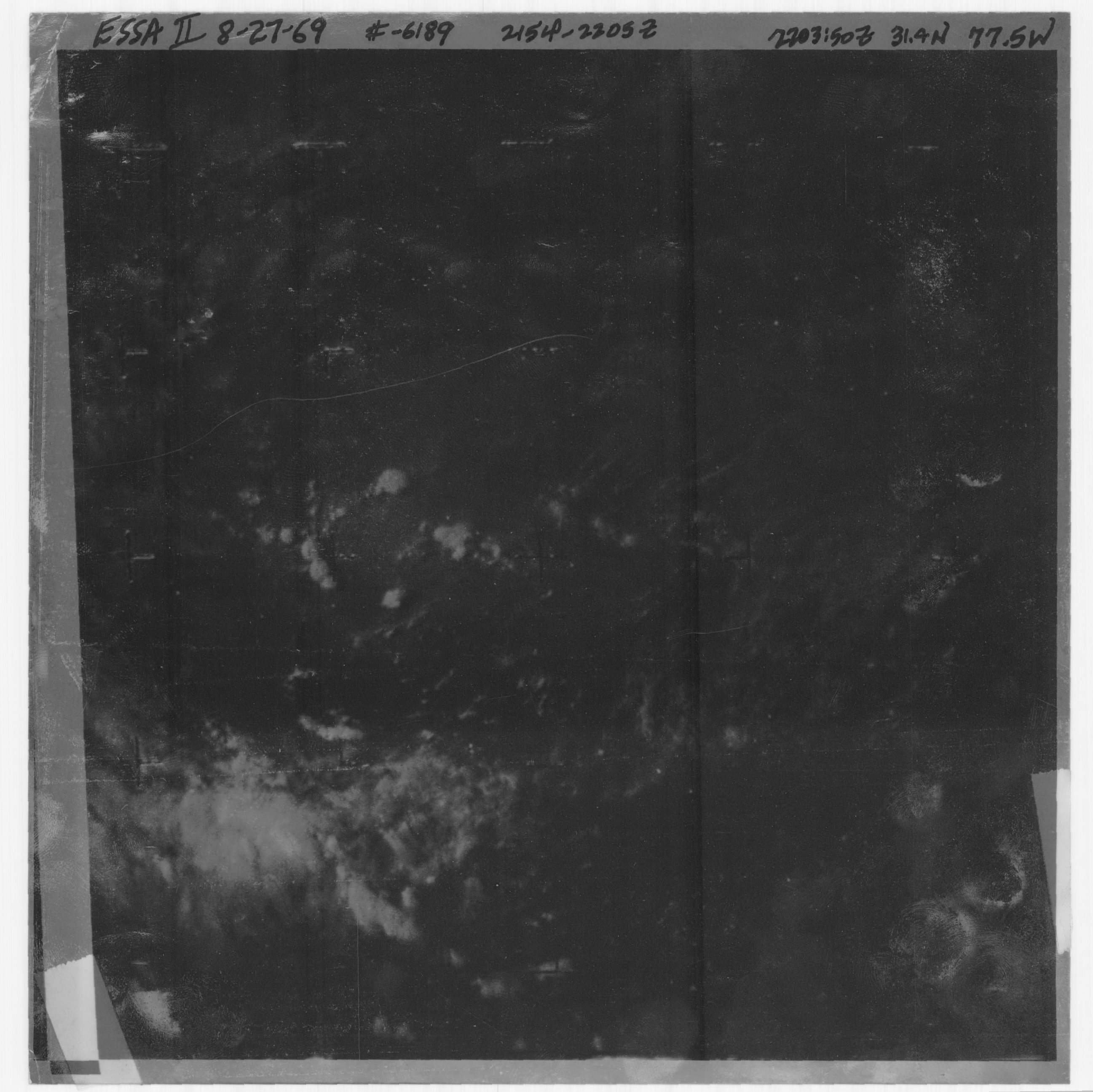
Tropical Depression Eve of 1969 on August 27, 1969. Source: http://www.nhc.noaa.gov/archive/storm_wallets/cdmp/dvd0007-jpg/1969/atlantic/eve/satpic/s272203z.jpg

Track map of Hurricane Holly of the 1969 Atlantic hurricane season. The points show the location of the storm at 6-hour intervals. The colour represents the storm's maximum sustained wind speeds as classified in the (see below), and the shape of the data points represent the nature of the storm, according to the legend below.
Storm type

Place-holder image for use in Northern Hemisphere tropical cyclone articles, without an image or track map.

Track map of Hurricane Seventeen of the 1969 Atlantic hurricane season. The points show the location of the storm at 6-hour intervals. The colour represents the storm's maximum sustained wind speeds as classified in the (see below), and the shape of the data points represent the nature of the storm, according to the legend below.
Storm type

Storm total rainfall map of Subtropical Storm One (operationally designated as Tropical Depression Thirty-Two) during September and October 1969.

Track map of Tropical Storm Anna of the 1969 Atlantic hurricane season. The points show the location of the storm at 6-hour intervals. The colour represents the storm's maximum sustained wind speeds as classified in the (see below), and the shape of the data points represent the nature of the storm, according to the legend below.
Storm type

Track map of Tropical Storm Jenny of the 1969 Atlantic hurricane season. The points show the location of the storm at 6-hour intervals. The colour represents the storm's maximum sustained wind speeds as classified in the (see below), and the shape of the data points represent the nature of the storm, according to the legend below.
Storm type

Track map of Hurricane Kara of the 1969 Atlantic hurricane season. The points show the location of the storm at 6-hour intervals. The colour represents the storm's maximum sustained wind speeds as classified in the (see below), and the shape of the data points represent the nature of the storm, according to the legend below.
Storm type