Ashland (Montana)
| Ashland | |
|---|---|
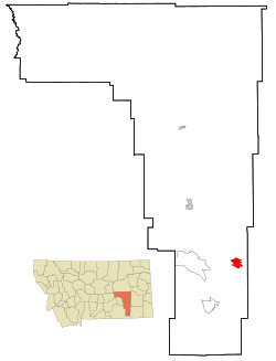
Lage in Montana | |
| Basisdaten | |
| Staat: | Vereinigte Staaten |
| Bundesstaat: | Montana |
| County: | Rosebud County |
| Koordinaten: | 45° 36′ N, 106° 17′ W |
| Zeitzone: | Mountain (UTC−7/−6) |
| Einwohner: | 773 (Stand: 2020) |
| Haushalte: | 354 (Stand: 2020) |
| Fläche: | 19,6 km² (ca. 8 mi²) |
| Bevölkerungsdichte: | 39 Einwohner je km² |
| Höhe: | 890 m |
| Postleitzahlen: | 59003 - 59004 |
| Vorwahl: | +1 406 |
| FIPS: | 30-02800 |
| GNIS-ID: | 0802003 |
Ashland ist eine Ortschaft (Census-designated place) im Rosebud County im US-Bundesstaat Montana, Vereinigte Staaten.
Der Ort liegt direkt östlich des Northern Cheyenne Indian Reservation der Nördliche Cheyenne im Custer National Forest.
Der indianische Name lautet Vóhkoohémâhoéve'ho'éno.
Auf dieser Seite verwendete Medien
Autor/Urheber: Arkyan, Lizenz: CC BY-SA 3.0
This map shows the incorporated and unincorporated areas in Rosebud County, Montana, highlighting Ashland in red. It was created with a custom script with US Census Bureau data and modified with Inkscape.

