Arthur-Insel
| Arthur-Insel | ||
|---|---|---|
 | ||
| Gewässer | Arktischer Ozean | |
| Inselgruppe | Franz-Josef-Land | |
| Geographische Lage | 81° 7′ N, 50° 41′ O | |
| Länge | 17,5 km | |
| Breite | 11 km | |
| Fläche | 110 km² | |
| Höchste Erhebung | Leningrader Eiskappe 275 m | |
| Einwohner | unbewohnt | |
 | ||
Die Arthur-Insel (russisch Остров Артура, Ostrow Artura) ist eine unbewohnte Insel des zu Russland gehörenden arktischen Franz-Josef-Lands.
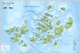
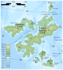
Sie ist die nördlichste Insel im Westen des Archipels. Von der Armitage-Halbinsel der südlich gelegenen Insel Prinz-Georg-Land ist sie durch die 10 km breite Leigh-Smith-Straße getrennt. Die Arthur-Insel ist 110 km² groß[1] und bis auf die Küstenregion im Nordwesten und das Südkap Mys Niski von einer bis zu 275 m hohen Eiskappe bedeckt.
Die Insel wurde während der Jackson-Harmsworth-Expedition 1894–1897 von Frederick Jackson entdeckt und nach seinem Bruder Arthur benannt.[2] Jackson betrat die Insel nicht und zeichnete sie nur ungenau in seine Karte ein, gemeinsam mit der Alfred-Harmsworth- und der Albert-Edward-Insel, die sich später als Phantominseln erweisen sollten.
Einzelnachweise
- ↑ Andreas Umbreit: Arthur (Artura) Insel – Franz-Joseph-Land (Memento vom 28. Januar 2021 im Internet Archive)
- ↑ Frederick G. Jackson: A thousand days in the Arctic. Harper, New York & London 1899, S. 631 (englisch).
Weblinks
- Topografische Karte der Insel im Maßstab 1:200 000
Auf dieser Seite verwendete Medien
Autor/Urheber: User:Mysid (adapted by User:Aymatth2), Lizenz: CC BY-SA 3.0
Map of the western part of Franz Josef Land
Autor/Urheber: Nzeemin, Lizenz: CC BY-SA 3.0
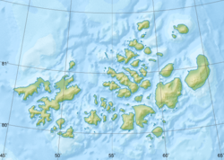
Физическая карта -- Земля Франца-Иосифа, Россия.
- Проекция: Lambert Azimuthal Equal-Area
- Longitude and latitude of the projection center: 55 / 80.8
- Инструменты: GMT
Map of Franz Josef Land : showing journeys and discoveries of Frederick G. Jackson, F.R.G.S., leader of the Jackson-Harmsworth Polar Expedition 1894-7
Scale 1:1.000.000
Publisher: London, Royal Geographical Society
Lithogr., color, 31 × 41 cm
Published in v. 11, no. 2, February 1898 issue of the Geographical Journal, accompanying article titled "Three years’ exploration in Franz Josef Land" by Frederick G. Jackson.Autor/Urheber: Oona Räisänen (übersetzt durch Thariama), Lizenz: CC BY 3.0
Karte des russischen Franz-Josef-Land.


