Arda Valles
| Tal auf dem Mars | ||
|---|---|---|
| Arda Valles | ||
 | ||
| Position | 20° 24′ S, 32° 19′ W | |
| Länge | 174 km | |
| Geschichte | ||
| Benannt nach | Arda, Fluss in Bulgarien | |
Die Arda Valles („Arda-Täler“) sind ein großes, von Flussläufen durchzogenes Gebiet auf dem Mars. Es ist insgesamt 174 km lang und wurde nach dem Fluss Arda in Bulgarien benannt.
Weblinks
Auf dieser Seite verwendete Medien
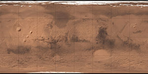
Carte de Mars reconstituée à partir des mesures de Mars Global Surveyor (MOLA) et des observations de Viking.
Autor/Urheber: European Space Agency, Lizenz: CC BY-SA 2.0
The Arda Valles region of Mars, comprising the network of drainage valleys seen in the left-hand portion of the image. The region lies on the western rim of an ancient large impact basin, which can be seen in the right-hand portion of the image.
The region has been heavily influenced by the action of water. In addition to the drainage valleys, the crater to the right of centre was once filled by muddy sediments that later collapsed into the chaotic terrain seen in the crater floor. Zooming in to the left of this crater, just above the bottom central crater, reveals light-toned deposits that have been identified as clays, formed in the presence of water.
The fractured terrain to the right of the scene is also linked to the loss of underground ice and evaporating water. The fractures are also likely linked to stresses in the surface materials due to the compaction of sediments deposited by water.
The region was imaged by the High Resolution Stereo Camera on Mars Express on 20 July 2015 during orbit 14649. The image is centred on 19°S / 327°E; the ground resolution is about 14 m per pixel.
Copyright ESA/DLR/FU Berlin, CC BY-SA 3.0 IGO
Full story and high res: <a href="http://www.esa.int/Our_Activities/Space_Science/Mars_Express/Footprints_of_a_martian_flood" rel="nofollow">www.esa.int/Our_Activities/Space_Science/Mars_Express/Foo...</a>

