Annet (Scilly-Inseln)
| Annet | ||
|---|---|---|
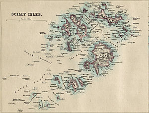
| Scilly-Inseln auf historischer Karte von 1874. Annet liegt südwestlich der Hauptinsel St. Mary’s | ||
| Gewässer | Keltische See | |
| Inselgruppe | Scilly-Inseln | |
| Geographische Lage | 49° 53′ 40″ N, 6° 22′ 20″ W | |
| ||
| Fläche | 21 ha | |
| Einwohner | unbewohnt | |
Annet ist eine der 134 unbewohnten Scilly-Inseln in Großbritannien. Sie liegt ca. 45 km vom Land’s End entfernt. Auf Annet befinden sich große Brutkolonien von Alkenvögeln, wie den Papageitauchern, die in den unzähligen Felsvorsprüngen ihre Nester bauen.
Touristen haben die Möglichkeit mit einem Ausflugsboot, von Hugh Town abfahrend, die 0,21 km² große Insel zu umfahren und die Vögel zu beobachten.
Weblinks
Auf dieser Seite verwendete Medien
Contains Ordnance Survey data © Crown copyright and database right, CC BY-SA 3.0
Blank map of the Isles of Scilly, UK with districts shown.
Equirectangular map projection on WGS 84 datum, with N/S stretched 150%
Geographic limits:
- West: 6.45W
- East: 6.23W
- North: 49.99N
- South: 49.86N


