Allia Bay
Koordinaten: 3° 35′ 4″ N, 36° 16′ 4″ O
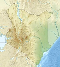
Allia Bay ist eine paläoanthropologische Fundstätte aus dem Pliozän im Nordwesten von Kenia. Sie liegt südlich von Koobi Fora bei 3° 35' 04 Nord, 36° 16' 04 Ost am nördlichen Ende des Turkanasees. Als bedeutendste Funde gelten Fossilien von Australopithecus anamensis. Die Fundstätte wurde nach einer gleichnamigen Bucht des Turkanasees benannt.[1]
Das erste hominine Fossil wurde 1982 als Oberflächenfund aufgesammelt, ein einzelner linker Molar (Sammlungsnummer: KNM-ER 7727), jedoch, ohne dass man den Zahn einer bestimmten Art zuordnen konnte. Erst 1995 wurde er, gemeinsam mit Fossilien aus der Fundstätte Kanapoi, der neu beschriebenen Art Australopithecus anamensis zugeschrieben, nachdem in Allia Bay rund zwei Dutzend weitere, gleich alte Backenzähne entdeckt worden waren. Alle homininen Fossilien sind rund vier Millionen Jahre alt.[2]
Literatur
- Margaret J. Schoeninger, Holly Reeser, Kris Hallin: Paleoenvironment of Australopithecus anamensis at Allia Bay, East Turkana, Kenya: evidence from mammalian herbivore enamel stable isotopes. In: Journal of Anthropological Archaeology. Band 22, Nr. 3, 2003, S. 200–207, doi:10.1016/S0278-4165(03)00034-5.
- Melanie Marie Beasley: Seasonal precipitation at a 3.97 Ma Australopithecus anamensis site, Allia Bay, Kenya. Diss. University of California, San Diego, 2016, Volltext.
- Laurence Dumouchel et al.: The environments of Australopithecus anamensis at Allia Bay, Kenya: A multiproxy analysis of early Pliocene Bovidae. In: Journal of Human Evolution. Band 151, 2021, 102928, doi:10.1016/j.jhevol.2020.102928.
Belege
- ↑ Eintrag Allia Bay in Bernard Wood (Hrsg.): Wiley-Blackwell Encyclopedia of Human Evolution. 2 Bände. Wiley-Blackwell, Chichester u. a. 2011, ISBN 978-1-4051-5510-6.
- ↑ R. E. Heinrich, M. D. Rose, R. E. Leakey und A. C. Walker: Hominid radius from the middle Pliocene of Lake Turkana, Kenya. In: American Journal of Physical Anthropology. Band 92, Nr. 2, 1993, S. 139–148, doi:10.1002/ajpa.1330920203.
Auf dieser Seite verwendete Medien
Autor/Urheber: Uwe Dedering, Lizenz: CC BY-SA 3.0
Location map of Kenya
Equirectangular projection. Strechted by 100.0%. Geographic limits of the map:
- N: 6.0° N
- S: -5.0° N
- W: 33.0° E
- E: 43.0° E

