Afdera (Vulkan)
| Afdera | ||
|---|---|---|
 | ||
| Afrera obere rechte Bildmitte, direkt südlich des Afrerasees. Dunkler Bildbereich in Bildmitte: Alayta-Lavafeld | ||
| Höhe | 1295 m | |
| Lage | Region Afar, Äthiopien | |
| Koordinaten | 13° 4′ 48″ N, 40° 51′ 0″ O | |
| ||
| Typ | Stratovulkan | |
| Letzte Eruption | 1907 | |
Der Afdera ist ein isolierter, 1295 m hoher Stratovulkan in Nord-Äthiopien. Er liegt im Kreuzungspunkt von drei Bruchsystemen zwischen den Vulkanen Erta Ale, Tat Ali sowie Alayta. Der letzte bekannte Ausbruch fand im Juni 1907 statt mit dem Ausstoß von Lava an der Westflanke des Vulkans.
Am Fuße des Berges befindet sich der Lake Afdera an dem Gesteinssalz abgebaut wird.
Weblinks
- Afdera im Global Volcanism Program der Smithsonian Institution (englisch)
Auf dieser Seite verwendete Medien
The elongated massif extending down the center of the image is Alayta shield volcano, which covers an area of 2700 sq km in the western Danakil depression. A series of very recent craters is aligned along the NNW-trending axis of the basaltic-to-trachytic shield. The Alayta lava field, covered by very fresh lava flows, was erupted from N-S-trending fissures along the east side of the shield volcano and laps up against the western flank of Afderà volcano, immediately south of Lake Guilietti (Lake Afrera) at the upper right-center.
(c) Karte: NordNordWest, Lizenz: Creative Commons by-sa-3.0 de
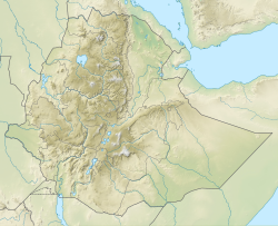
Positionskarte von Äthiopien


