Adams County (Mississippi)
 Adams County Courthouse | |
| Verwaltung | |
|---|---|
| US-Bundesstaat: | Mississippi |
| Verwaltungssitz: | Natchez |
| Adresse des Verwaltungssitzes: | County Courthouse P.O. Box 1008 Natchez, MS 39121-1008 |
| Gründung: | 2. April 1799 |
| Gebildet aus: | Natchez District |
| Vorwahl: | 001 601 |
| Demographie | |
| Einwohner: | 29.538 (Stand: 2020) |
| Bevölkerungsdichte: | 24,78 Einwohner/km2 |
| Geographie | |
| Fläche gesamt: | 1259 km² |
| Wasserfläche: | 67 km² |
| Karte | |
 | |
Das Adams County[1] ist ein County im US-amerikanischen Bundesstaat Mississippi. Im Jahr 2010 hatte das County 32.297 Einwohner und eine Bevölkerungsdichte von 27,1 Einwohnern pro Quadratkilometer.[2] Der Verwaltungssitz (County Seat) ist Natchez,[3] das nach dem indianischen Wort für Wälder benannt wurde.
Geographie
Das County liegt fast im äußersten Südwesten von Mississippi, grenzt im Westen an Louisiana, getrennt durch den Mississippi, der die natürliche Grenze bildet. Es hat eine Fläche von 1259 Quadratkilometern, wovon 67 Quadratkilometer Wasserfläche sind. An das Adams County grenzen folgende Countys und Parishes:
| Tensas Parish | Jefferson County | |
.svg) | Franklin County | |
| Concordia Parish | Wilkinson County |
Geschichte

Das Adams County wurde am 2. April 1799 aus dem Natchez District gebildet. Es war das erste County, das im Mississippi-Territorium gebildet wurde; 18 Jahre, bevor Mississippi als Bundesstaat aufgenommen wurde. Benannt wurde es nach John Adams, dem zweiten Präsidenten der USA. In der Folgezeit stammten vier Gouverneure von Mississippi aus dem Adams County: David Holmes, George Poindexter, John A. Quitman und Gerard Brandon.
Im Adams County liegt ein National Historical Park, der Natchez National Historical Park. 13 Orte haben den Status einer National Historic Landmark.[4] 118 Bauwerke und Stätten des Countys sind insgesamt im National Register of Historic Places eingetragen (Stand 31. Januar 2018).[5]
Demografische Daten
| Bevölkerungsentwicklung | |||
|---|---|---|---|
| Census | Einwohner | ± rel. | |
| 1800 | 4660 | — | |
| 1810 | 10.002 | 114,6 % | |
| 1820 | 12.076 | 20,7 % | |
| 1830 | 14.937 | 23,7 % | |
| 1840 | 19.434 | 30,1 % | |
| 1850 | 18.601 | −4,3 % | |
| 1860 | 20.165 | 8,4 % | |
| 1870 | 19.084 | −5,4 % | |
| 1880 | 22.649 | 18,7 % | |
| 1890 | 26.031 | 14,9 % | |
| 1900 | 30.111 | 15,7 % | |
| 1910 | 25.265 | −16,1 % | |
| 1920 | 22.183 | −12,2 % | |
| 1930 | 23.564 | 6,2 % | |
| 1940 | 27.238 | 15,6 % | |
| 1950 | 32.256 | 18,4 % | |
| 1960 | 37.730 | 17 % | |
| 1970 | 37.293 | −1,2 % | |
| 1980 | 38.035 | 2 % | |
| 1990 | 35.356 | −7 % | |
| 2000 | 34.340 | −2,9 % | |
| 2010 | 32.297 | −5,9 % | |
| 2020 | 29.538 | −8,5 % | |
| Vor 1900[6] 1900–1990[7] 2000[3] 2010[2] | |||

Nach der Volkszählung im Jahr 2010 lebten im Adams County 32.297 Menschen in 12.074 Haushalten. Die Bevölkerungsdichte betrug 27,1 Einwohner pro Quadratkilometer. In den 12.074 Haushalten lebten statistisch je 2,61 Personen.
Ethnisch betrachtet setzte sich die Bevölkerung zusammen aus 44,3 Prozent Weißen, 53,8 Prozent Afroamerikanern, 0,4 Prozent amerikanischen Ureinwohnern, 0,4 Prozent Asiaten sowie aus anderen ethnischen Gruppen; 1,0 Prozent stammten von zwei oder mehr Ethnien ab. Unabhängig von der ethnischen Zugehörigkeit waren 6,8 Prozent der Bevölkerung spanischer oder lateinamerikanischer Abstammung.
22,0 Prozent der Bevölkerung waren unter 18 Jahre alt, 62,2 Prozent waren zwischen 18 und 64 und 15,8 Prozent waren 65 Jahre oder älter. 50,0 Prozent der Bevölkerung war weiblich.
Das jährliche Durchschnittseinkommen eines Haushalts lag bei 26.784 USD. Das Pro-Kopf-Einkommen betrug 17.249 USD. 31,5 Prozent der Einwohner lebten unterhalb der Armutsgrenze.[2]
Ortschaften im Adams County
Census-designated places (CDP)
- Cloverdale
- Morgantown
- Pine Ridge
- Sibley
- Stanton
- Washington
Gliederung
Das Adams County ist in fünf durchnummerierte Distrikte eingeteilt:[8]
| Distrikt | Einwohner (2010) | FIPS |
|---|---|---|
| 1 | 5959 | 28-90009 |
| 2 | 6912 | 28-90747 |
| 3 | 6061 | 28-91485 |
| 4 | 5408 | 28-92223 |
| 5 | 7957 | 28-92961 |
Siehe auch
- Liste der Einträge im National Register of Historic Places im Adams County
Weblinks
Einzelnachweise
- ↑ GNIS-ID: 695726. Abgerufen am 24. Februar 2011 (englisch).
- ↑ a b c U.S. Census Buero, State & County QuickFacts - Adams County, MS Abgerufen am 30. Juni 2013
- ↑ a b National Association of Counties Abgerufen am 30. Juni 2013
- ↑ Listing of National Historic Landmarks by State: Mississippi. National Park Service, abgerufen am 31. Januar 2018.
- ↑ Suchmaske Datenbank im National Register Information System. National Park Service, abgerufen am 31. Januar 2018.
- ↑ U.S. Census Bureau _ Census of Population and Housing Abgerufen am 19. Februar 2011
- ↑ Auszug aus Census.gov Abgerufen am 19. Februar 2011
- ↑ Missouri Census Data Center - Mississippi (Seite nicht mehr abrufbar, Suche in Webarchiven) Info: Der Link wurde automatisch als defekt markiert. Bitte prüfe den Link gemäß Anleitung und entferne dann diesen Hinweis. Abgerufen am 30. Juni 2013
Liste der Countys in Mississippi
Adams | Alcorn | Amite | Attala | Benton | Bolivar | Calhoun | Carroll | Chickasaw | Choctaw | Claiborne | Clarke | Clay | Coahoma | Copiah | Covington | DeSoto | Forrest | Franklin | George | Greene | Grenada | Hancock | Harrison | Hinds | Holmes | Humphreys | Issaquena | Itawamba | Jackson | Jasper | Jefferson | Jefferson Davis | Jones | Kemper | Lafayette | Lamar | Lauderdale | Lawrence | Leake | Lee | Leflore | Lincoln | Lowndes | Madison | Marion | Marshall | Monroe | Montgomery | Neshoba | Newton | Noxubee | Oktibbeha | Panola | Pearl River | Perry | Pike | Pontotoc | Prentiss | Quitman | Rankin | Scott | Sharkey | Simpson | Smith | Stone | Sunflower | Tallahatchie | Tate | Tippah | Tishomingo | Tunica | Union | Walthall | Warren | Washington | Wayne | Webster | Wilkinson | Winston | Yalobusha | Yazoo
Koordinaten: 31° 29′ N, 91° 21′ W
Auf dieser Seite verwendete Medien
Ruins of the Elizabeth Female Academy on the Natchez Trace Parkway in Mississippi, USA

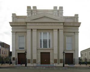
Title: Front exterior, U.S. Courthouse, Natchez, Mississippi
Physical description: 1 photograph : digital, TIFF file, color.
Notes: Gift; Carol M. Highsmith; 2009; (DLC/PP-2009:083).; Photographed as part of an assignment for the General Services Administration.; Built in 1853 as Memorial Hall, a Greek Revival structure, later turned into a U.S. Courthouse.; Title, date, and subject note provided by the photographer.; Credit line: Photographs in the Carol M. Highsmith Archive, Library of Congress, Prints and Photographs Division.; Forms part of the Carol M. Highsmith Archive.
Autor/Urheber: Rocky Vaughn, Sue Anna Joe, Dominique Pugh, Clay Moss, Kara Giles, Micah Whitson and the Mississippi Department of Archives and History, Lizenz: Copyrighted free use
The flag of the U.S. state of Mississippi - aspect ratio of 5:3. Designed in 2020 and adopted in 2021, the "New Magnolia" flag was selected by the Commission to Redesign the Mississippi state flag in 2020.
This is a locator map showing Adams County in Mississippi. For more information, see Commons:United States county locator maps.