Abwrackwerften in Brownsville
Koordinaten: 25° 58′ 50,7″ N, 97° 19′ 16,9″ W
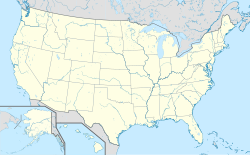
Zu den Abwrackwerften in Brownsville gehören drei Abwrackwerften in Brownsville (Texas).
Von den Unternehmen All Star Metals, International Shipbreaking und SteelCoast werden überwiegend außer Dienst gestellte Schiffe der United States Navy und der United States Maritime Administration verwertet.[1] Die Betriebe liegen am Brownsville Ship Channel, der den Tiefwasserhafen mit dem Golf von Mexiko verbindet.
Weblinks
Einzelnachweise
- ↑ America’s Premier Ship Recycling Port. Port of Brownsville, 6. Juni 2022, abgerufen am 30. März 2023 (englisch).
Auf dieser Seite verwendete Medien
Autor/Urheber: TUBS
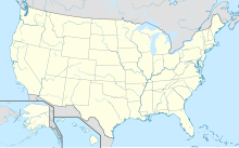
Location map of the USA (Hawaii and Alaska shown in sidemaps).
Main map: EquiDistantConicProjection : Central parallel :
* N: 37.0° N
Central meridian :
* E: 96.0° W
Standard parallels:
* 1: 32.0° N
* 2: 42.0° N
Made with Natural Earth. Free vector and raster map data @ naturalearthdata.com.
Formulas for x and y:
x = 50.0 + 124.03149777329222 * ((1.9694462586094064-({{{2}}}* pi / 180))
      * sin(0.6010514667026994 * ({{{3}}} + 96) * pi / 180))
y = 50.0 + 1.6155950752393982 * 124.03149777329222 * 0.02613325650382181
      - 1.6155950752393982  * 124.03149777329222 *
     (1.3236744353715044  - (1.9694462586094064-({{{2}}}* pi / 180))
      * cos(0.6010514667026994 * ({{{3}}} + 96) * pi / 180))
Hawaii side map: Equirectangular projection, N/S stretching 107 %. Geographic limits of the map:
- N: 22.4° N
- S: 18.7° N
- W: 160.7° W
- E: 154.6° W
Alaska side map: Equirectangular projection, N/S stretching 210.0 %. Geographic limits of the map:
- N: 72.0° N
- S: 51.0° N
- W: 172.0° E
- E: 129.0° W

