259 v. Chr.
Portal Geschichte | Portal Biografien | Aktuelle Ereignisse | Jahreskalender | Tagesartikel
◄ | 4. Jahrhundert v. Chr. | 3. Jahrhundert v. Chr. | 2. Jahrhundert v. Chr. | ►
◄ | 270er v. Chr. | 260er v. Chr. | 250er v. Chr. | 240er v. Chr. | 230er v. Chr. | ►
◄◄ | ◄ | 262 v. Chr. | 261 v. Chr. | 260 v. Chr. | 259 v. Chr. | 258 v. Chr. | 257 v. Chr. | 256 v. Chr. | ► | ►►
| 259 v. Chr. | |
|---|---|
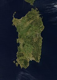
 Die Römer unter L. Cornelius Scipio erobern Korsika ... |  ... und große Teile Sardiniens im Ersten Punischen Krieg. |
| 259 v. Chr. in anderen Kalendern | |
| Buddhistische Zeitrechnung | 285/286 (südlicher Buddhismus); 284/285 (Alternativberechnung nach Buddhas Parinirvana) |
| Chinesischer Kalender | 40. (41.) Zyklus, Jahr des Wasser-Tigers 壬寅 (am Beginn des Jahres Metall-Büffel 辛丑) |
| Griechische Zeitrechnung | 1./2. Jahr der 130. Olympiade |
| Jüdischer Kalender | 3502/03 |
| Römischer Kalender | ab urbe condita XDV (495) |
| Seleukidische Ära | Babylon: 52/53 (Jahreswechsel April); Syrien: 53/54 (Jahreswechsel Oktober) |
Ereignisse
- Erster Punischer Krieg: Einer Flottenexpedition der Römer unter dem Konsul Lucius Cornelius Scipio gelingt die Einnahme Korsikas mit dem Hafen Aléria, sowie weiter Teile Sardiniens. Olbia bleibt noch in karthagischer Hand.
- Dem karthagischen Feldherr Hamilkar Barkas gelingt auf Sizilien bei Thermae nahe Himera in einem Gefecht ein Sieg über die Römer. Zudem erobert er Camarina und Enna. Drepanum (heute Trapani) an der Westspitze Siziliens baut er zur stärksten karthagischen Festung der Insel aus und siedelt die Bewohner von Eryx (heute Erice) dorthin um.
Geboren
- Qin Shihuangdi, erster Kaiser des geeinten China († 210 v. Chr.)
Gestorben
- Ptolemaios der Sohn, Sohn des Königs Ptolemaios II. von Ägypten, gegen den er rebellierte
Auf dieser Seite verwendete Medien
NASA-Satellitenbild Korsikas
Credit Jeff Schmaltz, MODIS Rapid Response Team, NASA/GSFC The island of Sardinia sits between the Mediterranean Sea to the south and west and the Tyrrhenian Sea to the east. To its immediate north is the island of Corsica, which is a part of France. To the east of Sardinia is the middle of the Italian peninsula (not shown). Sardinia glows here with the green blush of spring.
Sardinia has had a tumultuous history. Starting in ancient times, the island was occupied by Phoenicians, Carthaginians, and Romans; thereafter it was controlled by Vandals, Byzantines, and a long string of rulers of Italian city-states. In the late 15th century, Sardinia came under the control of Spain, then in the early 18th century was passed to the Austrians. It briefly fell to Spanish occupation in 1717, but by 1720 was given over again to the control of Italian rule. This true-color Aqua MODIS image was acquired on April 27, 2003.
