Îlot Gabriel
| Îlot Gabriel | ||
|---|---|---|
| Îlot Gabriel, Nordküste, im Hintergrund Flat Island | ||
| Gewässer | Indischer Ozean | |
| Geographische Lage | 19° 53′ 12″ S, 57° 40′ 22″ O | |
| Länge | 800 m | |
| Breite | 700 m | |
| Fläche | 42,2 ha | |
| Höchste Erhebung | 21 m | |
| Einwohner | unbewohnt | |
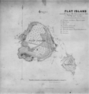
| Karte von Flat Island mit Îlot Gabriel (1857) | ||
Îlot Gabriel (Englisch Gabriel Island) ist eine zum Staat Mauritius gehörende Insel. Sie weist eine Fläche von 42,2 Hektar auf.[1] Sie liegt etwa 11 km nordöstlich von Cap Malheureux auf Mauritius. In der Nähe liegen die Inseln Round Island, Île aux Serpents und Coin de Mire. Bei Ebbe ist die nur wenige Meter entfernte Insel Flat Island zu Fuß zu erreichen. Nördlich von Flat Island liegt sich die kleine Felseninsel Pigeon House Rock.
Auf der Insel befinden sich einige Sonnenliegen sowie ein gedecktes Picknickhäuschen. Die Insel wird touristisch genutzt. Die meisten Touristen kommen zum Schnorcheln zwischen der Îlot Gabriel und der Île Plate. Besonders Katamarane sind häufig anzutreffen.
Die Insel ist unbewohnt und ein Naturschutzgebiet.
Einzelnachweise
- ↑ Ilets of Mauritius (Memento vom 30. Mai 2016 im Internet Archive)
Weblinks
Auf dieser Seite verwendete Medien
Autor/Urheber: Uwe Dedering, Lizenz: CC BY-SA 3.0
Relief location map of Mauritius.
- Projection: Equirectangular projection, strechted by 106.0%.
- Geographic limits of the map:
- N: -19.7° N
- S: -20.6° N
- W: 57.21° E
- E: 57.91° E
- GMT projection: -JX23.706666666666667cd/32.30880000000028cd
- GMT region: -R57.21/-20.6/57.91/-19.7r
- GMT region for grdcut: -R57.21/-20.6/57.91/-19.7r
- Relief: SRTM30plus.
- Made with Natural Earth. Free vector and raster map data @ naturalearthdata.com.
map of Flat Island, Mauritius, also showing Gabriel Island and Pigeon (House) Rock
Gabriel Island is an uninhabited Mauritian island in the Indian Ocean, about 12 km north of Mauritius, across from Île Plate (Flat Island). The island has area of 42 ha.


