United States 1789-03-1789-08
Autor/Urheber:
Made by User:Golbez.
Attribution:
Das Bild ist mit 'Attribution Required' markiert, aber es wurden keine Informationen über die Attribution bereitgestellt. Vermutlich wurde bei Verwendung des MediaWiki-Templates für die CC-BY Lizenzen der Parameter für die Attribution weggelassen. Autoren und Urheber finden für die korrekte Verwendung der Templates hier ein Beispiel.
Shortlink:
Quelle:
Größe:
1000 x 677 Pixel (99534 Bytes)
Beschreibung:
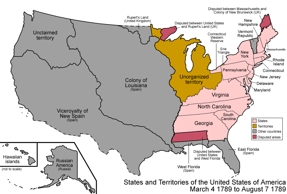
Map of the states and territories of the United States as it was from March 1789 to August 1789. On March 4 1789, the United States Constitution was enacted, though not all of the states had joined the union by then; to simplify this map, they are shown anyway. On August 7 1789, the Territory North West of the Ohio River (Northwest Territory) was organized.
Kommentar zur Lizenz:
Own work, attribution required (Multi-license with GFDL and Creative Commons CC-BY 2.5)
Lizenz:
Bild teilen:


Relevante Bilder


.jpg)
.jpg)
.jpg)


