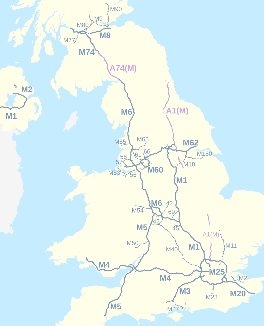
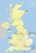
UK motorways map 2016
Nilfanion and Dr Greg. © OpenStreetMap contributors. Contains Ordnance Survey data © Crown copyright and database right 2010., CC BY-SA 4.0
Autor/Urheber:
- A38 UK road map.svg: Nilfanion, created using Ordnance Survey data
- Stirling UK location map.svg: Nilfanion, created using Ordnance Survey data
- Fife UK location map.svg: Nilfanion, created using Ordnance Survey data
- Glasgow UK location map.svg: Nilfanion, created using Ordnance Survey data
- Scottish council areas 2011.svg: Nilfanion, created using Ordnance Survey data
- North Yorkshire UK location map.svg: Nilfanion, created using Ordnance Survey data
- OpenStreetMap: OpenStreetMap contributors
- derivative work: Dr Greg
Shortlink:
Quelle:
Größe:
1038 x 1279 Pixel (525375 Bytes)
Beschreibung:
Map of the motorways of the United Kingdom in 2016. The shortest motorways are not labelled. Motorways in Northern Ireland are numbered independently from motorways in Great Britain.
Equirectangular map projection on WGS 84 datum.
- Key
M-designated motorway
under construction
Upgraded A-road designation
under reconstruction
Lizenz:
Credit:
Diese Datei wurde von diesen Werken abgeleitet:
-
 A38 UK road map.svg
  Stirling UK location map.svg
 Fife UK location map.svg
 Glasgow UK location map.svg
 Scottish council areas 2011.svg
 North Yorkshire UK location map.svg
- OpenStreetMap for Northern Ireland motorways: http://www.openstreetmap.org/#map=8/54.687/-5.606 2016-02-21
Relevante Bilder
Relevante Artikel
Vereinigtes KönigreichDas Vereinigte Königreich Großbritannien und Nordirland, kurz Vereinigtes Königreich, ist ein auf den Britischen Inseln vor der Nordwestküste Kontinentaleuropas gelegener europäischer Staat und bildet den größten Inselstaat Europas. .. weiterlesen
